

Arches NP: Roundup of Hikes
Arches NP: Roundup of Hikes
Oct 28 - Nov 8, 2021

Arches National Park is famous for red sandstone formations — spires, fins, natural bridges, balanced rocks, and yes, arches. I’ll depart from my usual format in this blogpost. Instead of walking you chronologically through the 11 days we spent in Arches, I’ll tell you about the hikes we took, in our order of preference.
What I’ll Skip
We spent a couple days resting and doing chores in Moab. The town really grew on us as we got to know the library and grocery store. We had enchiladas at Gilbertos one day. We also took a two-day side trip to the town of Monticello to explore the Needles area of Canyonlands.
General Note about Hiking in Arches NP
Perhaps the most important thing I can say is that we were able to do these hikes because of the time of year we visited (late October and early November). Even then the sun was a factor. I really can’t imagine visiting this park in the heat of summer — it would be torture. There’s a logistical problem with hiking in Arches — it’s best to hike in early morning or late evening, which are the times it’s the most difficult to be there. That can be quite a conundrum unless you’re able to camp in the park.
A Note about Camping in/near Arches NP
There’s only one campground in Arches NP, Devil’s Garden, which is a field of red rock formations, simply drop-dead gorgeous. I’ve camped a lot, and this is the most beautiful campground I’ve ever experienced. Most of the year you need a reservation. We were able to enter on Nov 1 because the reservation system expired on Oct 31.
Before we could get into Devil’s Garden, we camped at some BLM sites along the bends of the Colorado River (this forms the east boundary of the park). Those sites are lovely and easy to access. They work on the honor system, first come first serve. We watched bats at twilight. The dark sky makes for fabulous stargazing. As another bonus, the campground names are straight out of Tolkein (e.g. Goose Island, Middle Drinks, Upper Big Bend).

Hikes in Arches National Park, in order of our preference
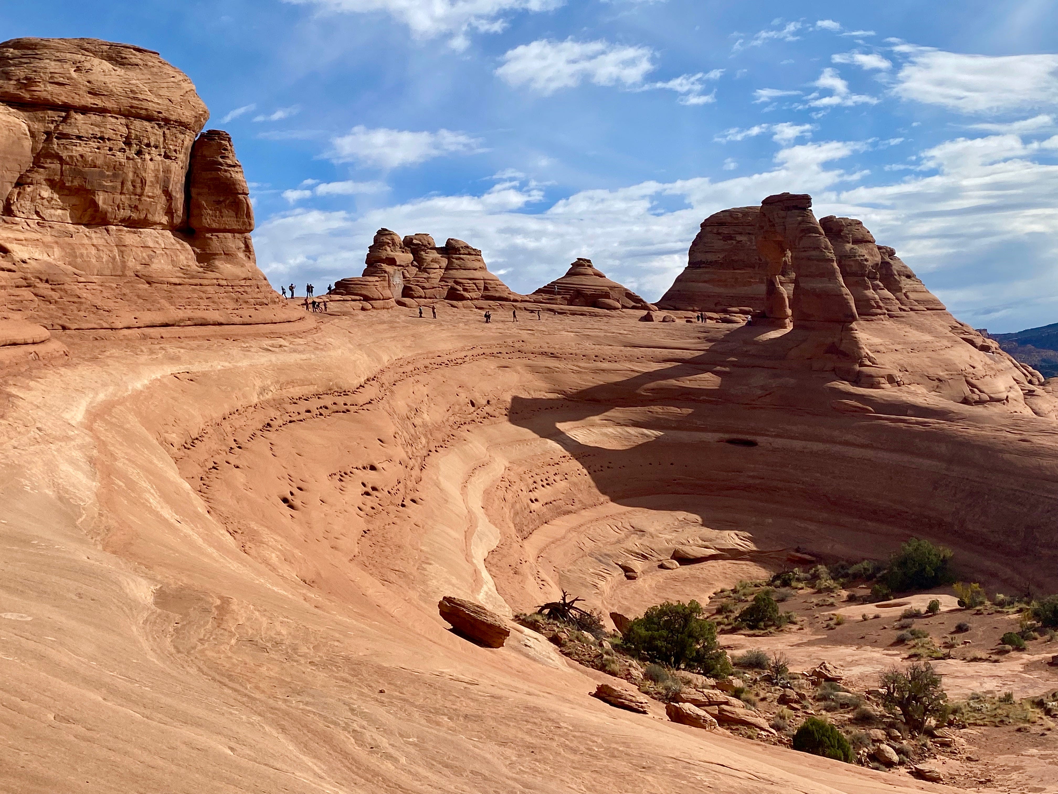
#8. Delicate Arch
Delicate Arch is perhaps the “iconic” arch of the park — you’ve probably seen photos taken at various times of day. Yet it was our least favorite arch for a couple of reasons.
This slick rock arch stands alone, so the trail passes over sand, sagebrush and bare rock, all under the blazing sun. It was the hottest hike we did.
Because it’s a popular hike, hordes of people do it every day — yet I lost the trail! I was actually following an arrow which had a crowd of people around it. Because I was avoiding the crowd I turned a little too soon. Unfortunately I was unaware of my mistake. There were footprints going everywhere on the sandy rock surface so we appeared to be following a trail.
What’s worse, a group of four hikers followed me and Doug. None of us realized we weren’t on the trail for a half hour or more. Finally we came over a rise and could see Delicate Arch in the far distance. An ant-like trail of people was barely visible coming and going to the arch, but there were multiple valleys and hills in the way. It was like being in a bad western movie with heat shimmering off the rocks and a mirage hovering in the impossible distance. Not only did we have to choose which valleys to go down and which hills to go up (which meant we would lose our vantage point), but we would also have to scramble over lots of boulders and navigate some slippery bowl-shaped rock formations.
At that point the group of four went one way, and Doug and I went another. I seriously considered turning around in defeat. But we soldiered on.
We finally arrived close to the arch (as pictured below), only to discover we could not get there, and had to make yet another detour. The arch is on the right but the bowl formation was too slippery to navigate, so we backtracked quite a ways.
Eventually we encountered the group of four near Delicate Arch and I tried to apologize. It was difficult to do because they were Korean-speaking and I am not. But I made lots of gestures! Fortunately they were all extremely good-natured about my mistake. We ended with smiles and laughter.
Still, what was supposed to be a 3 mile round trip stretched into 4.5 miles. While it never became a survival situation, the expected 90 minute hike took 2 hours. That extra 30 minutes of sun exposure and slippery scrambling turned this from “fun” into “let’s just power through” which is not the point of hiking.
I never did take the usual photo of Delicate Arch. Oops.
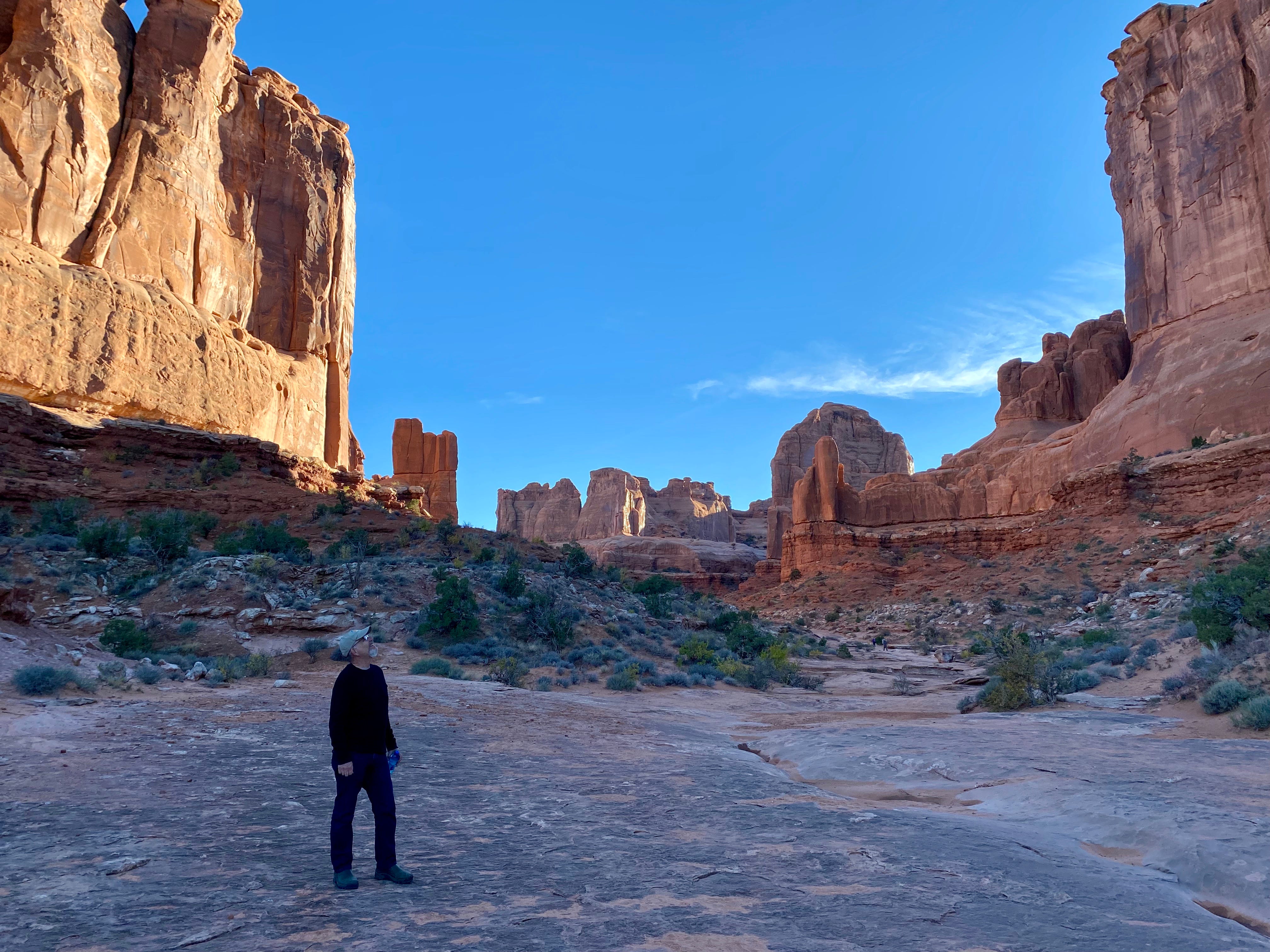
#7. Park Avenue through Courthouse Towers
In some ways the Park Avenue hike is the opposite of Delicate Arch. The path is well-shaded because it passes between giant monoliths on each side (hence the reference to a cityscape). It is also flat, following a canyon floor. We purposely hiked this trail in the late hours of the afternoon to avoid the overhead sun. Really gorgeous to watch the colors of the rock change as the sun dropped lower in the sky.
It’s not a loop trail, so the downhill going becomes uphill returning. It’s a mile each way. Our hiking time was 1.25 hours.
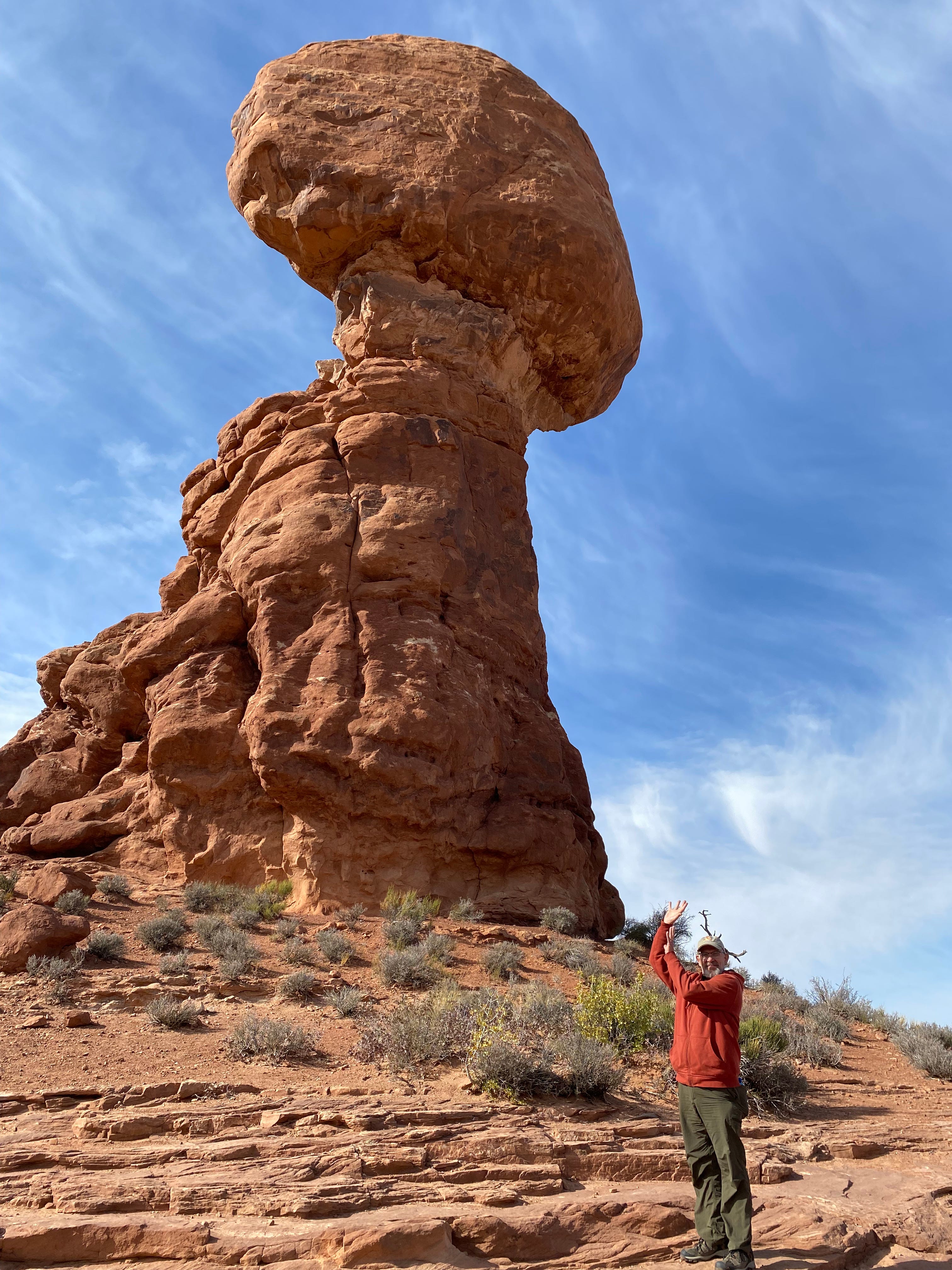
#6. Balanced Rock
This isn’t really a hike at all, but an easy stop to snap a photo. Doug grew up with an iconic photo of Balanced Rock prominently displayed on the wall of his family’s den — his dad and mom took it on their honeymoon. So we definitely wanted to see the formation and perhaps recreate the photo. However we soon realized we couldn’t do that. His family’s historic photo featured a secondary balanced rock, “Little Guy,” which has since tumbled down.
I was surprised how much I enjoyed walking around Balanced Rock to take photos from all the different angles. You are allowed to walk very close to the rock, so it is an ever-changing view, much more impressive close up than from a distance. This formation is next to the Windows region, which is another enjoyable hike. If you have only a short time to see this park, or if it’s very hot, this is the area I would suggest visiting.
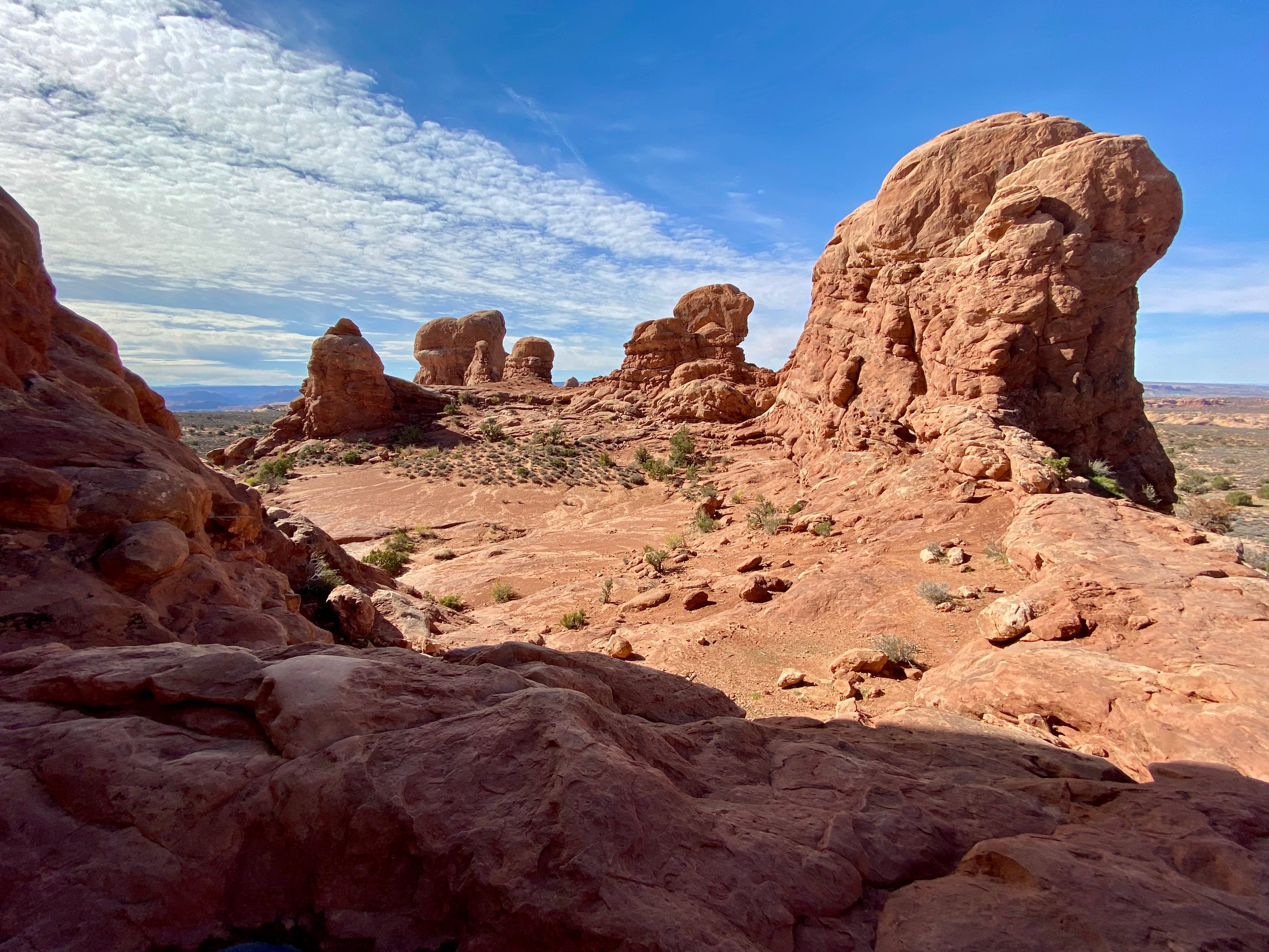
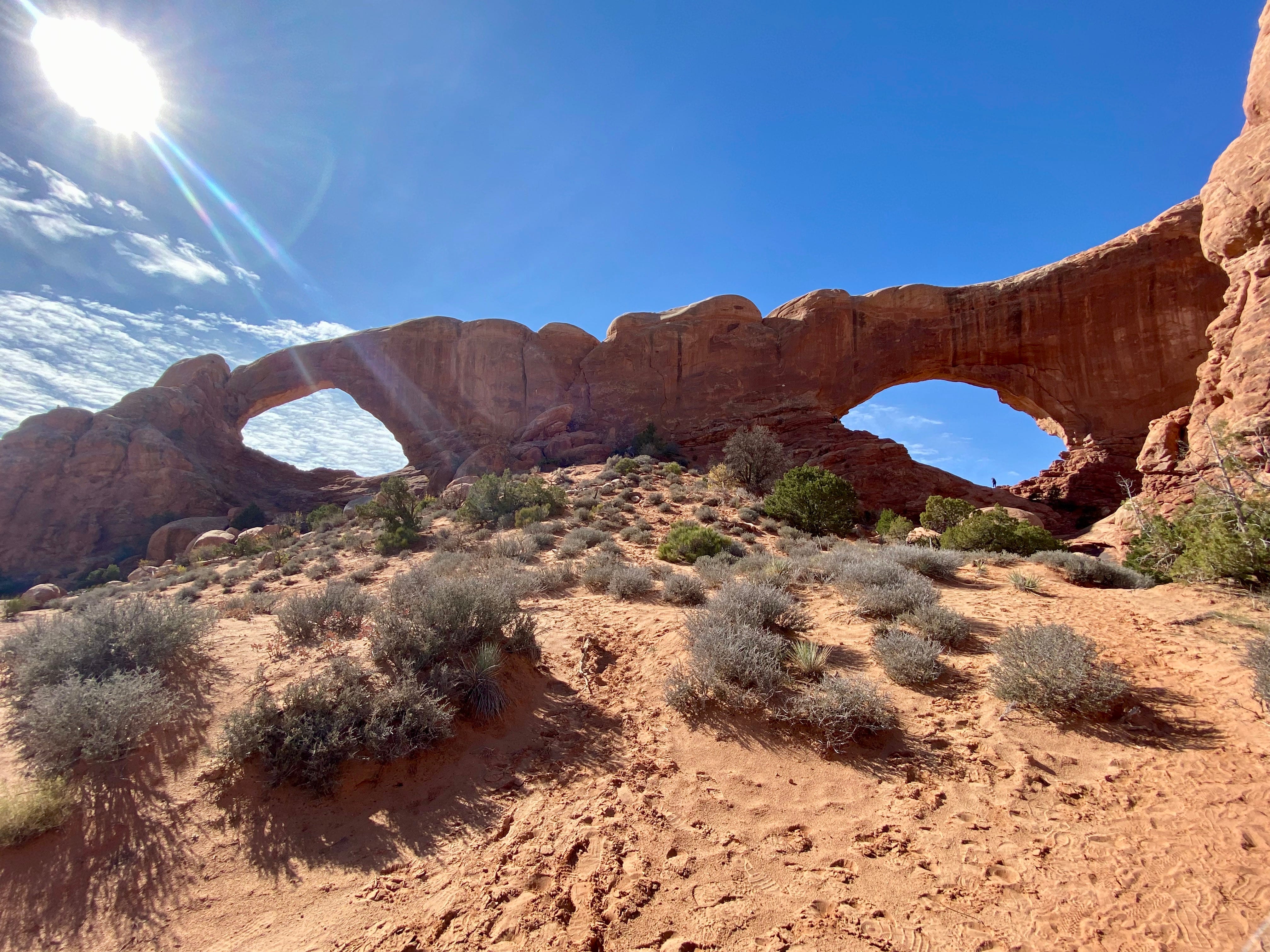
#5. Turret Arch, North and South Windows
We hiked to Turret Arch around noon, then continued on to North and South Windows. The day had begun overcast and then the sky blued up, which made it fun to take photos.
On the return trip we took the primitive trail around the “backside” of the formations. That trail was the real highlight! It passes behind a series of monoliths called the Parade of Elephants, which are huge, rounded formations. You can climb up into the mouth of several of those formations. Wandering along without anyone else in sight was a real pleasure. The trail was well-marked and well-shaded, often passing through waist-high desert plants. Our hiking time was 90 minutes.
#4. Devils Garden
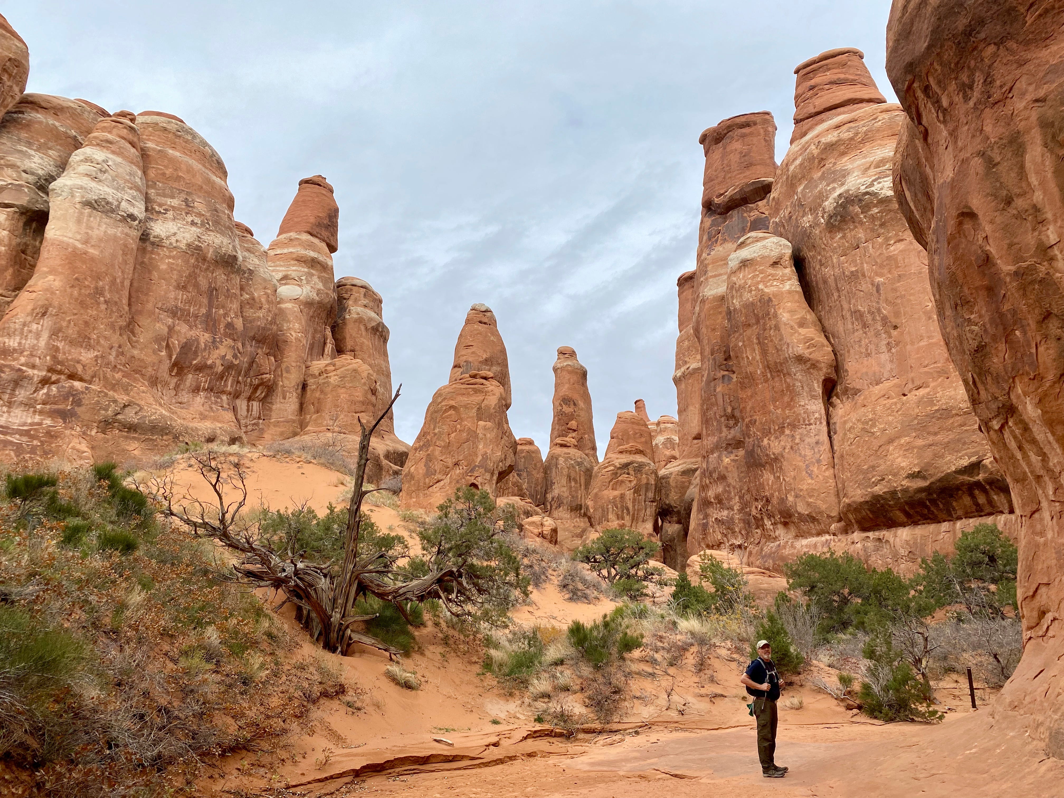
This was one of the longer trails we hiked, and we did it on the first day. We covered more than 5 miles. The trail is marked with small rock cairns and entails a lot of bouldering and rock scrambling.
About halfway through, it climbs into an area of red-rock “fins” (which I would probably call “baffles”). You can see them in the photo below, the projections on either side of the trail.

The day we hiked Devils Garden the wind was strong and the air was cold.
The pay-off of this hike is enormous! We saw these arches:
Tunnel Arch
Pine Tree Arch
Partition Arch (below, like a wind tunnel, forget the hat!)
Navajo Arch
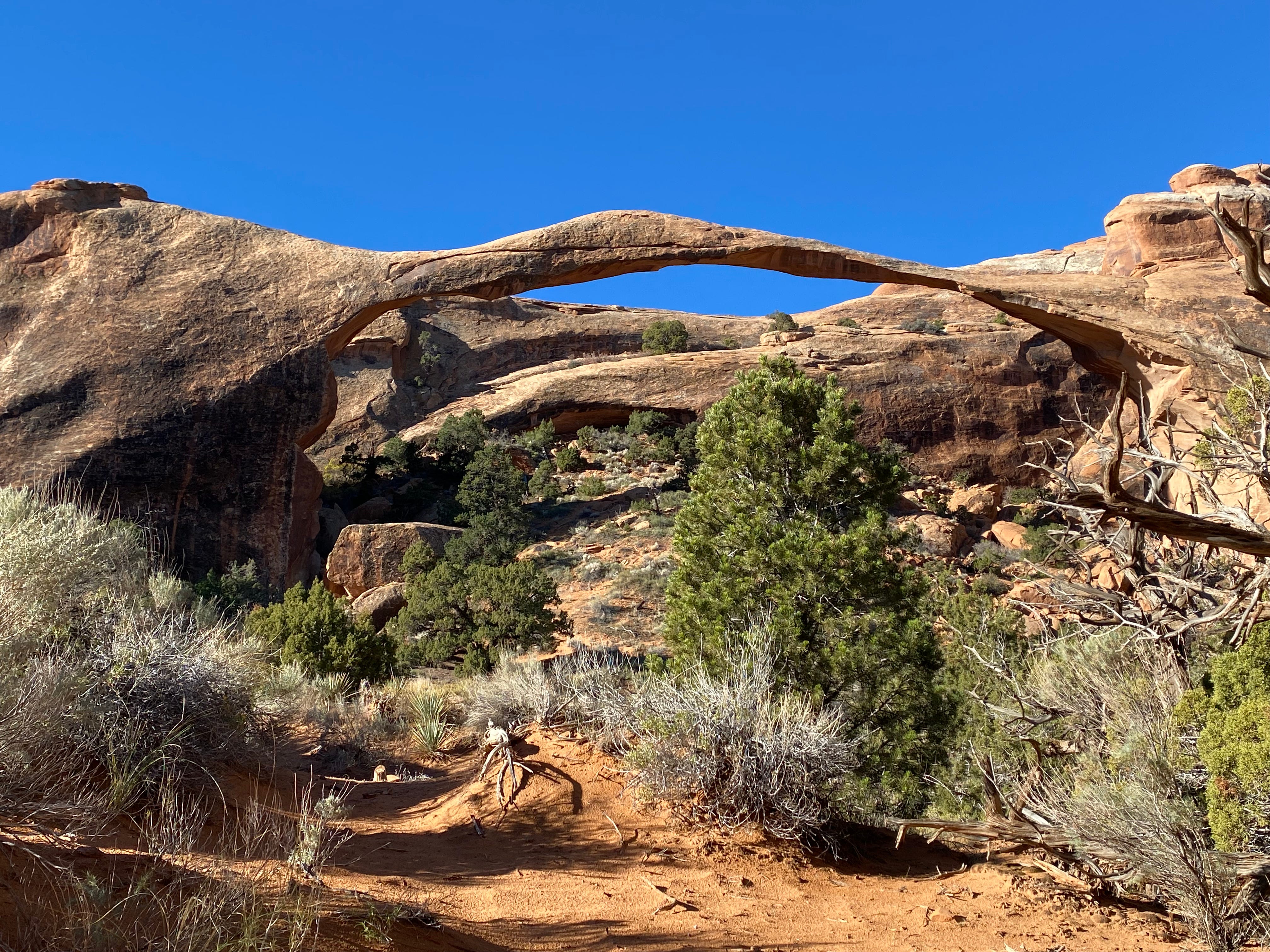
Landscape Arch (below, quite famous)
Double O Arch
On the return trip we intended to take the primitive trail, thinking it would shorten the trip overall. According to our map, the primitive trail led off from the Double O Arch — but we couldn’t locate it.
We noticed a group of 8 to 10 young men who appeared to be looking for the same trail head. I chatted with them. I teased that they looked smart so we would maybe just follow them. I said: “This many people can’t get lost.”
Another pair of hikers overheard me. One of those guys stopped and said to me: “You’d be surprised.” He was quite intense. He said the primitive trail is very poorly marked — difficult to find and easy to lose. Also, it involves just as much bouldering as what we’d already done. He said there’s even a place where you have to remove your shoes and socks and ford through more than a few inches of water. His final comment was that a ranger told him that in the last couple of weeks someone lost the trail and spent three days in the desert. (I would love to verify this story.)
So we decided to return the same way we came. Looking back, we could see the large group of young men high on a formation. “That can’t possibly be the trail!” I gasped to Doug.
We were completely pooped when we got back to the rig, but in the best possible way. Our hiking time was about 4 hours.
#3. Tapestry Arch, Broken Arch
This trail is accessed from the Devils Garden campground, where we camped for 4 nights.
What a lovely hike! There was virtually no one else on the trail, which was such a treat. Also, we could explore both arches by scrambling right into them.
Tapestry Arch especially captivated Doug. It’s really a series of 3 arches, although the formations flanking Tapestry are still arches-in-the-making. They just need a million years or so. Then the arch will be a triptych.
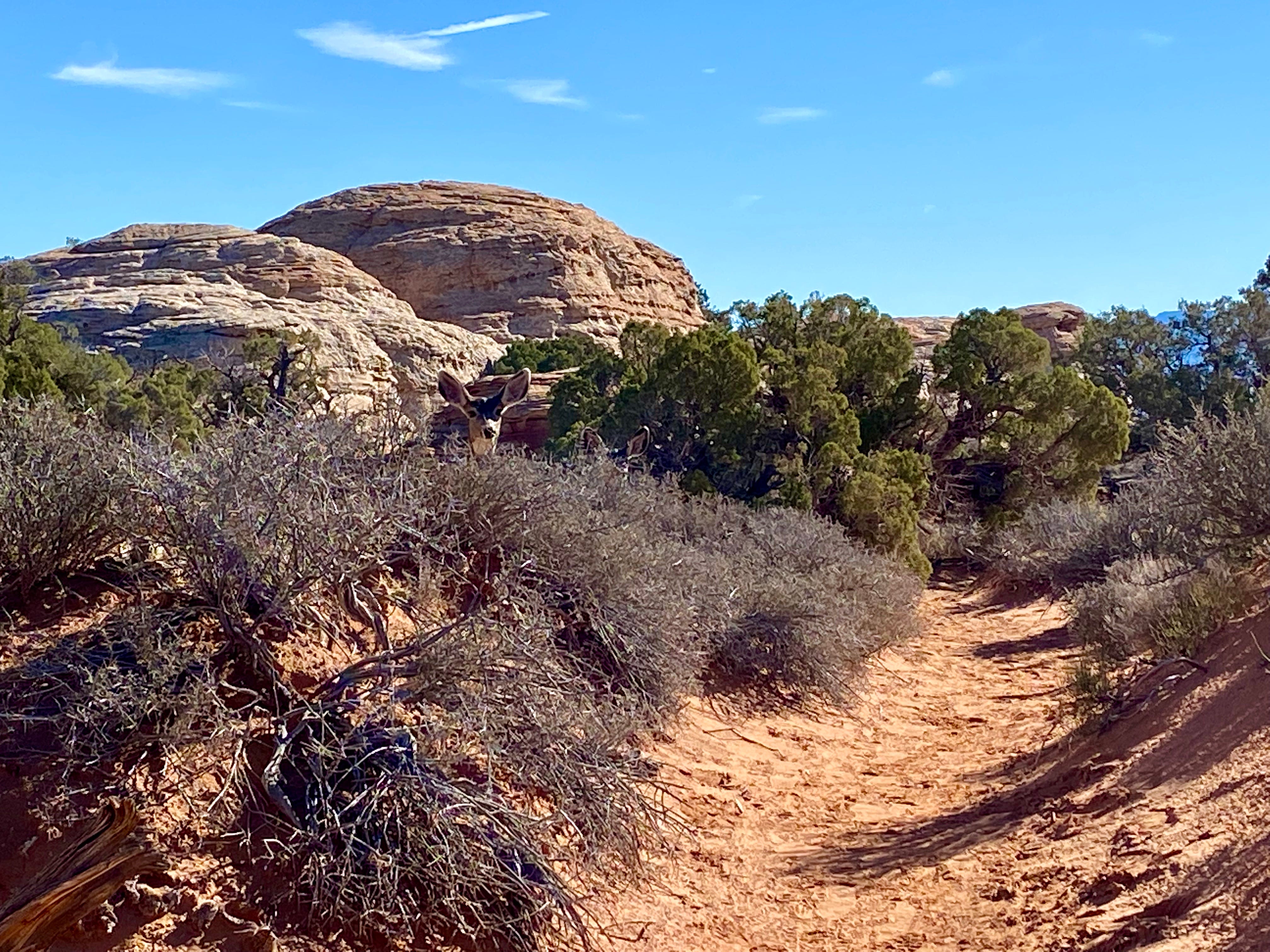
Maybe it’s because we were hiking alone, but we noticed a bit of wildlife — a group of nuthatches flitting about, and chipmunks in the distance. We also saw lots of cleft-hoof footprints, and sure enough, as we approached Broken Arch, we came across a family of mule deer, photo below. (This was the only wildlife we saw our whole time at Arches. It’s a park for hiking formations, not for viewing wildlife.) Our hiking time was 90 minutes.
#2. Double Arch
I rated this one so highly because there’s a fabulous view from inside the arch and we had fun enjoying it with other hikers.
Double Arch is in the Windows region. We didn’t get it done the day we hiked the rest of that area — it just got too hot. So we returned in the late afternoon on another day. That timing was perfect as the whole area was in shade. And what a fabulous arch!
It’s called a “pothole” arch because a pothole above created an “alcove” below. Somehow it also became two arches, basically at 90 degree angles to each other. What a photographer’s delight. The blue sky peeks through in lots of interesting ways. I was glad to have humans in the photo (at bottom) for scale.

We hiked up to the arch then into the mouth of it.
On the other side there was a sheer drop. I think of myself as being average when it comes to a fear of heights, but I’ll say that it was quite exhilarating to look over that ledge! Also, you can glimpse Balanced Rock in the distance.
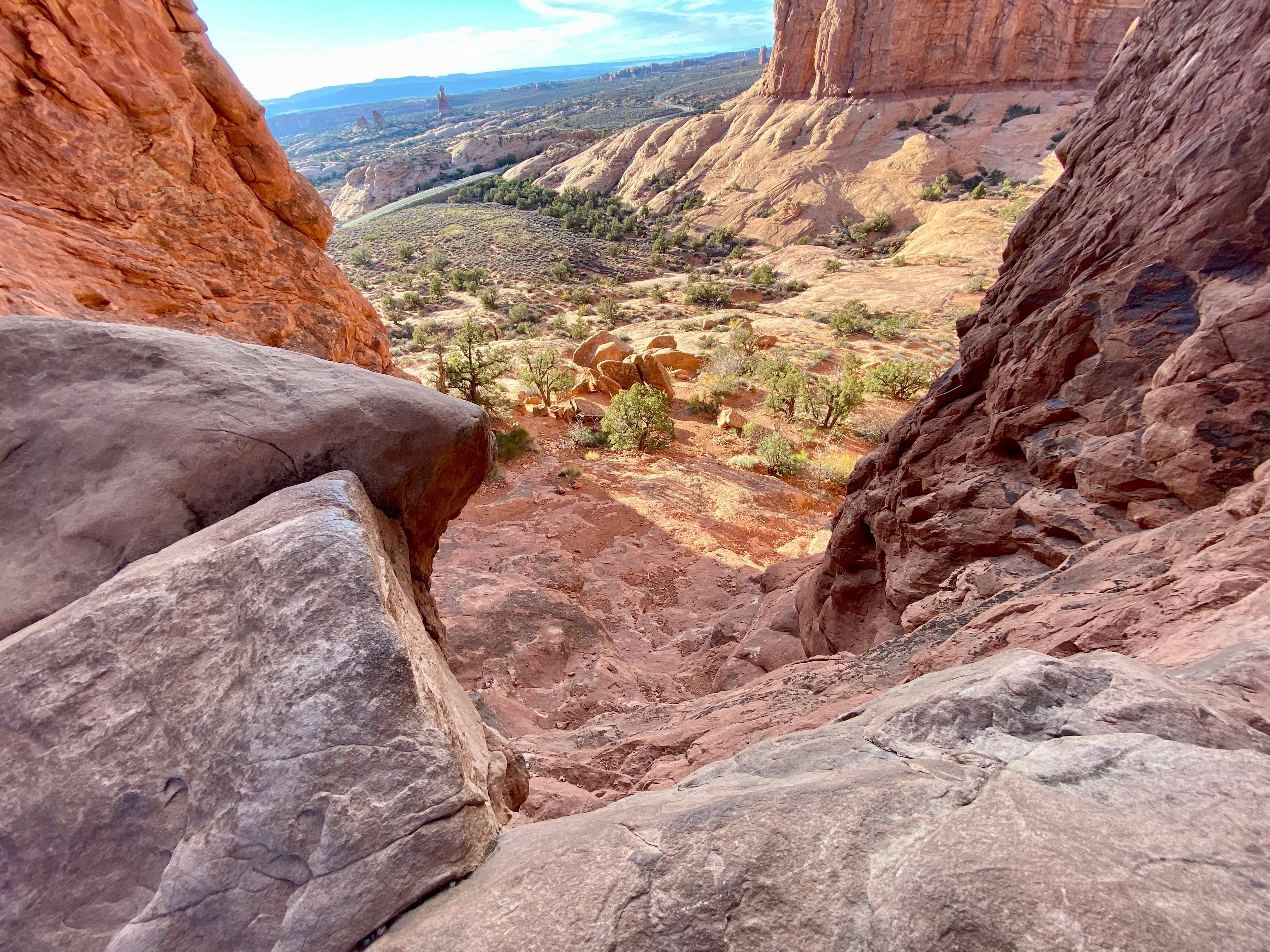
We could enjoy a vista of the whole region, including a great view of Balanced Rock. A family of three (mom, dad, son maybe 9 or 10 years old) had watched us scramble. The boy was staring at me. I told him, “There’s a sheer drop right here, if you’re not too scared of heights.”
The boy started coming up the rock but froze. He looked at me again. I asked his mom if she was okay with this and she nodded.
I told the boy, “Take your time and place each foot.” He went another little ways and got stuck again. He asked me how I did it. I pointed out my route, foot by foot. Which he then took. He was so excited to make it to the top! He whooped and yelled and was just beside himself.
His dad came up after him, they were both all grins. Mom was taking pictures from down below. Since there wasn’t enough room for me to get out of the frame for their photos, I joked that maybe they could edit me out.
The mom said, “I’ll just say you’re me.”
Then I noticed that 2 young couples to our left were waiting their turn. I told them I was coming down. One of the young men seemed quite concerned about whether I could make it safely. I said “Are you going to be my honorary son?” He was not obtrusive, but offered me his hand a couple of times. I told him my method: keep my center of balance low, and scoot. It really does work for me. I scooted all over Arches NP.
I wonder if I reminded that young man of someone — a mother or aunt or teacher? He was very sweet. It was so fun to borrow other people’s sons and enjoy this arch with them.
After the two young couples scrambled into the mouth of the arch (along with the son and his dad) everyone was busy taking photos. Then another man unobtrusively scooted up and photobombed them all. It was hilarious! We all laughed so hard. The photo-bomber had such great physical comedy. There was just so much joy up in that arch!
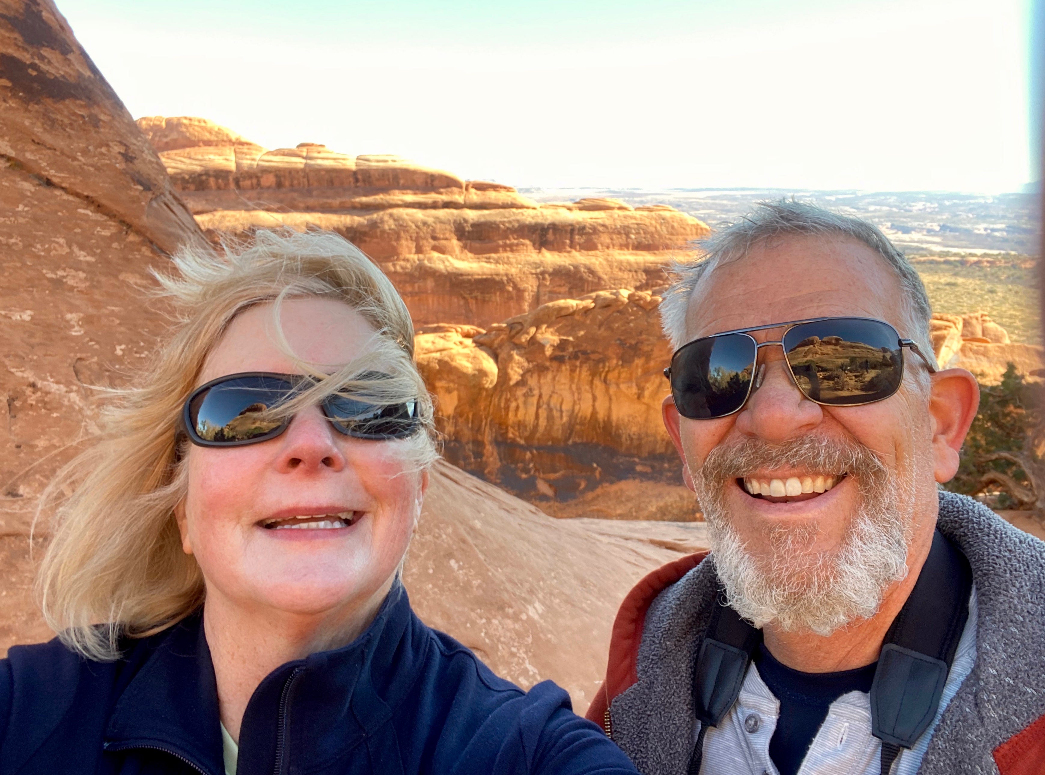
#1. Fiery Furnace
Fiery Furnace is one of those “best of” hikes. You have to sign up a week in advance and get a permit from a ranger, then go through an orientation process. They allow 53 people into the Fiery Furnace each day.
The orientation included an eight minute video with the rules for “leave no trace”. We were exhorted to not disturb the biological soil crust which is so slow growing. There were two large families being oriented at the same time as we were, and it was fun to see how excited the children were. They wanted to answer all the questions and become Jr. Rangers.
There is only one route through the Fiery Furnace — a 2-mile counter-clockwise loop. The route is marked by rock cairns, and also arrows which are about 3 inches long and can be hard to see. You’re allowed to explore on your own, as long as you don’t walk on the biological crust or get stuck.
The ranger said that happened the previous week — someone got stuck on top of a rock formation and had to be extracted. (Doug and I did hear a helicopter late in the day in the Devils Garden campground, which is quite near the Fiery Furnace.)
We began our day at the Fiery Furnace around 9:00 AM. A school bus was pulling up and discharging 13 third graders who were also going to spend the day there. We encountered the group a number of times during the day but it was never a problem.
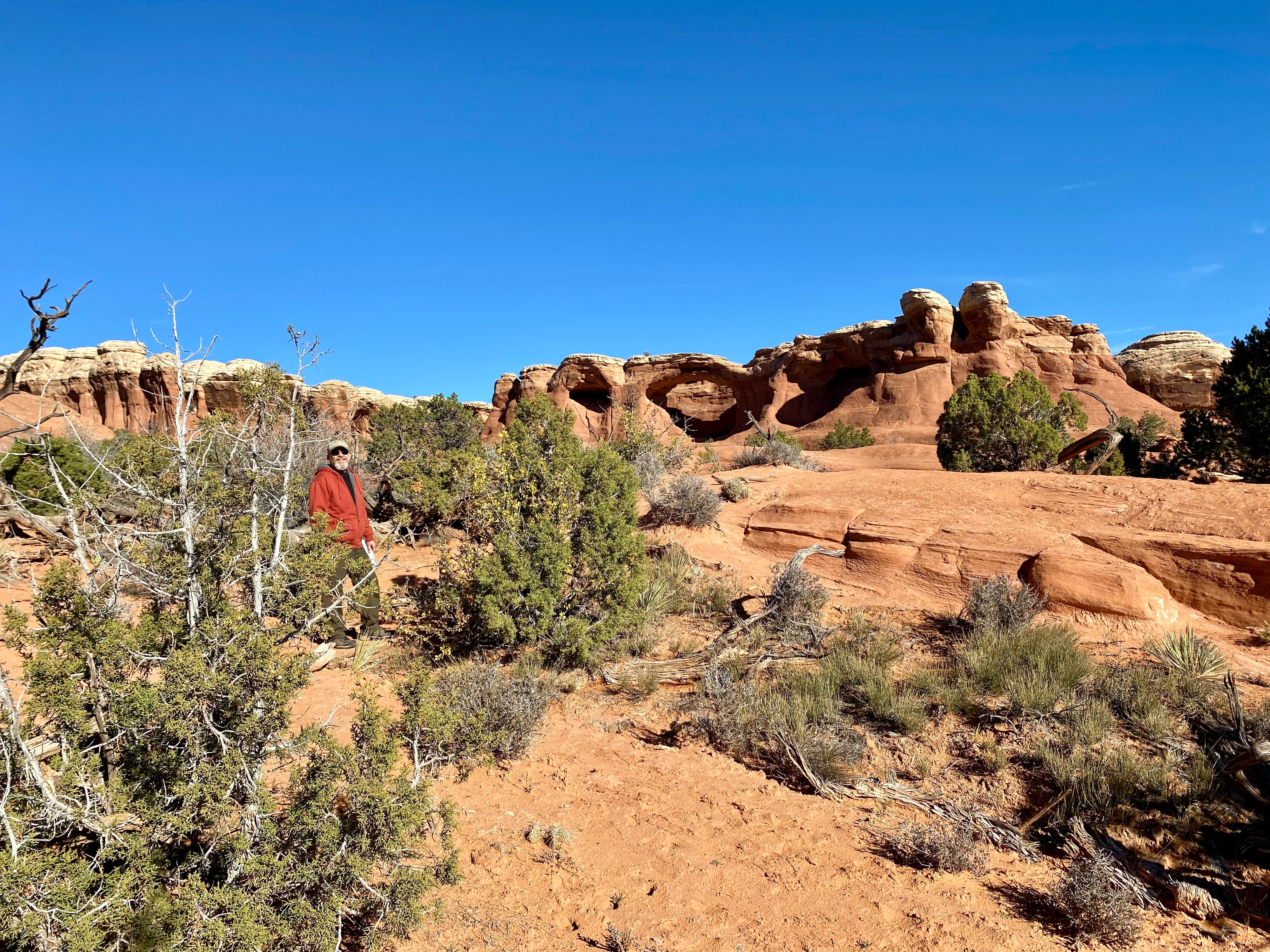
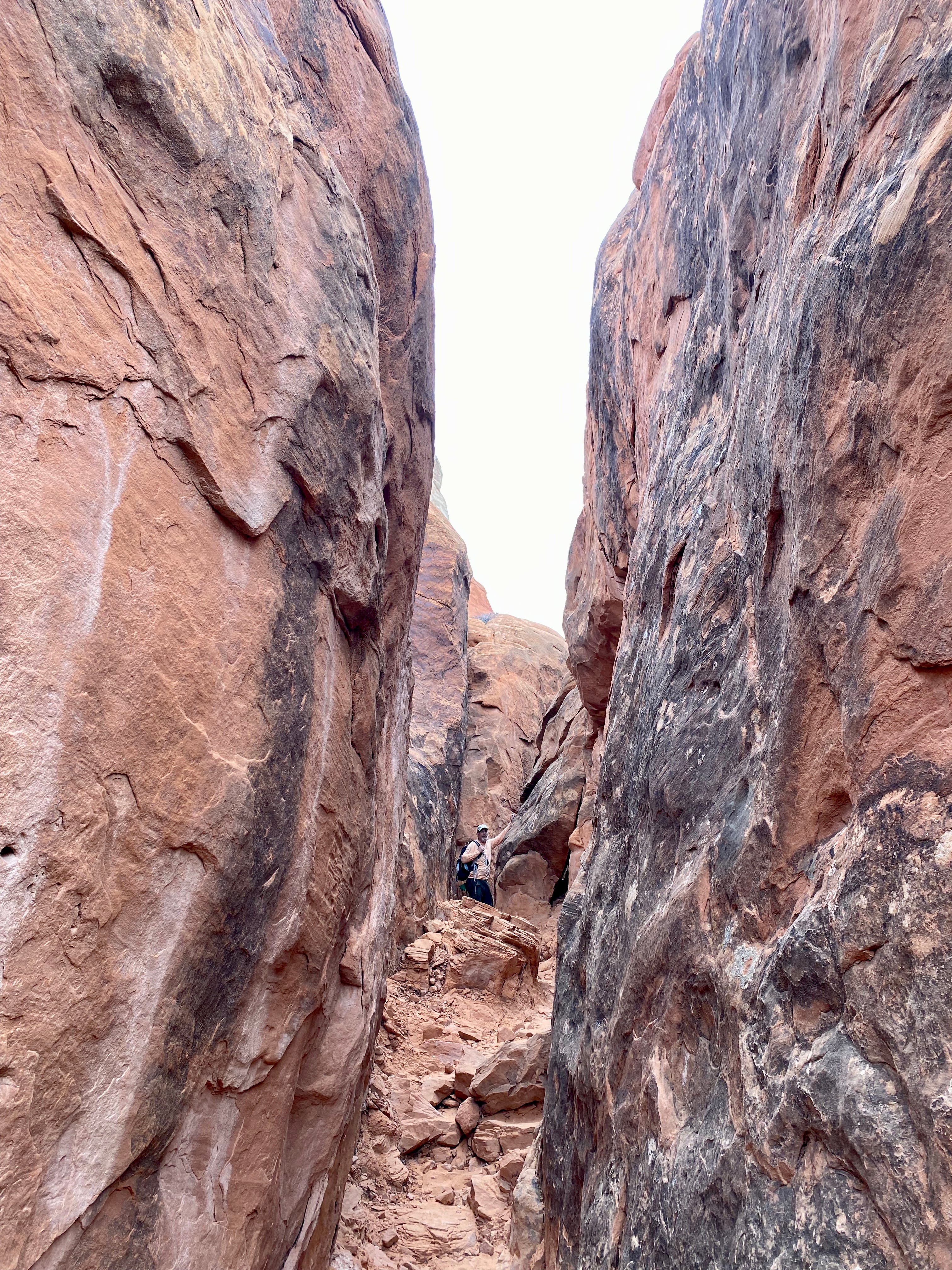
Since we had all day, we explored all the little side canyons we came across. In places its similar to a slot canyon, with narrow passageways and sheer walls all around. It’s hard to spot Doug in the photo below — he’s wearing a salmon colored overshirt.
Other times the trail climbs high, along cliff edges. In the canyon bottom there are sometimes pools of rain water, and vegetation growing.
In one side canyon, another hiker asked us if we’d found the arch yet. We didn’t know there was an arch! So we became determined to find it, and did. (But I will not divulge where.)
At one point I had trouble climbing over a very large rock in order to enter a side canyon. As I tried to throw my body weight higher, I could sense someone was watching. I looked down and saw a mother with a young girl, waiting. I stepped aside. The daughter looked at me with big eyes. The mother did a fabulous job of giving her daughter a tutorial. “First, you plan your route with your eyes. Then you see how far you can stretch your legs. Then you shift your weight . . . .” What a lucky daughter. And it’s not the last time you will meet this particular mother and daughter! Stay tuned for the next installment.
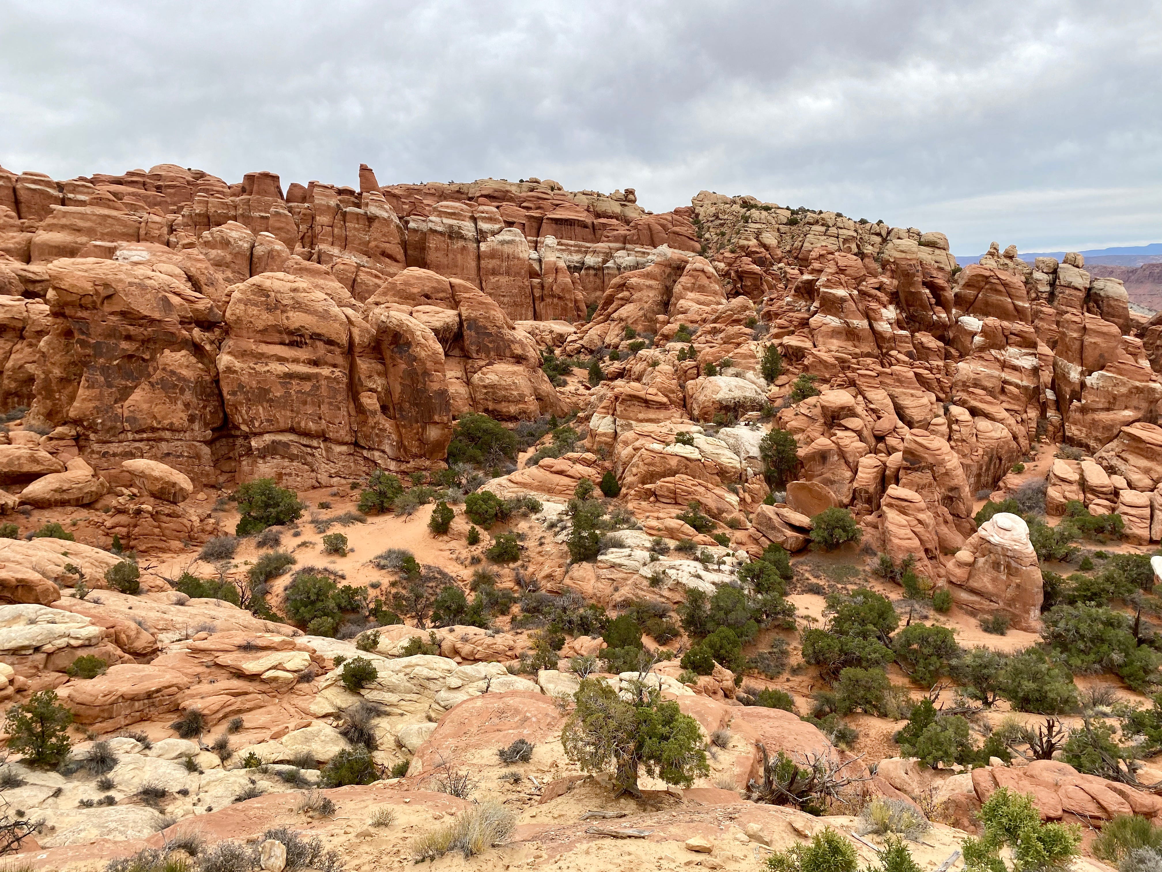
Meanwhile, here’s an overview of the Fiery Furnace, late in the day after the clouds came up.
I'm so glad you are meeting other humans who are as eager to see the park as you were. I love the "borrowing sons" part; and I'm certain you reminded him of someone. I'm looking forward to the next installment!
Happy Birthday, by the way!
Beautiful photos!