


Canyon-Bathing: Like Forest Bathing Without the Trees
Nov 9-11, 2021
Canyons and rocks are not our native habitat. We’re woods-walkers. Doug is from Minnesota and I grew up in the Midwest. Now we live on the East Coast. The trees we’re familiar with are maple, oak, pine, and ash. The birds we normally see are cardinals, robins, blue jays, hawks and starlings. We are conversant with whitetail deer, gray squirrels, the sly red fox, and box turtles.
For the past two weeks we’ve been soaking in an entirely different kind of landscape. Earlier I blogged about the eight hikes we did at Arches NP. But what I didn’t describe was the overall shift — from woods to canyons, from maple trees to sandstone cliffs, from cardinals to ravens. (And I’m not talking football!)
My favorite activity is to lace up my hiking shoes and walk where there is no pavement. I don’t need to walk particularly fast, or far, or far from home. Walking through trees helps slow down my thoughts and reset my brain.
When the pandemic lockdowns were in their early days Doug and I often escaped to the woods. We felt lucky to have them available. That first pandemic Easter I wrote an essay for the Christian Century (the link will take you to my website). Among other things, I describe the ways that woods-walking shifted my perspective.
The woods have always been our happy place. And now we’ve discovered a different sort of happy place. It turns out you can forest-bathe without any trees at all!
Arches NP vs. Canyonlands NP
After saturating ourselves in the red rocks of Arches NP for nearly two weeks, we were ready to head to Canyonlands NP. We didn’t know much about this park — except that it receives only a fraction of the visitors that Arches does. That sounded perfect for us. Early in our trip planning we had decided to specialize in “B-rated” parks. They are so much less crowded and often just as spectacular.
Canyonlands is very large, more than four times the size of Arches. It has two entrances leading to developed areas which, surprisingly enough, do not overlap or even connect. A large section to the east is called the Needles. (We spent a day exploring this area when we drove to Monticello. We saw Newspaper Rock and also some dinosaur tracks. I have not blogged about this yet as we expected to return.)
Canyonlands NP — Islands in the Sky
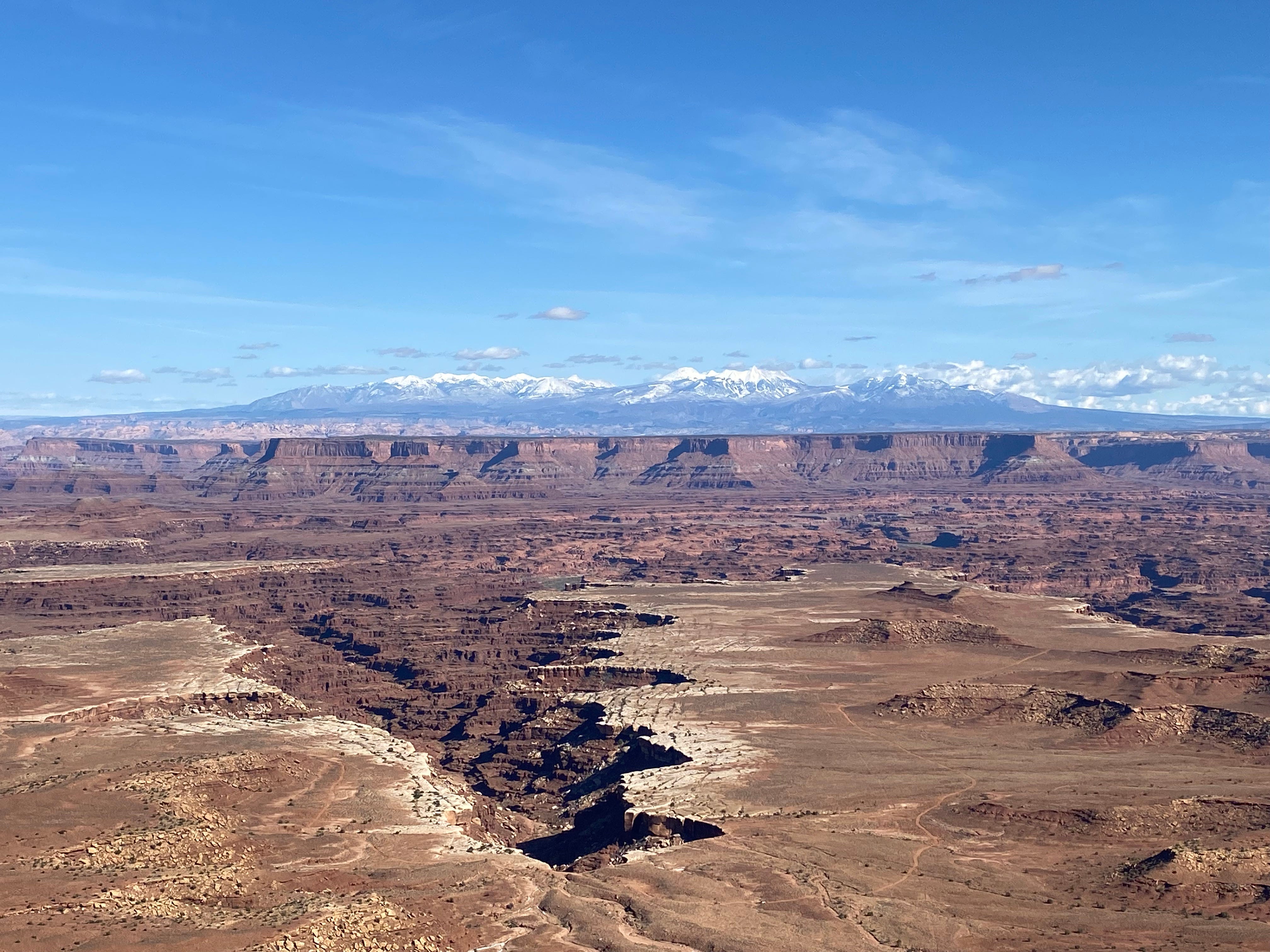
On this Tuesday we head toward the northern entrance of Canyonlands to explore the area called Islands in the Sky. It’s an overcast day, very windy and cold. We drive across a high desert plateau that feels very exposed. Off to our west we can see snow-capped mountains. The ranger at the entrance station tells us their name: the Henry Mountains.
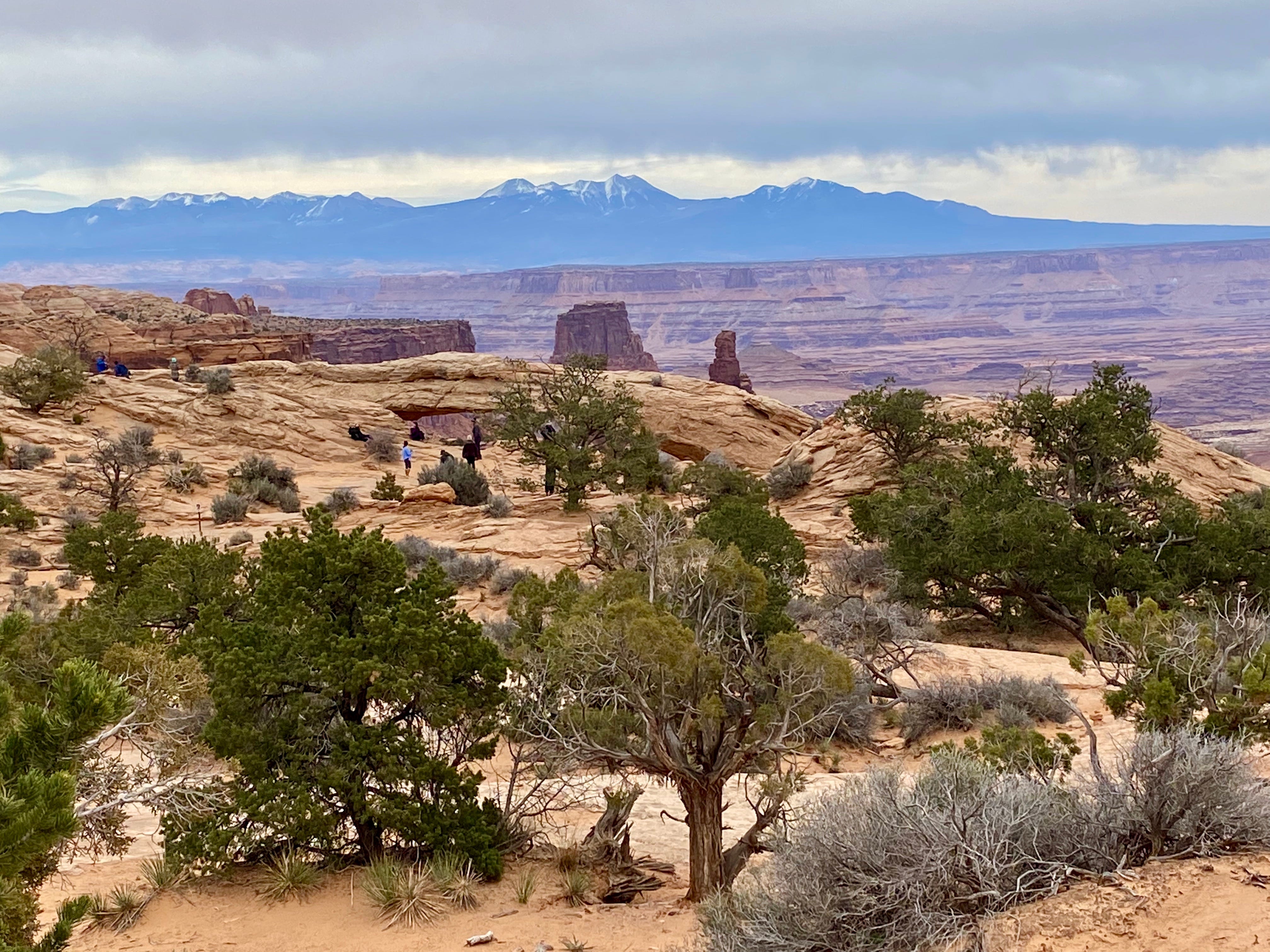
Shortly after our stop at the Visitor Center, we stop to hike out to Mesa Arch. This is one of the famous spots in Canyonlands, mainly because you can see the LaSal mountains in the distance behind the arch.
A Camping Snafu
There’s only one campground, Willow Flats, with a dozen campsites. Pretty minimal for a national park, don’t you think? It’s first come first serve. You fill out a payment envelope, tear off a stub and clip it to your campsite post. People usually leave a few items in their site so others can easily see that it’s been claimed. We typically unload our folding chairs and the bright orange leveling blocks.
Even though it’s early in the day, we claim a site. Then, because it’s so windy, we decide to eat lunch in the camper. We’ve never done this before, mainly because it’s a bit of a bother — we have to put the jacks down and slide out the dinette.
As we’re eating, I notice a small tent pitched in a sheltered corner of the campsite. Oops. Someone else was here first and we didn’t notice. We quickly move our folding chairs and leveling blocks to a neighboring (empty) site. We figure we’ll move the rig as soon as we finish our meal. Meanwhile other people are arriving and claiming sites.
Sure enough, a young man appears. He is quite distraught to find us in his campsite. Doug apologizes and explains that we have realized our mistake. The young man (whose name is Ryan) put his receipt on the post but the wind carried it away.
I say “You didn’t leave anything on the picnic table.”
He was traveling so light he didn’t have any items to leave behind!
Ryan explains that he was up before sunrise and is trying to do all the hikes in a single day. It’s all the time he has. He came back to camp just now to take a quick nap. Then he intends to finish the list. He’s obviously exhausted.
I remember when vacation time was that precious. Poor fella! But there’s no pressure on us. Because the wind continues and rain threatens, we spend the afternoon getting organized, writing postcards and drinking hot tea.
Canyonlands is a Dark Sky Park
Many of the Utah parks are Dark Sky Parks, which means that they’ve taken steps to limit their light pollution. The star cover can be astounding. Many planets are visible, along with the Milky Way and lots of constellations.
Our truck camper has a skylight over the bed. At night we can open the blind and look straight up at the sky. Sometimes I get on my knees and open the skylight and put my head out like a giraffe, or a periscope. Someone told me that you can sometimes see the Aurora Borealis from southern Utah. So now I have an irrational fear that the northern lights are flashing and I’m missing them. So I like to do a 360 degree check, just in case.
Wednesday, Nov 10 — Hiking in Canyonlands
I don’t want to shock anyone, but this morning for breakfast we are having cream of rice instead of oatmeal.
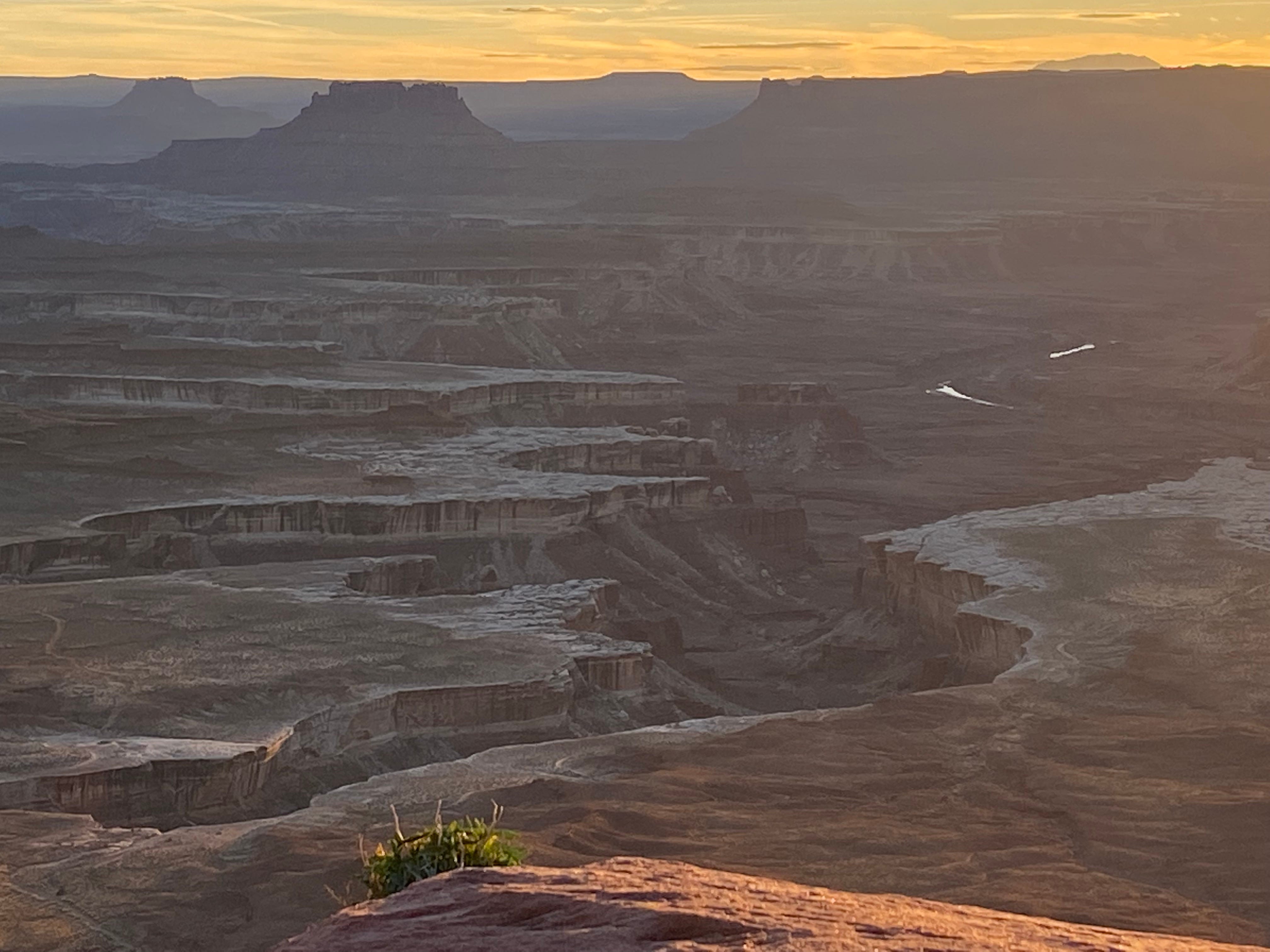
Today the weather is completely different from yesterday — the sun is strong in a bright blue sky. We drive to the nearby Green River overlook which affords a long view over a great expanse. The canyons spread out below us in two distinct steps, with upper and lower canyons. Towering canyon walls always have a lot of drama, but the additional lower canyon adds a sort of other-worldly quality, like this might be the place to literally drop off the face of the earth.

An exhibit talks about John Wesley Powell, who led an expedition to this area in 1869. He’s referred to as a “one-armed Civil War veteran.” (When you consider how many veterans lost a limb in that war, that seems a bit unfair.) I need to read more about Powell. Do you have any book suggestions for me?
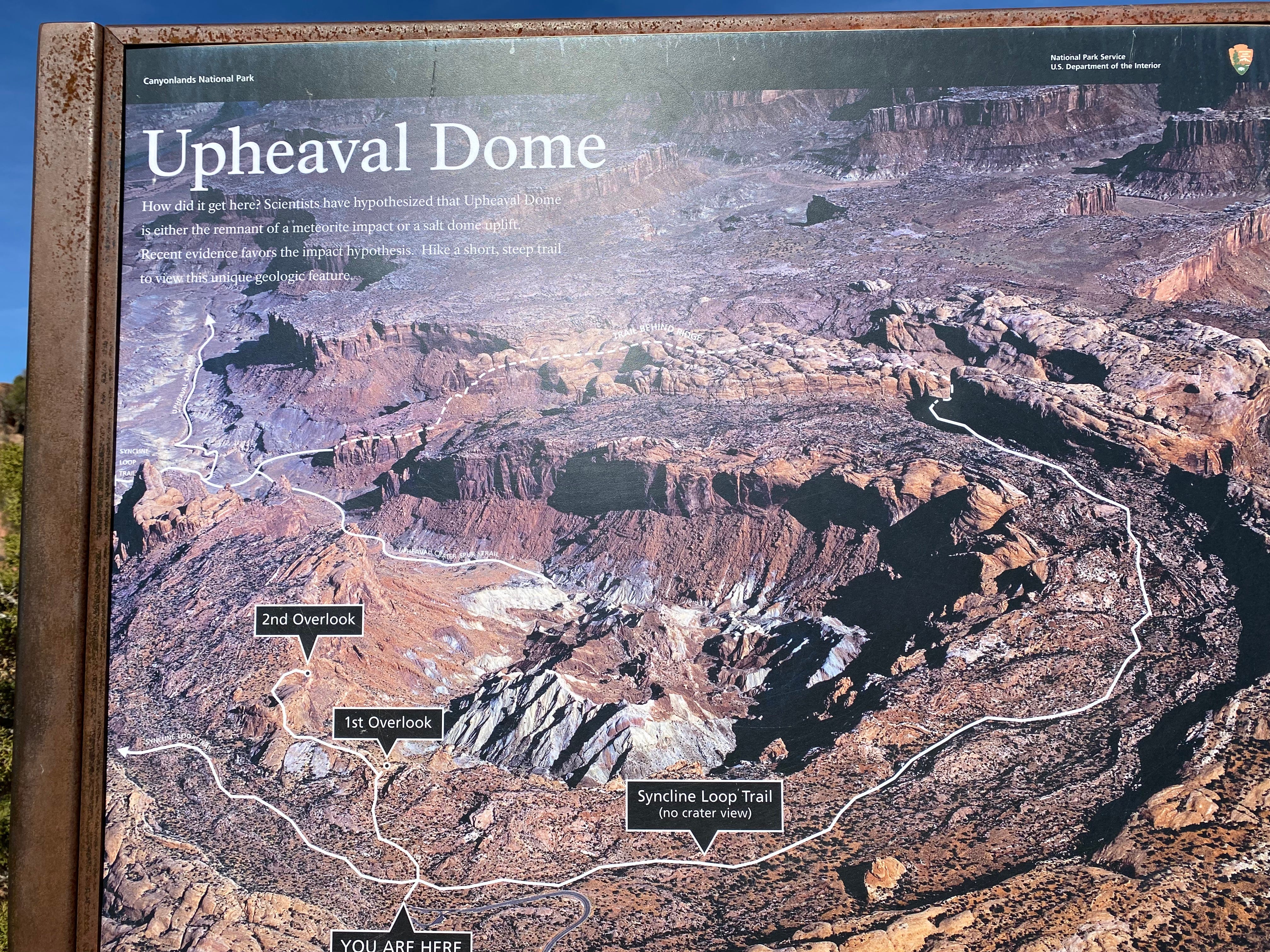
Upheaval Dome
Upheaval Dome is heralded as the park's most unique feature. Also, its origin is disputed. So of course we want to see it.
We go on a loop hike to different vantage points, each of which has interpretive signs inviting us to ponder how this formation came to be. The hike takes about an hour, but my mind is made up in the first ten minutes. The feature is called a “dome” but the dome is inverted. So it’s a crater, right? And the inside isn’t smooth like a bowl — it has interior ridges in white, gray and pastels.
There are two main origin theories. One has something to do with salt and seepage and so on. The other theory is that a meteorite struck.
I bet most of the people reading this blog can guess which theory I’m going with.
Whale Rock
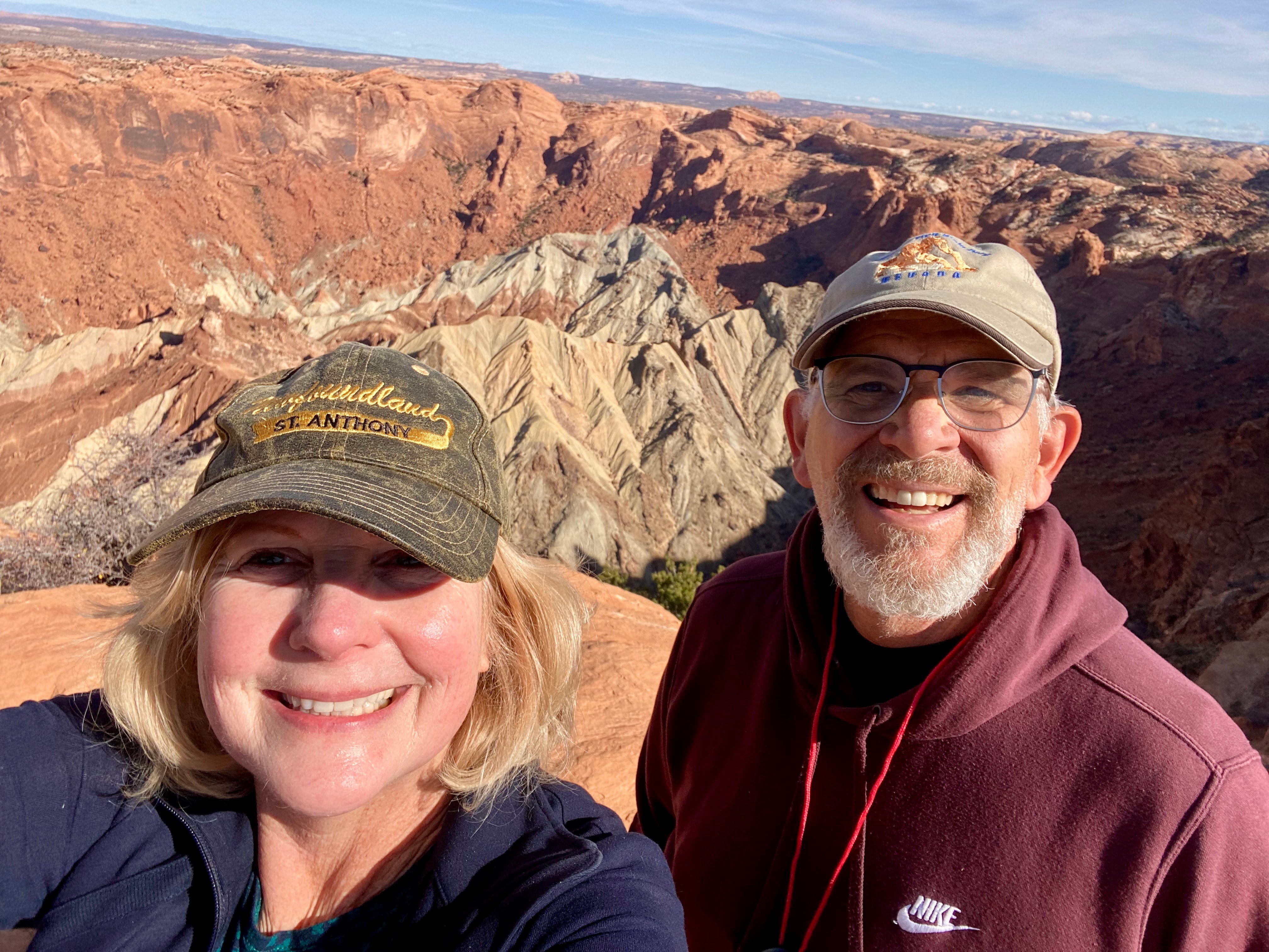
We also decide to hike Whale Rock, partly because it’s labeled as “good for children” and partly because it has a fun name. We bring along our picnic lunch. The distance is 1 mile each way with a significant elevation gain. The rock is well-named — it’s a dome as smooth and sloped as a whale’s back. The higher we climb. the further that smooth slope stretches in front of us. As we climb there’s a gorgeous view in every direction. At the top we’re on a perch, an “Island in the Sky” indeed.
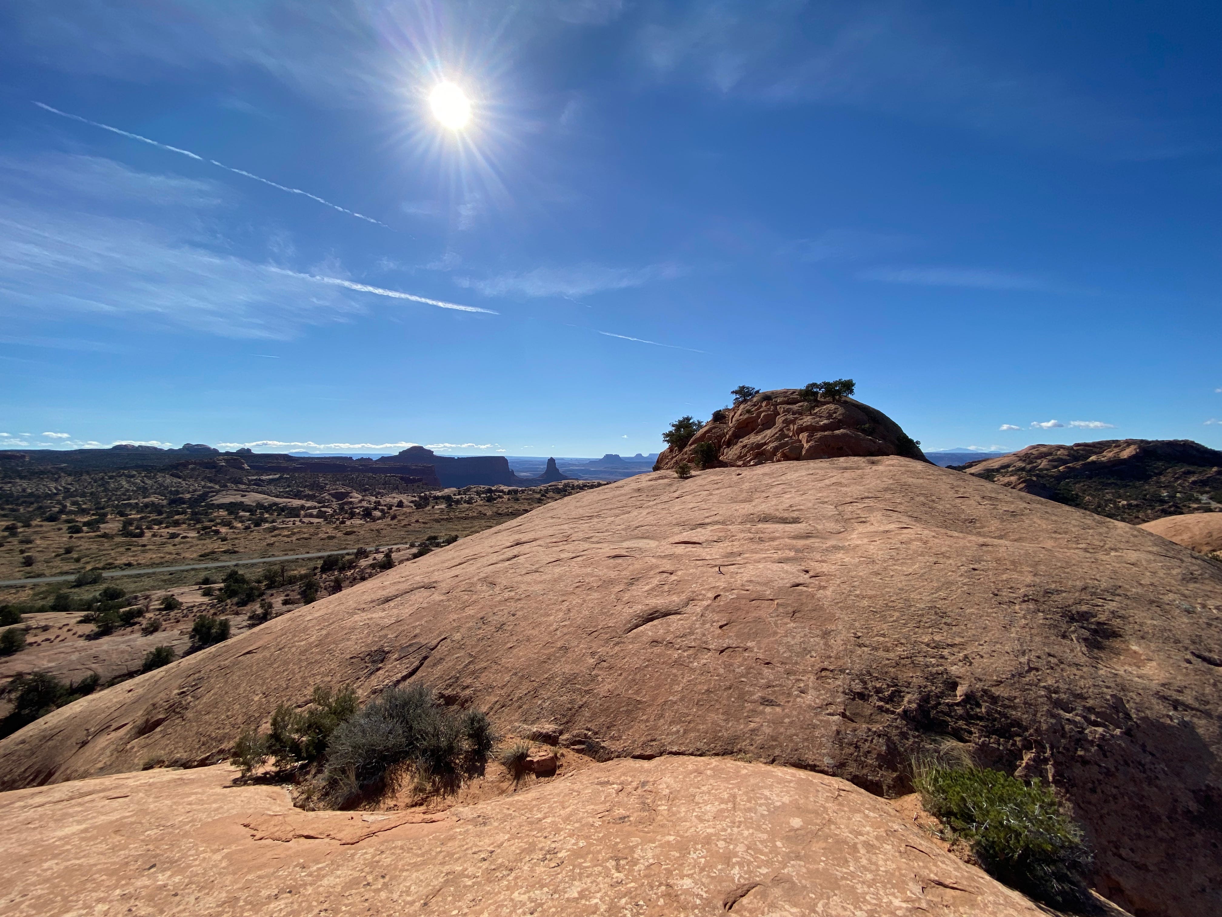
We sit down to enjoy the view and eat our picnic lunch. It’s quite windy and the rock makes for a cold seat. As we eat our sandwiches, a line of people passes behind us, climbing the whale’s spine. Down in the parking lot we can see their little Matchbox-sized bus.
One of the older guys stops next to me and makes a Dad joke about how nice it was that we brought him a picnic. It was exactly the kind of joke that my Dad would have made. I miss his jokes.
Also I want to go on record as saying how ridiculous it is to label this trail as “good for children.” Maybe none of the people who write this copy actually have children. The idea of having a three-year-old “scamper” on top of a round-bellied rock with a sheer drop all around is either laughable or actually criminal. Maybe every park is pressured to designate one trail as kid-friendly, whether or not that reflects reality.
Canyon Rim Walk
We take one last hike — not knowing we saved the best for last. It’s actually rather spontaneous. At Grand Overview we opt to do the Canyon Rim Walk. The hike curves around a point of land that projects out into the canyon. Talk about having a view with every step! The double-layered canyon with its ribbons of roads and dry washes stretches as far as the eye can see. Not only is the hike beautiful, it’s a relatively easy walk, primarily on stone as flat as a parking lot.
Then we head back to the Green River Overlook for sunset.
Thursday, Nov 11 — a transitional day
We gear our activities this Thursday around a phone call we need to make in the afternoon. A bit tricky because it happens to be Veterans Day so the public library is closed. We end up in the parking lot of a Juvenile Detention Center to pirate their free Wifi. Then we head to a dispersed camping spot in the Abajo National Forest, near Blanding, Utah.
Next up: Hovenweep and Natural Bridges, including another hiking failure.
I was in Canyonlands in …. 2000, or thereabouts. We rented a 4- wheel drive vehicle and bumped around on some back roads. We also did an afternoon rafting trip that the kids thrilled to, me too, as several years later Elaine and I did a rafting trip in the Grand Canyon. Your days hiking sound glorious. Thanks also for promoting my own memories!