


Driving Across Nevada: the Loneliest Road in America
Dec 8-9, 2021
After touring the Lehman Cave in Great Basin NP, and enjoying a bowl of lamb stew at the Border Inn (Utah/Nevada), we head west on Route 50, dubbed “The Loneliest Road in America.”

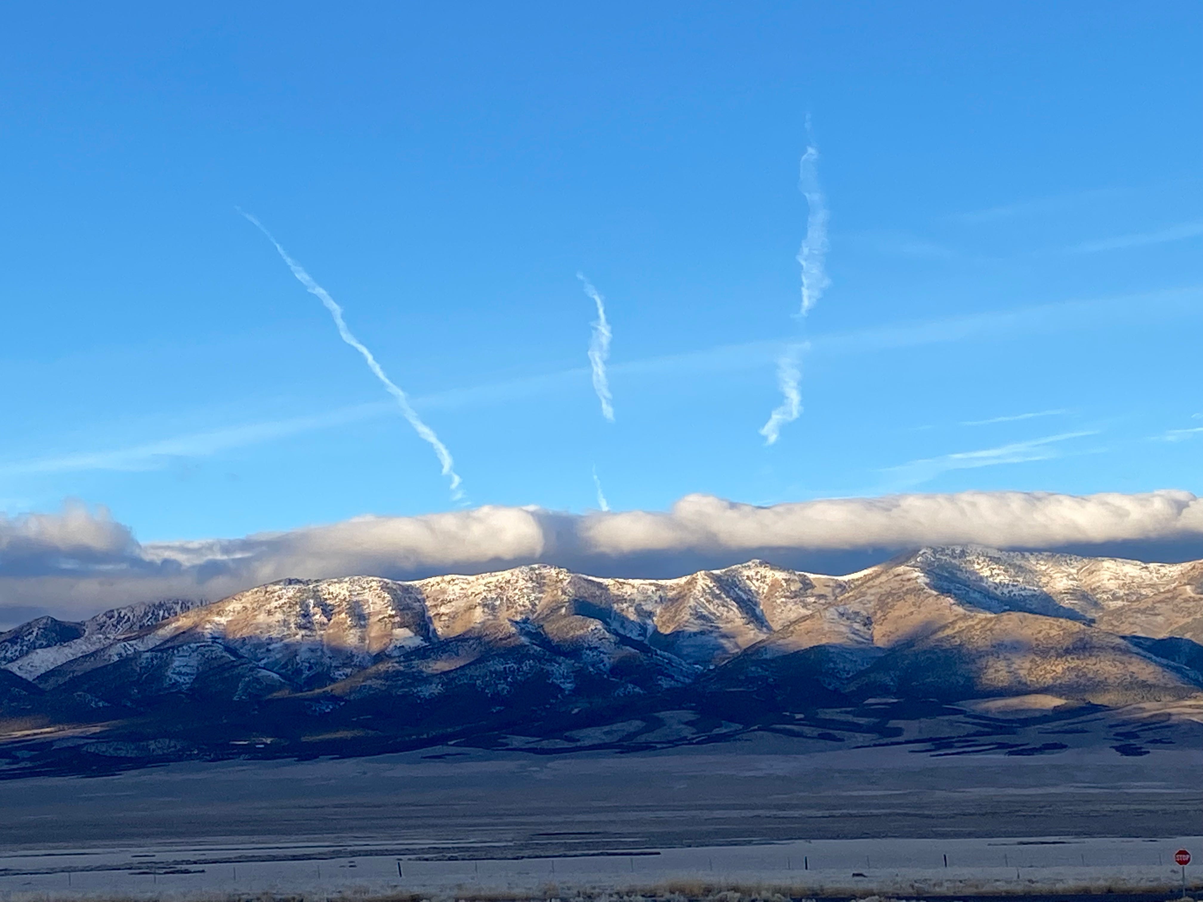
Driving west across Nevada, the land stretches flat with mountain peaks in the distance. Often the distant peaks flank us on both sides, as if we’re driving along the bottom of an enormous taco. Many of these peaks stretch to 13,000 feet, as high as the Rockies. The foothills are green from pinyon pine and juniper, and the slopes that face north are spotted and striped with snow.
I’m not sorry the Rockies hog all the attention, and visitors. I like being in this lonely place, a true wilderness, “A place to visit but not remain.”
Boondocking in the Elk Viewing Area
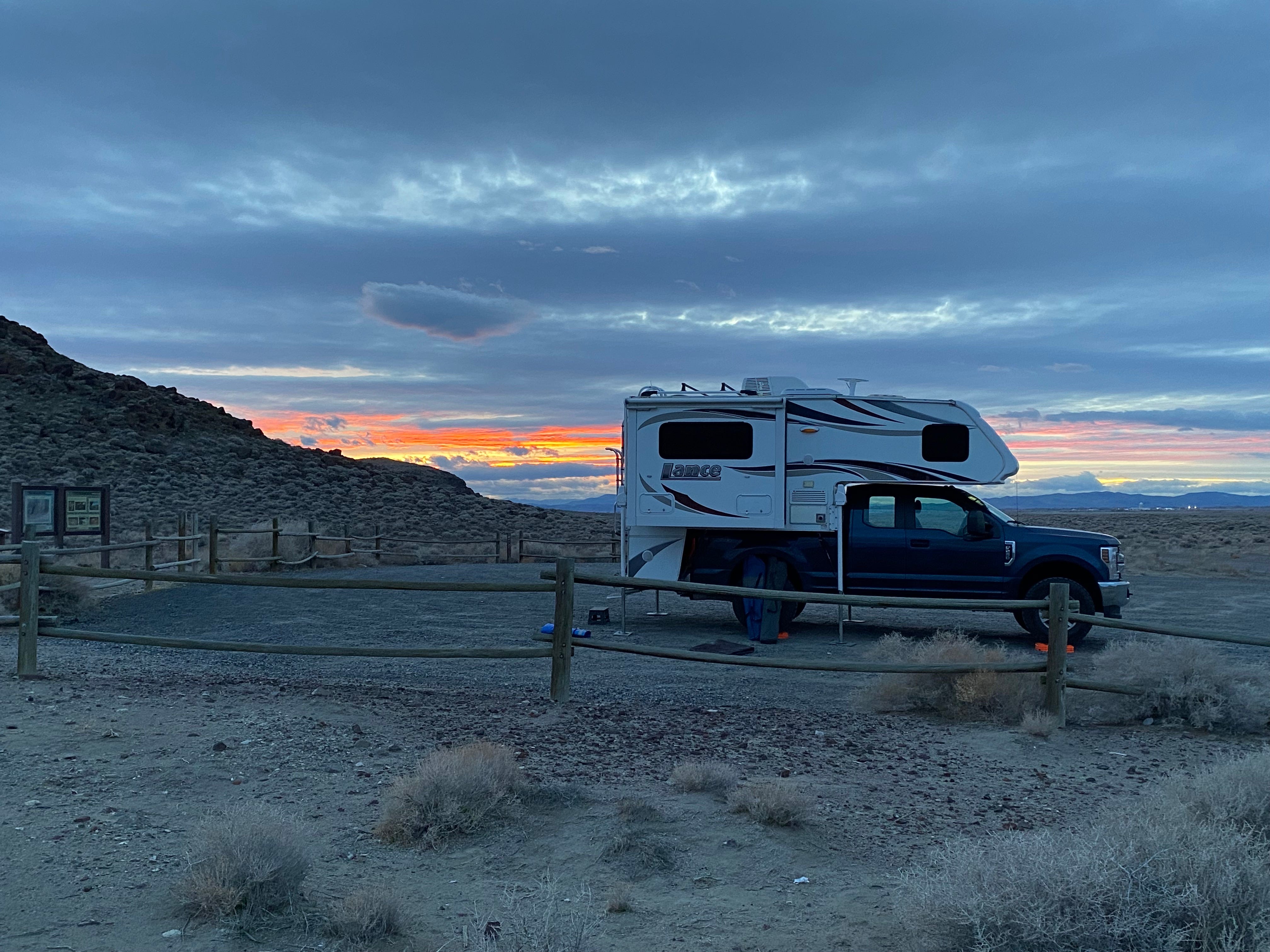
We stop for the night in an “Elk Viewing Area” east of the town of Ely. When we pull in around dusk, we’re the only vehicle. During the night two other vehicles pull in, but we don’t interact with either one.
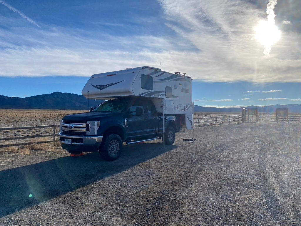
A sign explains that a century ago local cowhands pulled their money to import elk from Yellowstone, a small herd that now numbers about 1500 and fuels a significant hunting operation. At both sunset and sunrise we pop open the “moon roof” of the camper to scope for elk. But no elk are on view in the Elk Viewing Area.
The overnight low drops to a freezing 20 degrees but we stay warm with the propane heat set to 55.
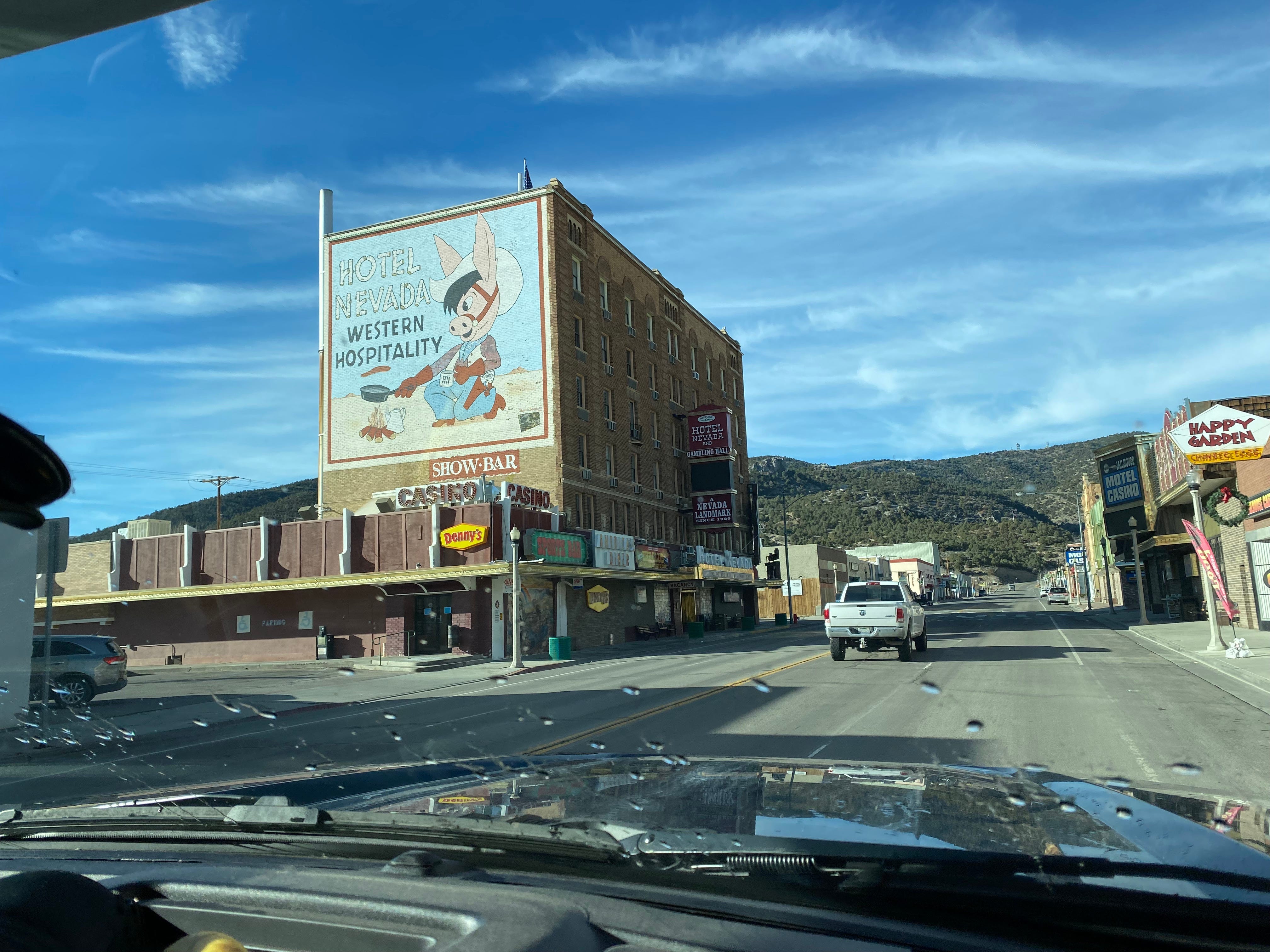
The Town of Ely, Nevada
Much of Route 50 follows the original Pony Express trail so there are bits of interesting history about that. The town of Ely began as a Pony Express stop. Later it became a mining boom town. The streets of Ely are surprisingly quaint. Many of the buildings sport murals celebrating the unity of different people groups. One proclaims “where the world met and became one.“
A once prominent hotel, the Hotel Nevada, now sits in disrepair.
Throughout Ely, Christmas decorations fly from lamposts. The garlands are very old and a bit ragged, but at least someone bothered to put them up.
The town has a number of places to eat. For a moment I wish we hadn’t had our simple breakfast in the rig. You never know what you’ll find on the road.
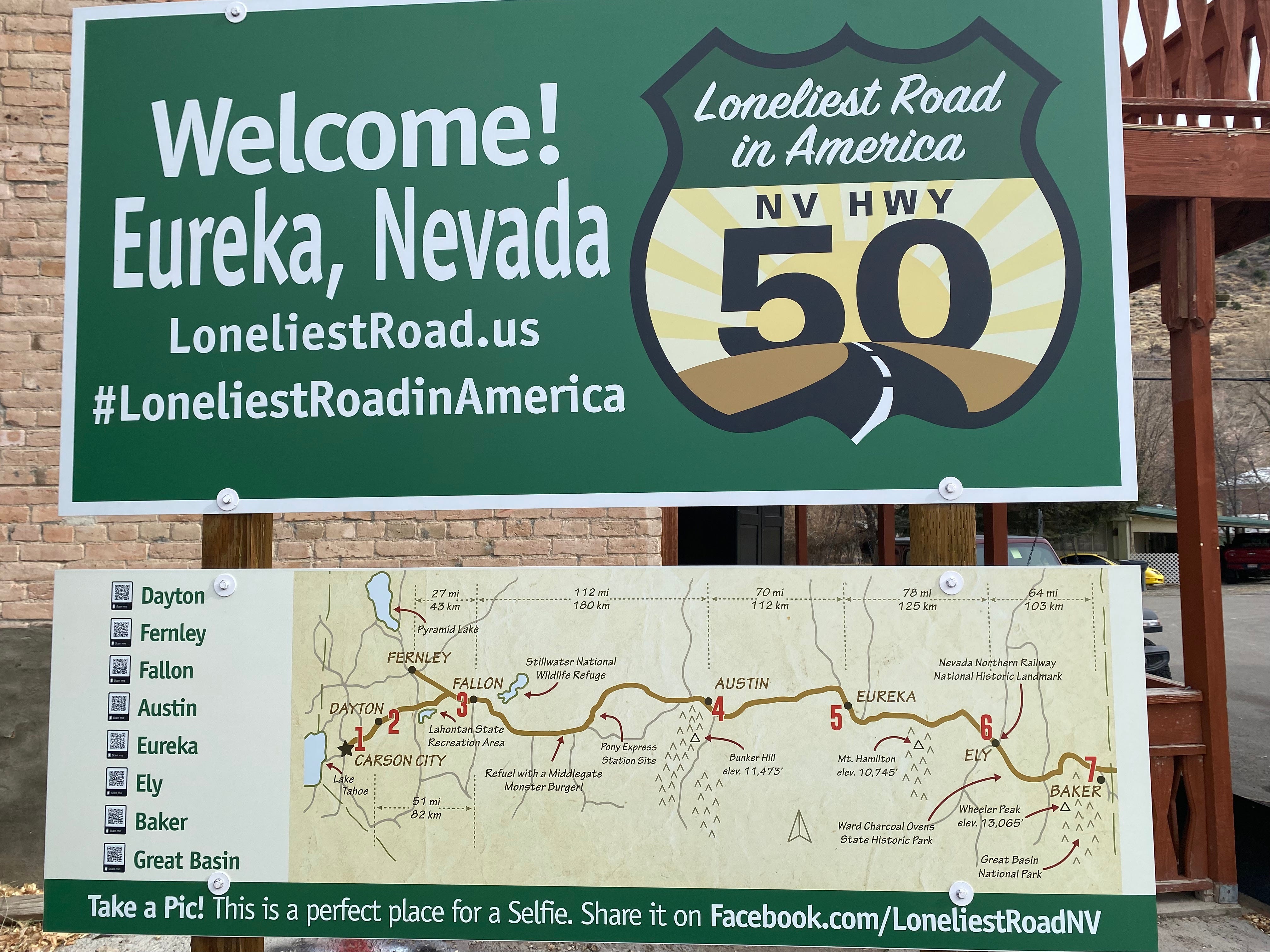
The Town of Eureka, Nevada
In the next town, Eureka, I took a photo — the map shows the Pony Express stops and the other sign suggests hashtags. The town is trying to market its history for this millennium.
We stop for lunch at a place called Adeline’s Saloon, housed in an old building. High ceilings, wood paneling, chandeliers, and very little heat. The menu consists of a few sandwiches scrawled on a whiteboard. We are the only people in the place. We each order a hot sandwich and coffee, and sit down.
While we wait for our order, two men seat themselves at the next table. They are a father and son, both quite chatty. The older gentleman explains that they’re from Gainesville, Florida, traveling while he recovers from a traumatic spinal injury. We compare itineraries and experiences. They stayed in Moab at a motel, and then tent camped in Canyonlands NP. He comments on how cold it’s been, and the lack of water. I feel very fortunate to travel in Big Blue.
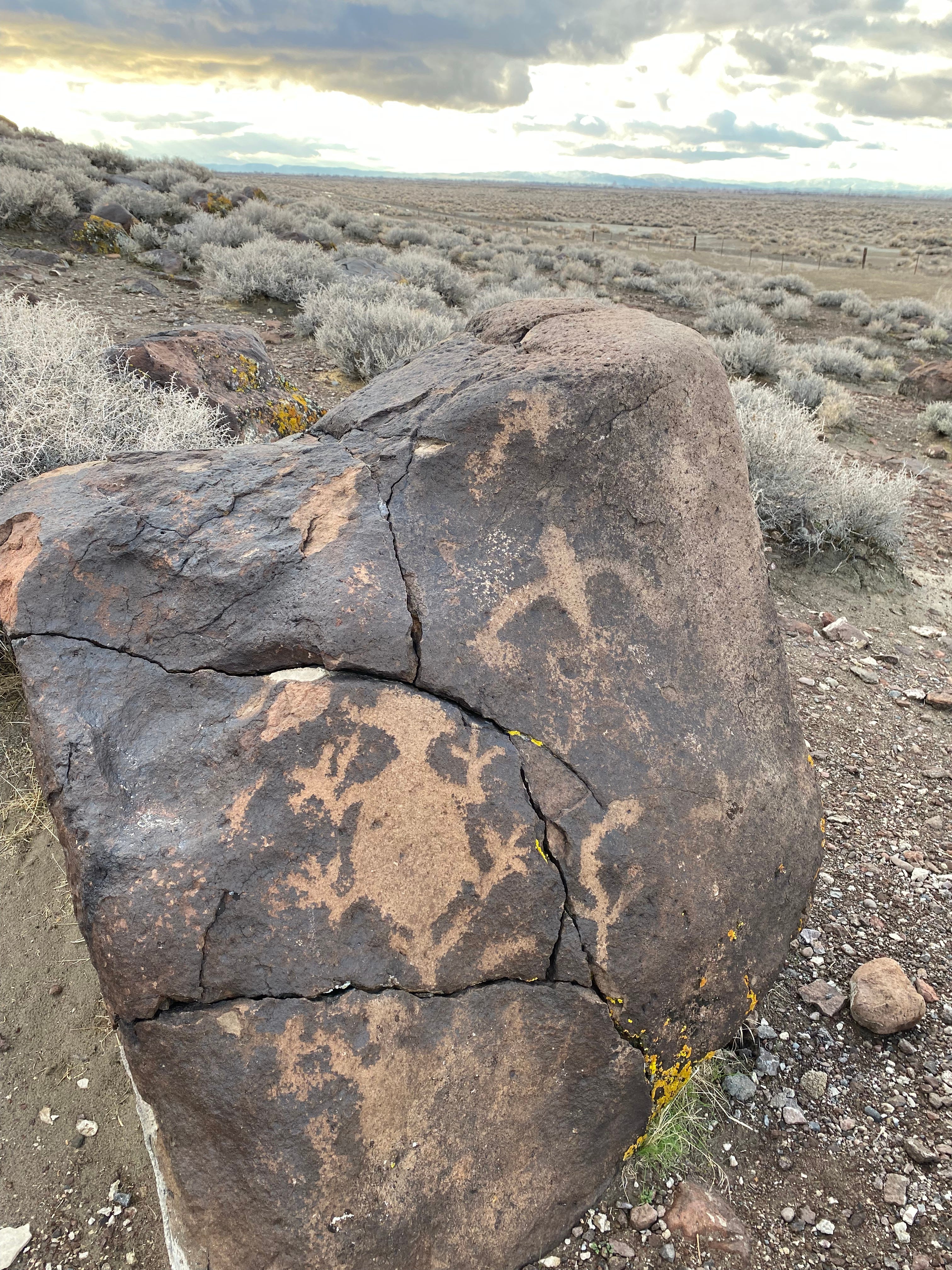
Hickison Petroglyphs
Around 1 o’clock we stop at the Hickison Petroglyph site and hike about two miles. Even though it’s cold, it feels good to be on foot in the fresh air.
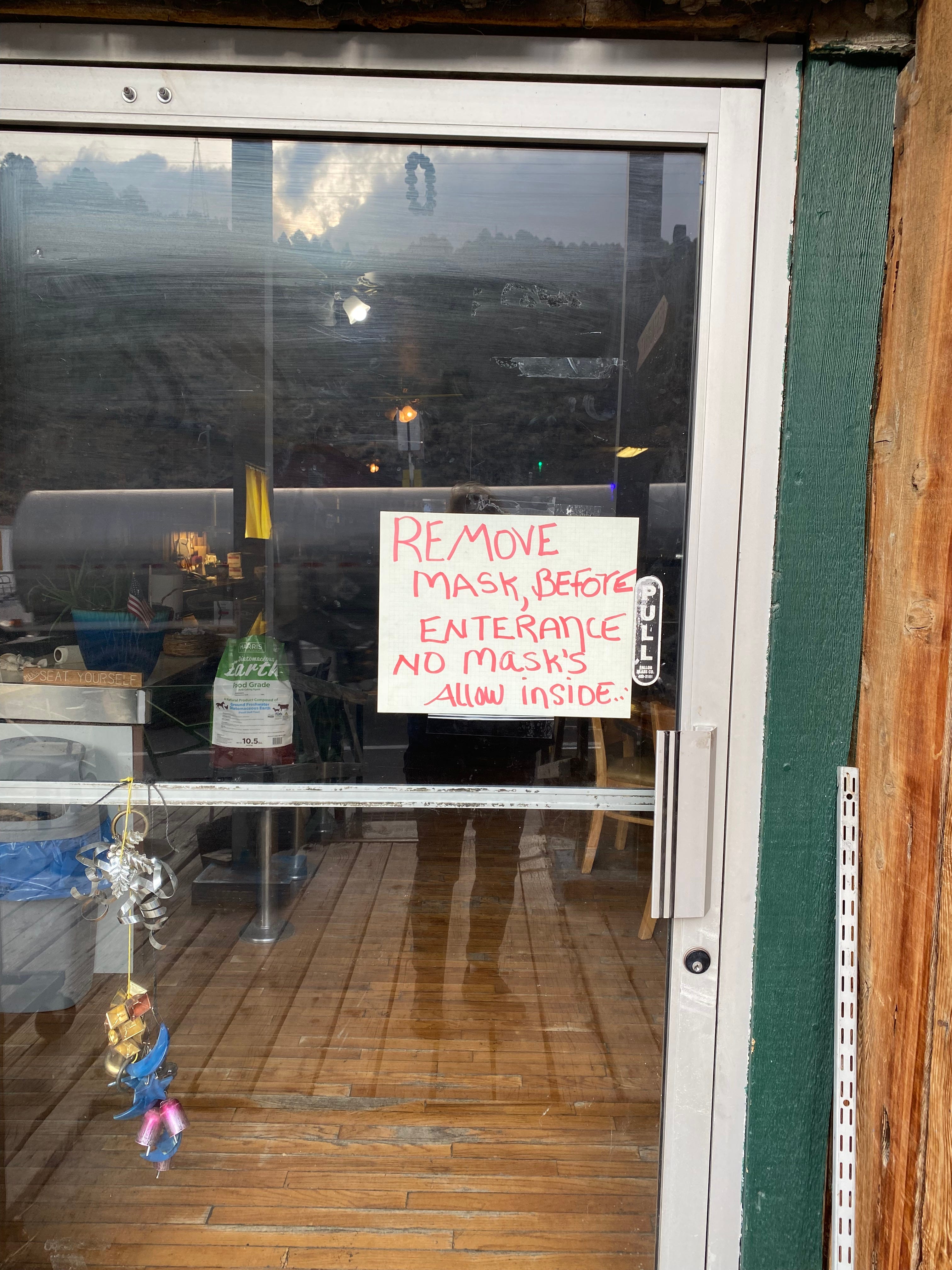
The Town of Austin, Nevada
We arrive in Austin around 2:30. The approach into town is memorable — you descend a hill and do a hairpin turn around a huge junkyard full of dead vehicles. A large sign welcomes all visitors: “Trump 2024, Save America Again.”
Only one restaurant in town appears to be open. A sign on the door says “Remove mask, before enterance. No mask’s allow inside.” [sic]
Only one gas station in town is open, a Champs, where we tank up for $4.29 per gallon. The pastor in me notices that this small town, with its hostile edge, sports three church buildings, all made of brick. The Episcopalian church has a new roof. The Baptist church appears to be in good shape. A third church is in disrepair.
As the afternoon wears on, the wind picks up. To the south are dark clouds that may hold snow. By 3:30 the sun is low in the sky.
At one point we pass a tree that is completely full of shoes hung by their tied shoelaces. I have no idea what that signifies. Do you know?
We pass the famous Sand Mountain. Snow lines both sides of the roadway, and people have used small dark rocks to make messages in the snow. One lengthy message begins “We the people.”
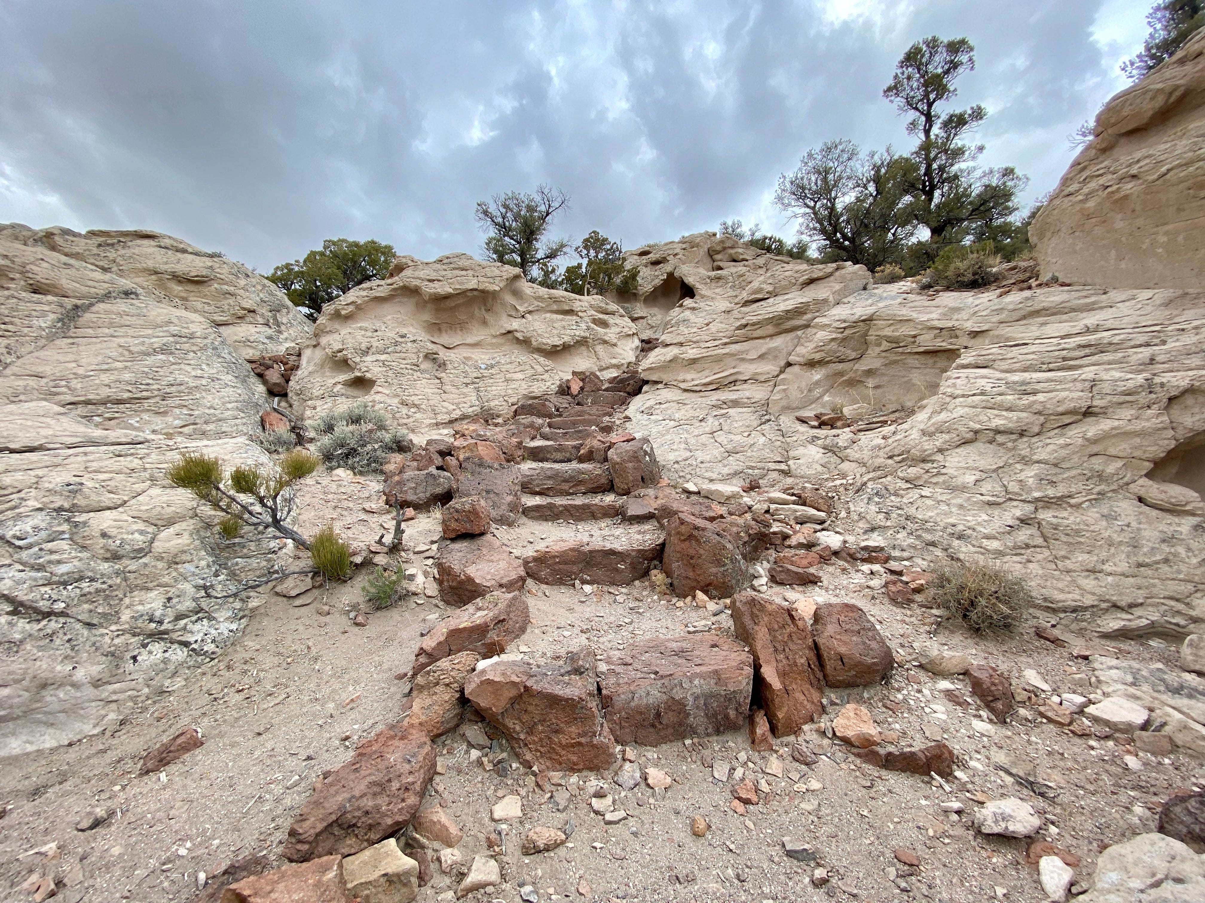
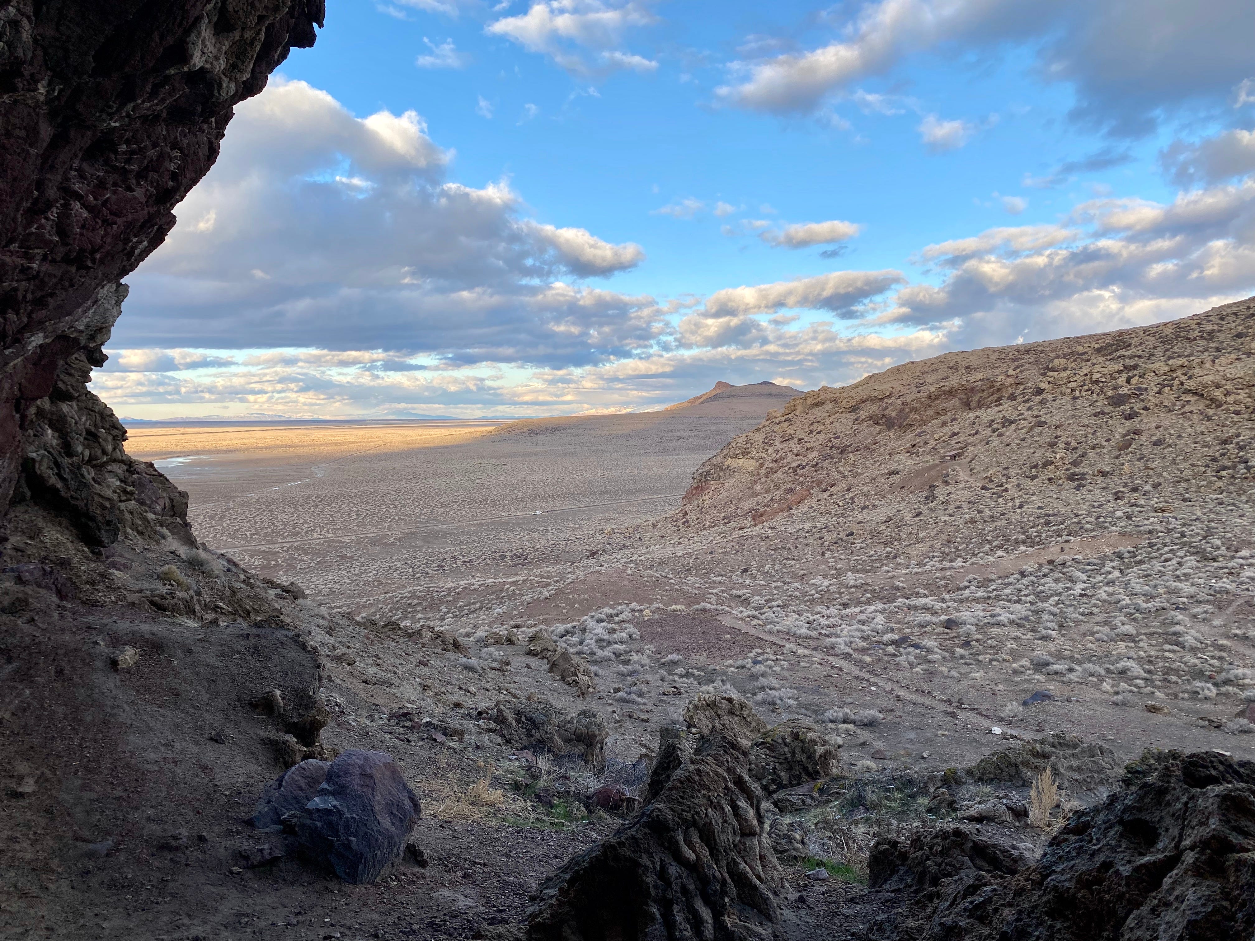
Hidden Cave, outside Fallon, NV
As the sun sets, around 4:30, we stop for the night at a spot called Hidden Cave. It’s on a dirt road about 6 miles east of Fallon. You need to arrange a tour of the cave in advance, but there’s also a petroglyph trail.
Thursday, December 9
We like this spot and don’t have anywhere else to be, so we spend the next day at this site. We take a number of long walks and explore the petroglyphs and hillside nooks made of tufa. We watch birds, including a pair of Condors, which is exciting as we’ve never seem them before. We observe fighter jets roaring up from the Naval Air Station in Fallon, which can be heard long before they can be seen.
On one hike to the top of a prominence I find a macrame bracelet tucked under a rock. A tag says “Merry Christmas to Whoever Finds This.” I keep it.
The next morning we stop in Fallon for breakfast at Jerry’s Restaurant before driving on to Reno, where more adventure awaits!