


Gros Morne NP
plus Codroy Provincial Park
Day 7, May 26
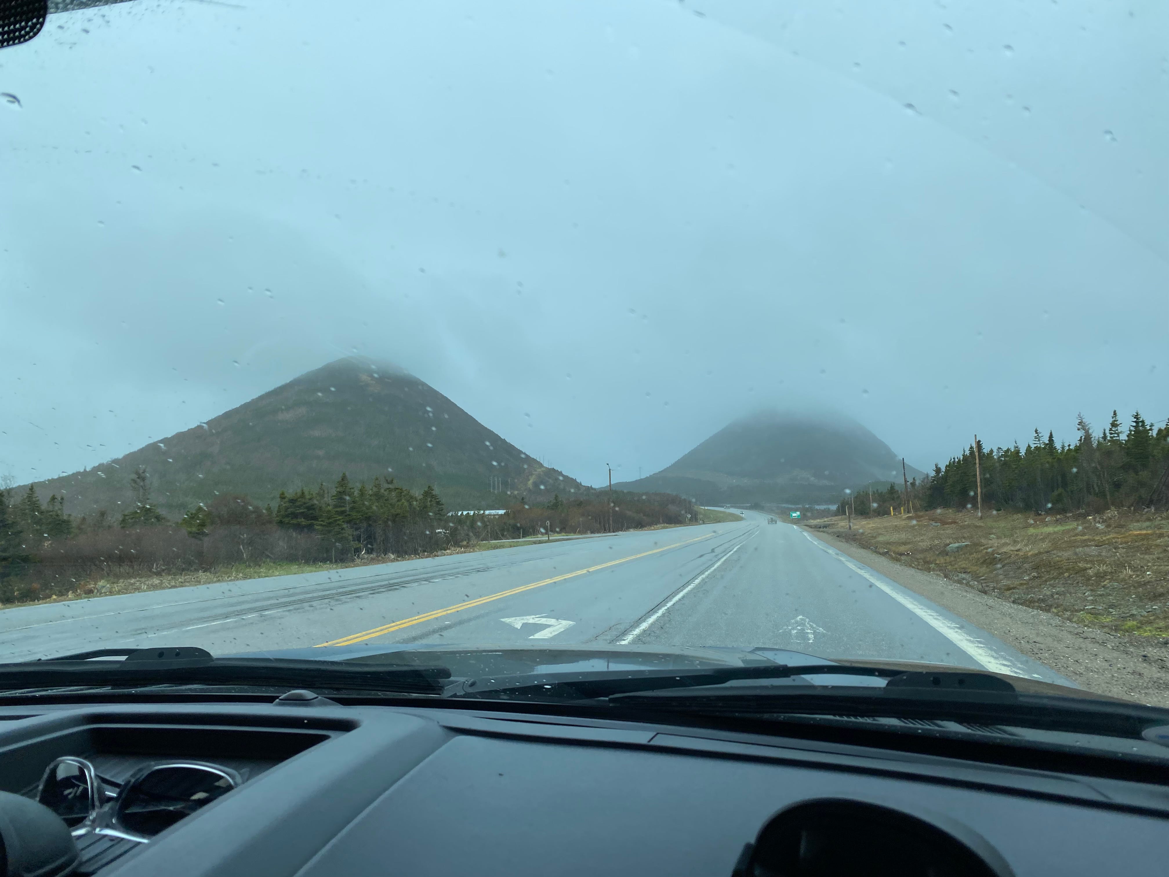
The Newfoundland ferry arrived at Port Aux Basque right on time, 7:30 AM, after a crossing time of 8 hours. The weather was overcast, 47 degrees, with a light drizzle.
This is the view from the TCH (Trans Canada Highway) almost immediately off the ferry:
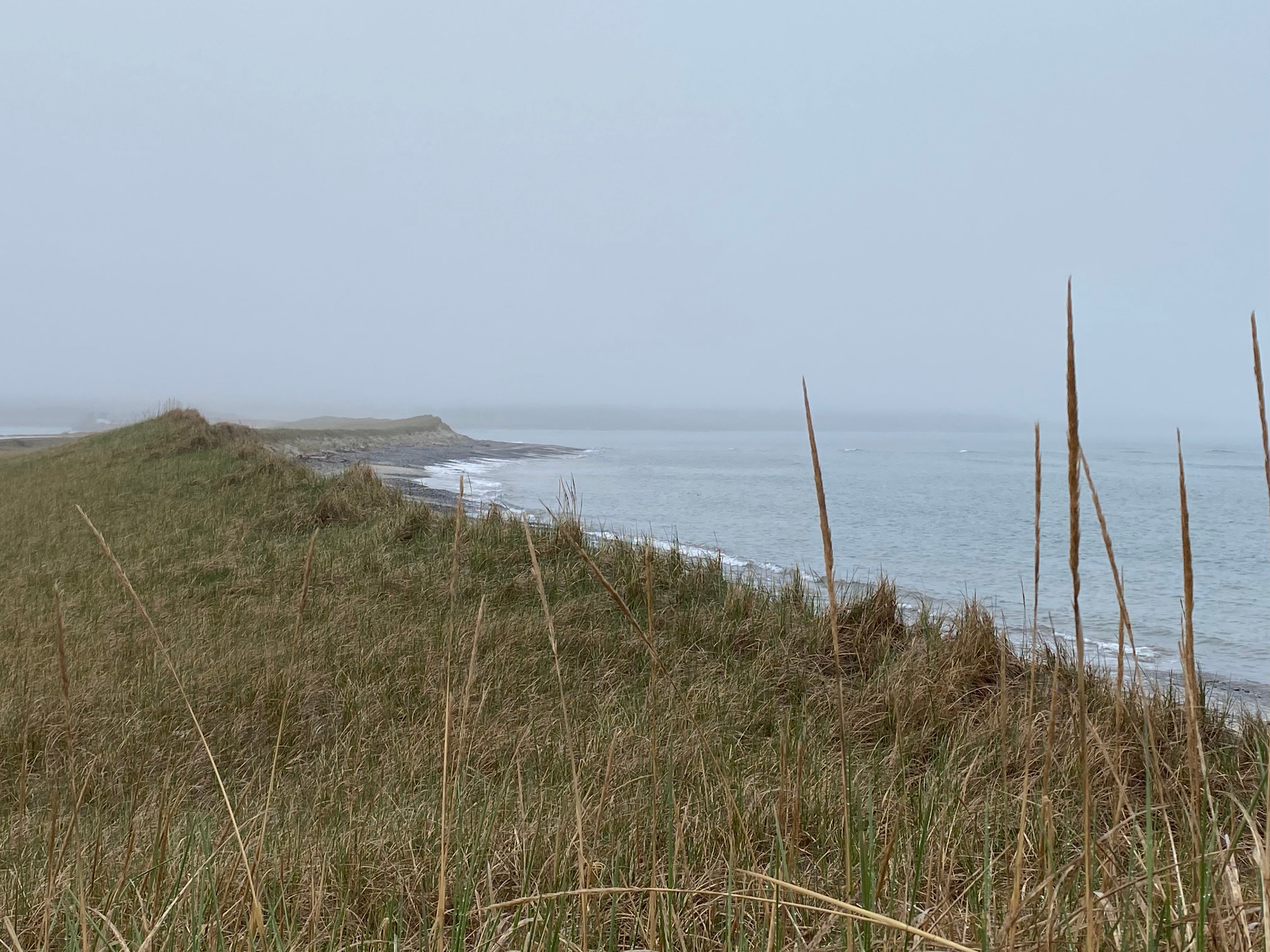
Codroy Provincial Park
We drove for a while then, on a lark, turned off the TCH onto a minor road leading to the town of Doyle. After all, it was time for breakfast.
Big Blue rattled along on the bumpy road. Eventually the road narrowed and we crossed a one lane bridge with high wooden sides.
We had happened upon Codroy Provincial Park, a protected estuary and sand dune along the Gulf of St. Lawrence. The park’s facilities were simply a pull-off with vault toilets. We stopped to take a break. While Doug was brewing some coffee, I walked along the beach, enjoying the misty sea air and open water of the Gulf.
We continued on and the fog and rain eventually cleared away. We rejoined the TCH, north toward the icebergs.
A fox carrying a kit in its mouth dove down an embankment right beside the highway.
A Breakfast Conversation
Around 10:00 we passed an Irving Gas station. At the last moment I spotted the modest sign that said “Restaurant” and yelled, and Doug was able to turn.
(If you plan to travel in Newfoundland, remember to look for restaurants at gas stations, they’re often your best bet.)
Breakfast was served by a petite, energetic woman with the name Suzie tattooed on her forearm. Her scrub top was printed with a Cow-Jumping-Over-the-Moon theme, and she addressed each and every customer as “my darling” or “my love.”
And she had lots of customers. One table had six young people, five men and one woman. The woman was heavily tattooed and one of the men sported a full head of blonde dreadlocks. Not your typical Newfoundlanders. I couldn’t puzzle out what language they were using to converse. When they left, I asked Suzie if they were musicians. She said No, they were circus performers. “They’re in a different place every night.”
A tall man came in and headed to the back corner. Suzie brought him a special mug and he wrapped his arms around her waist. I glanced their way and she said, “I don’t hug all my customers. This is my husband. He’s headed to St. Anthony’s.”
After we’d all enjoyed our breakfasts, I asked the man about the status of the icebergs, since St. Anthony is on Iceberg Alley. He said there are still lots.
He asked where we’re from, and when we told him, he replied, in a friendly tone, “We used to be friends.”
I laughed and said, “That’s right, we’re arch-enemies now, or so I hear.”
He stood up, spread his arms wide and said “Ain’t it somethin’?” I was grateful to not feel defensive of my citizenship. In fact, his tone and gesture felt like a curious form of absolution.
Suzie joined the conversation. She said that her husband’s sister married a US citizen. (Incidentally, she met him while sailing from Miami to Holland. I expressed surprise that people sail across the Atlantic. She said, Oh yes. Apparently rich people sometimes make that trip and then realize how far it is and don’t want to return. So their business was to sail the boats back.) Now the sister doesn’t dare visit her 90-year-old mother, as she’s afraid she won’t be able to get back into the States. What a pity.
Suzie’s tone became intense when she added that some of her family members are full blooded Mi'kmaq (indigenous). “We turn brown,” she said. “And some people don’t like that.”
Then our waitress in Newfoundland neatly summarized one of the problems in American politics today: “Trump is racist. And that’s not okay.”
Gros Morne NP
We drove for a long time. The temperature rose to above 60 degrees. Feeling rather nonplussed, I switched the cab from heat to air conditioning. After a lunch in Deer Lake, we turned off the TCH onto 430 north, toward Gros Morne National Park.
We paid our entrance fee. The ranger gave us a map and told us that all the campgrounds had plenty of room.
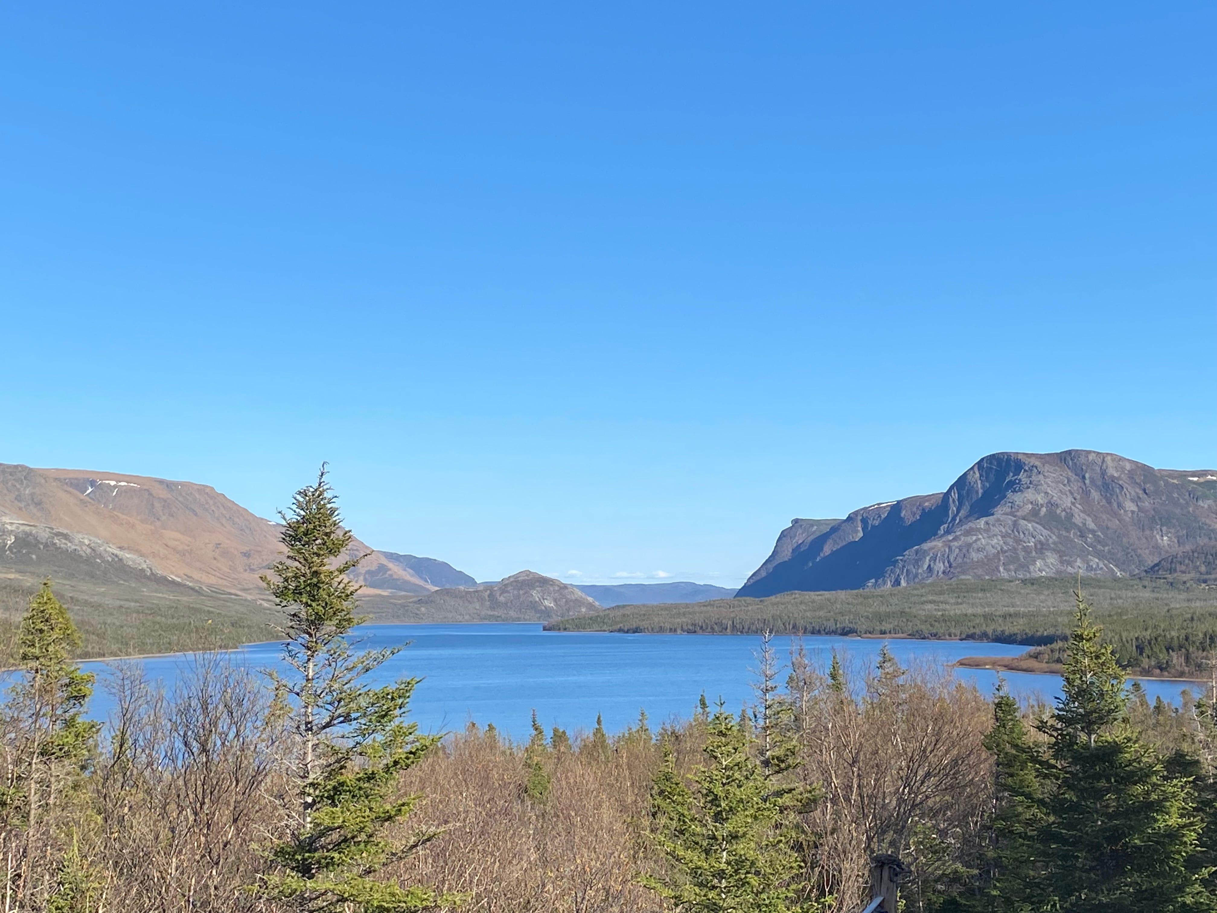
The park is quite large, and wraps around the long and beautiful Bonne Bay. The bay has an irregular coastline, and the water is deep blue in color. The pine trees provide an ever-present green, but the deciduous trees and shrubs were only budding. In the distance were higher mountains, rounded and barren, with sizable patches of snow.
We passed a business called Waters Edge where we stayed in a cabin in 2018. We remember having a long conversation with the owner, Rodney. The sign still advertised “Whale Watching from Your Campsite.”
Tablelands
The most famous region of Gros Morne is the Tablelands. It’s a geologist’s delight. This area experienced the shifting of tectonic plates, which exposed layers of rock from deep underground. Many of the rocks have a unique golden color, and they range in size from boulders to pebbles. Nothing grows on these rocks. Walking here is said to be like walking on the face of the moon.
Twice we’ve done some hiking there. Or I should say, twice we’ve attempted to do some hiking there. In 2018 it was so hot we had to abort after a mere ten minutes or so. In 2023 we persevered through, but the hike was not particularly pleasant.
This time, as we drove through the Tableland plateau I spotted a single caribou, the movement of its pale rump distinguishable against the yellow rock. What was it finding to eat?
The cooler temps tempted us to try hiking again. So we headed to the Green Gardens area, which has a bit more vegetation. A trail there winds down to the gulf.
Green Garden Hike
It was 4:45 by the time we laced on our hiking books and set out. The trail crossed a plateau scattered with the golden rocks, then climbed a ridge and disappeared. When we got to the top of that ridge, a similar rock-strewn plateau appeared.
After the next ridge, we began to descend through scrubby pine, as tall as my head. Water trickled along the way. The rocks were often loose underfoot, and the trail went down and down. The water sparkled in the distance.
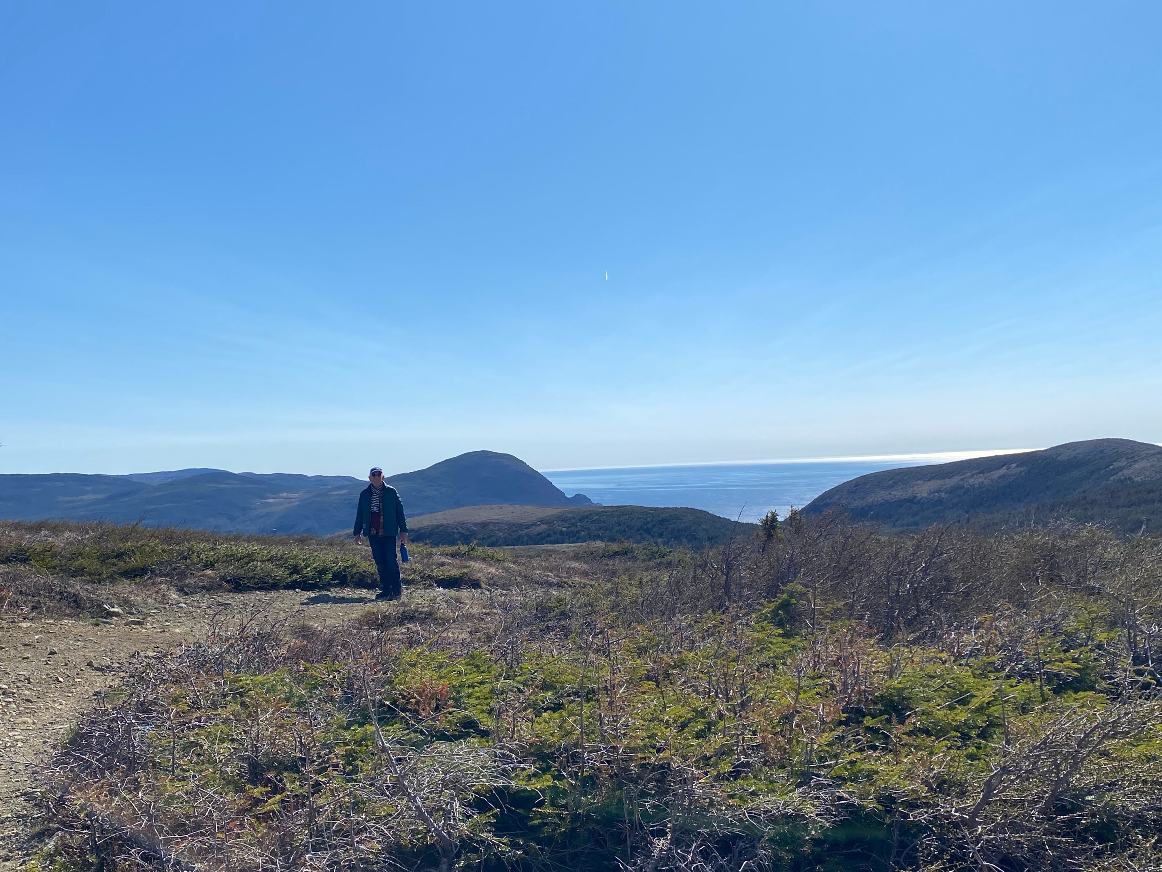
Two hikers who spoke German were coming up the trail. They confirmed that the trail descends the whole rest of the way, right to the water’s edge. We asked if it was steep. They conferred. Then one said it was “grueling.” They looked much more fit than we are, and the hour was getting late, so shortly after that conversation we turned around. It was about 5:30. We were back to the rig by 6:30. We’d hiked just under 4 miles, and were happy with our choice.
Camping
As we drove toward the Trout River campground, we hoped we might see moose or caribou, as they are crepuscular. Which is just a fun word to say that they feed at dawn and at dusk.
We drove down a long, unpaved road only to discover that the campground was closed. Which was pretty irritating, as the ranger could have provided correct information. Or they could have put a sign on the paved portion of the road.
Still, it was a gorgeous detour. A formation called Elephant head towered over a beautiful blue lake. A head is a geologic term for a sloping rock formation. You often see them alongside large bodies of water. This one does look like an elephant head.
It was getting late and we didn’t have a place to camp. Normally we would look for a place to boondock, which is to camp without amenities wherever it’s legal. Except it’s not legal in the National Parks.
The next campground, Lomond, lay down another long dirt road. What if it, too, was closed?
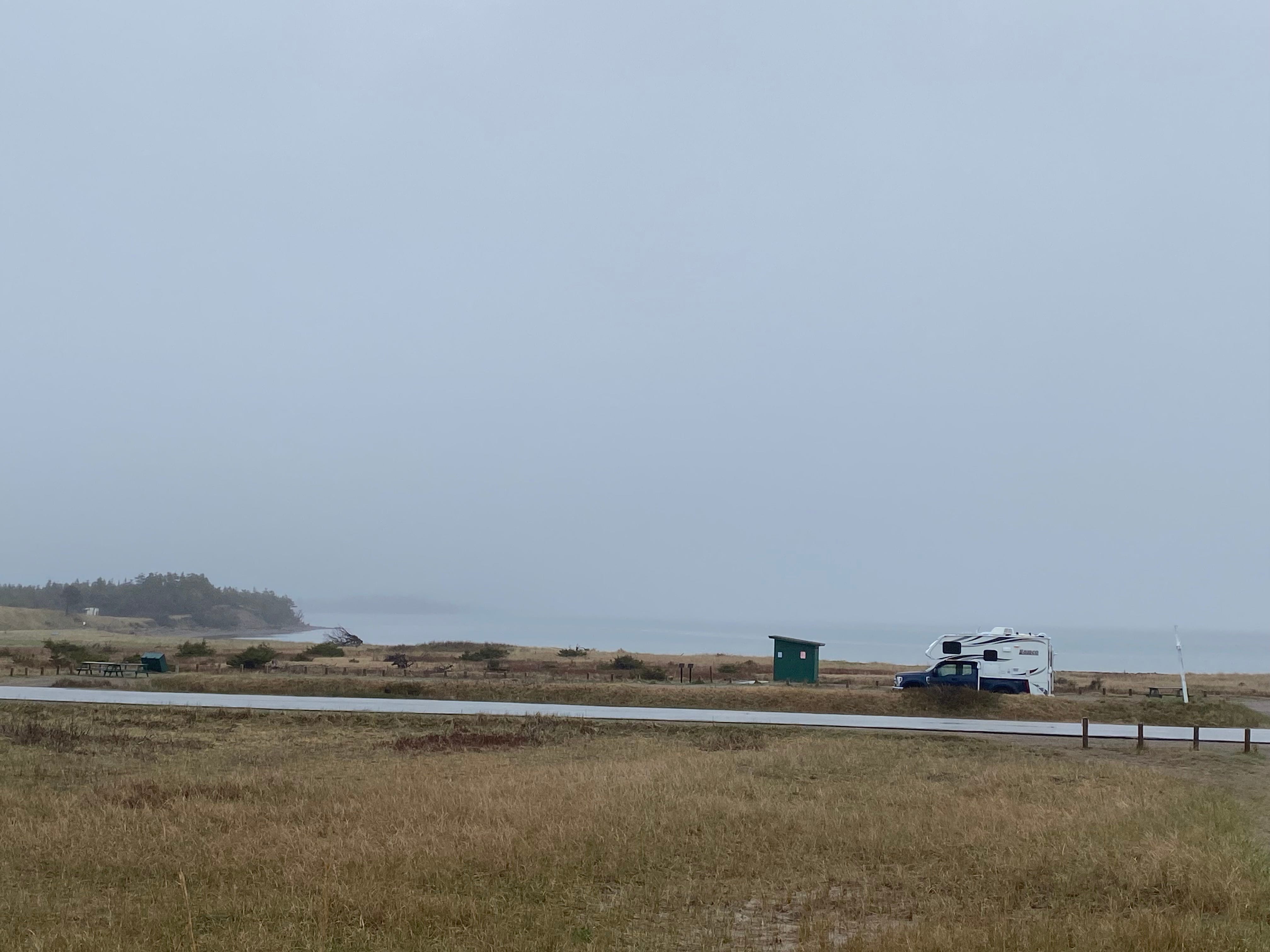
At that moment we once again passed The Water’s Edge, where we could “whale watch from our campsite.” For $30 CAN we could solve our problem. The owner was happy to hear that we had stayed in a cabin in 2018. He bought the place from Rodney in 2019 and happily told Doug all about the improvements he’s made since then. We wish him well.
PS: No whales spotted from this campsite.