


Hitting Big Blue's Limits, and Our Own
Nov 14-16, 2021
Sunday, Nov 14
We drive from Hovenweep toward Natural Bridges, crossing a mesa which is gorgeous in a flat, arid way. This is open grazing land with lots of horses, a few cattle and a random donkey or two. We occasionally glimpse the tumbled interior of a side canyon.
It’s Sunday morning so I pay attention to the churches we pass. There are two, and each has an array of pickup trucks in the parking lot. I wish I were brave enough to join them for worship. Would I have been, pre-Covid?
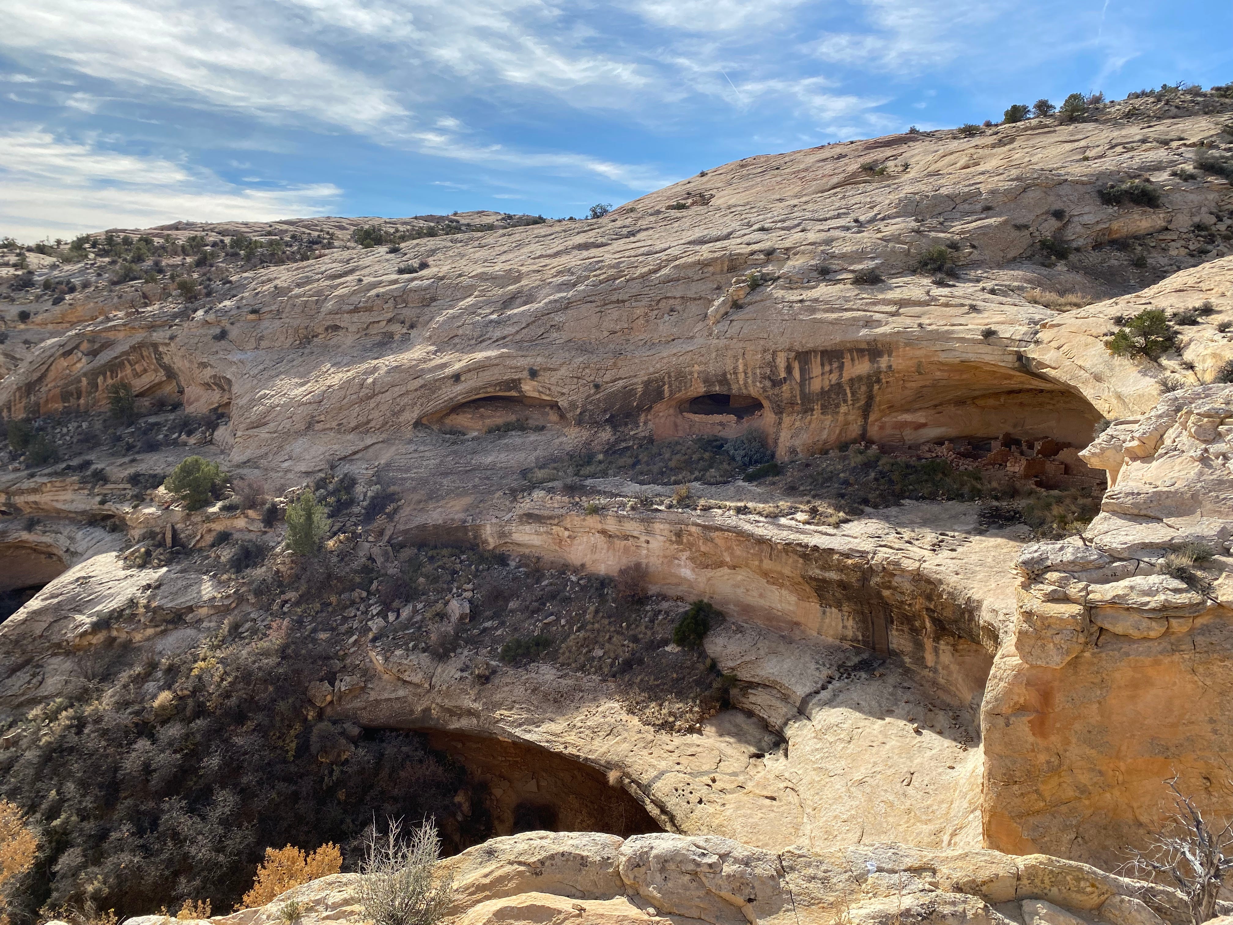
Butler Wash Ruins
Around noon we see a sign for Butler Wash Ruins and stop to take a hike, a mile round-trip. The hike features interpretive signs about the desert plants we pass. We’ve been in the desert for some weeks so I attempt to imprint the information into my memory: sagebrush, rabbit brush, black brush, narrow-leaf yucca, juniper, pinyon pine, serviceberry.
The trail ends at an overlook of Anasazi ruins. As the sign says, it’s “a spectacular panoramic view of the entire ruined area.” And a lovely spot to enjoy our lunch.
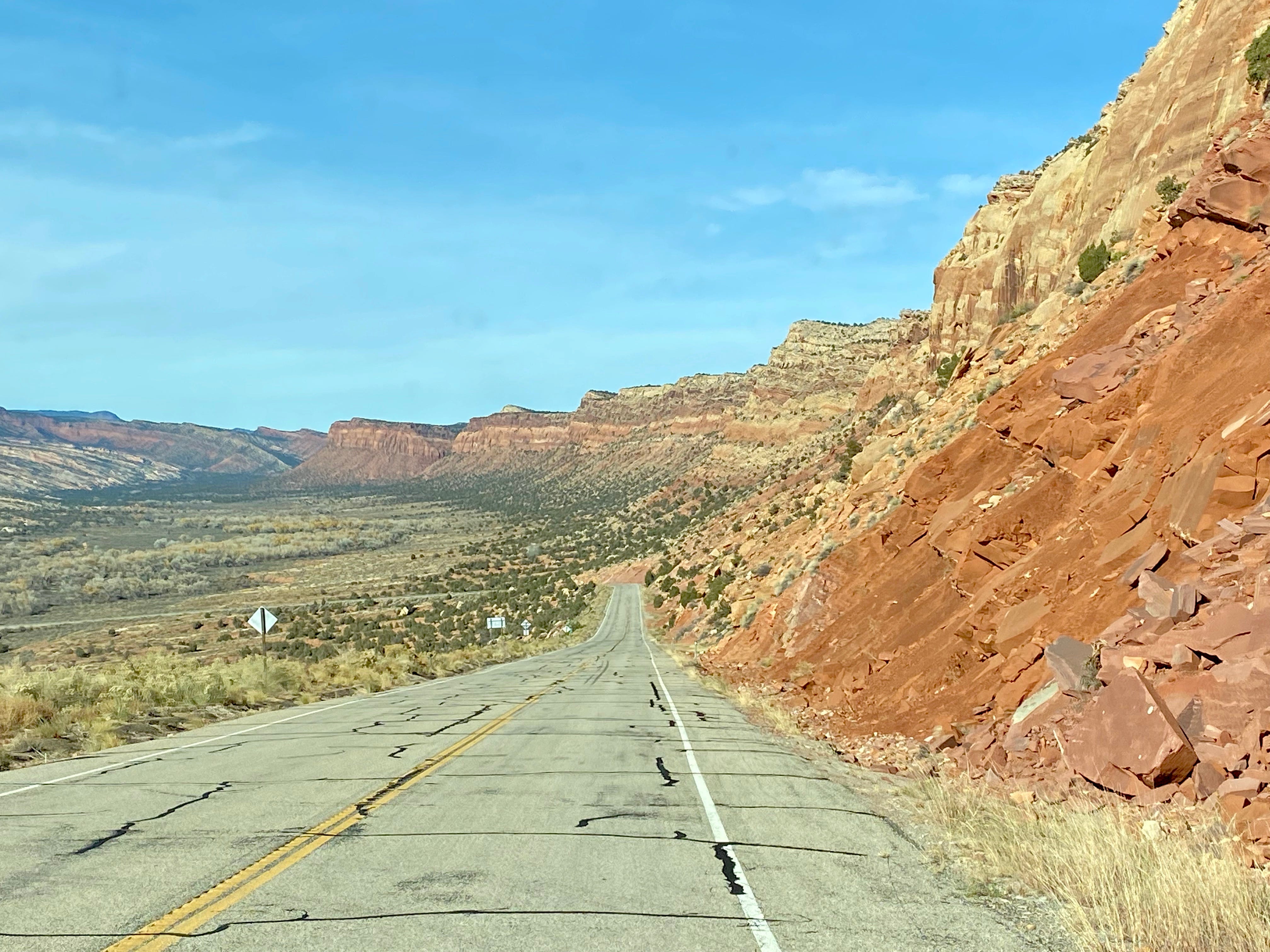
Back in Big Blue, we continue on Route 95. We pass red rock walls that jut out to form a long ripple. The geological layers add to their beauty, making the formations as showy as ribbon candy.
We stop briefly at Mule Canyon Kiva, which features a restored kiva and above-ground rooms.
As we leave that place, we see some two dozen turkeys on the side of the road, so handsome with their colorful heads and black and white plumage. “Thanksgiving’s coming,” I warn them.

Natural Bridges National Monument
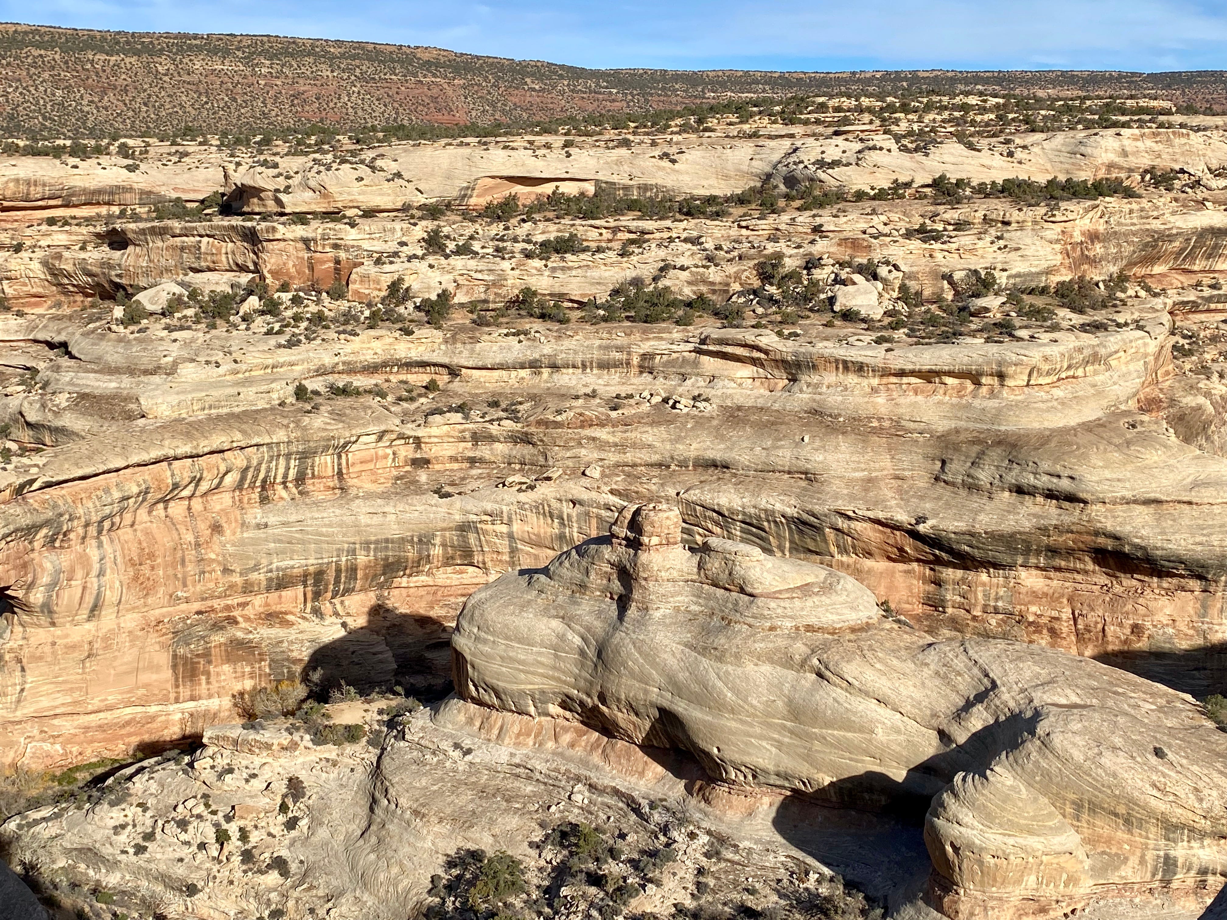
Around 3:00 we arrive at the Natural Bridges National Monument. We make a quick stop at the Visitors Center and have no problem claiming a site in the almost-empty campground. Then we drive the 9 mile one-way loop through the park, stopping at each of the three bridge overlooks.
The white sandstone formations have a very different feel from the red sandstone at Arches. According to the geology chart below, the white sandstone is much older.
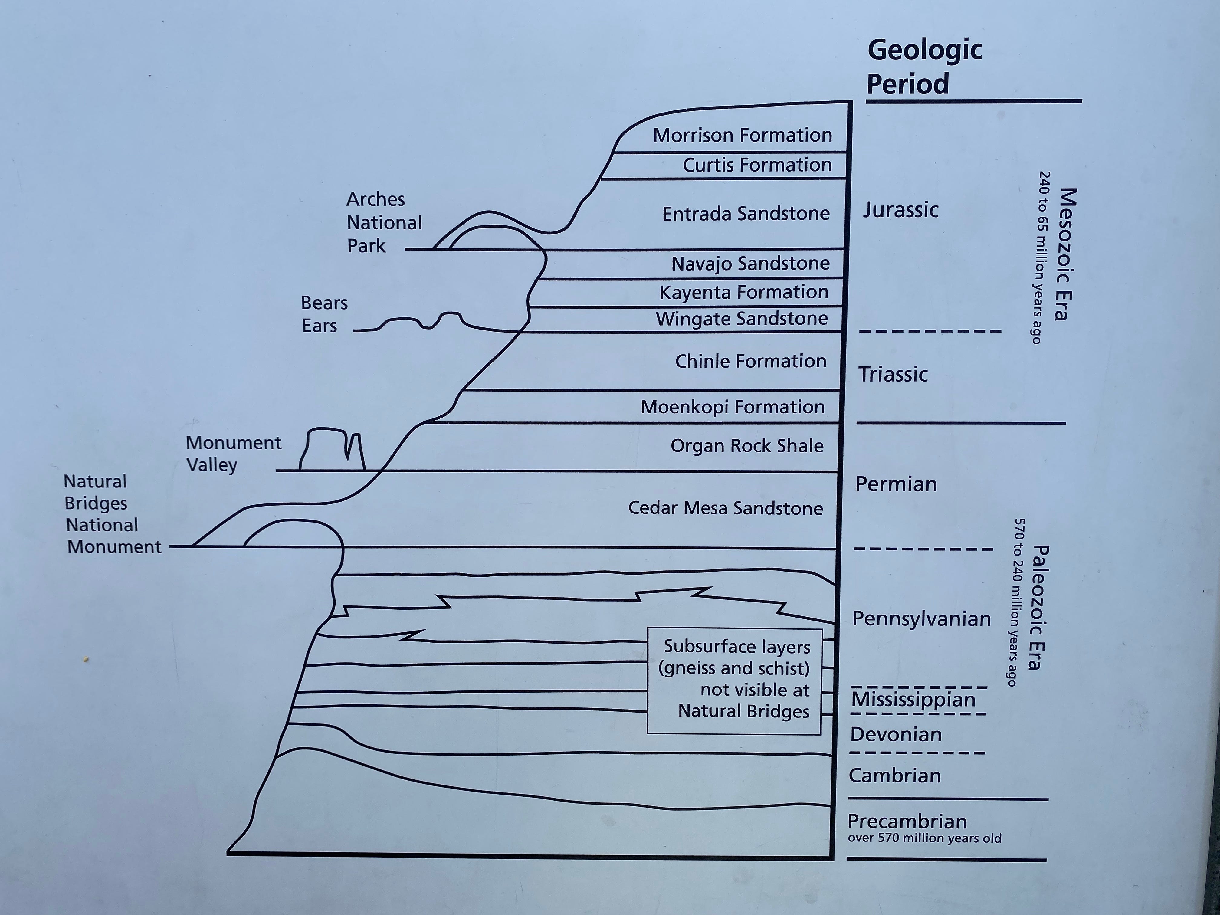
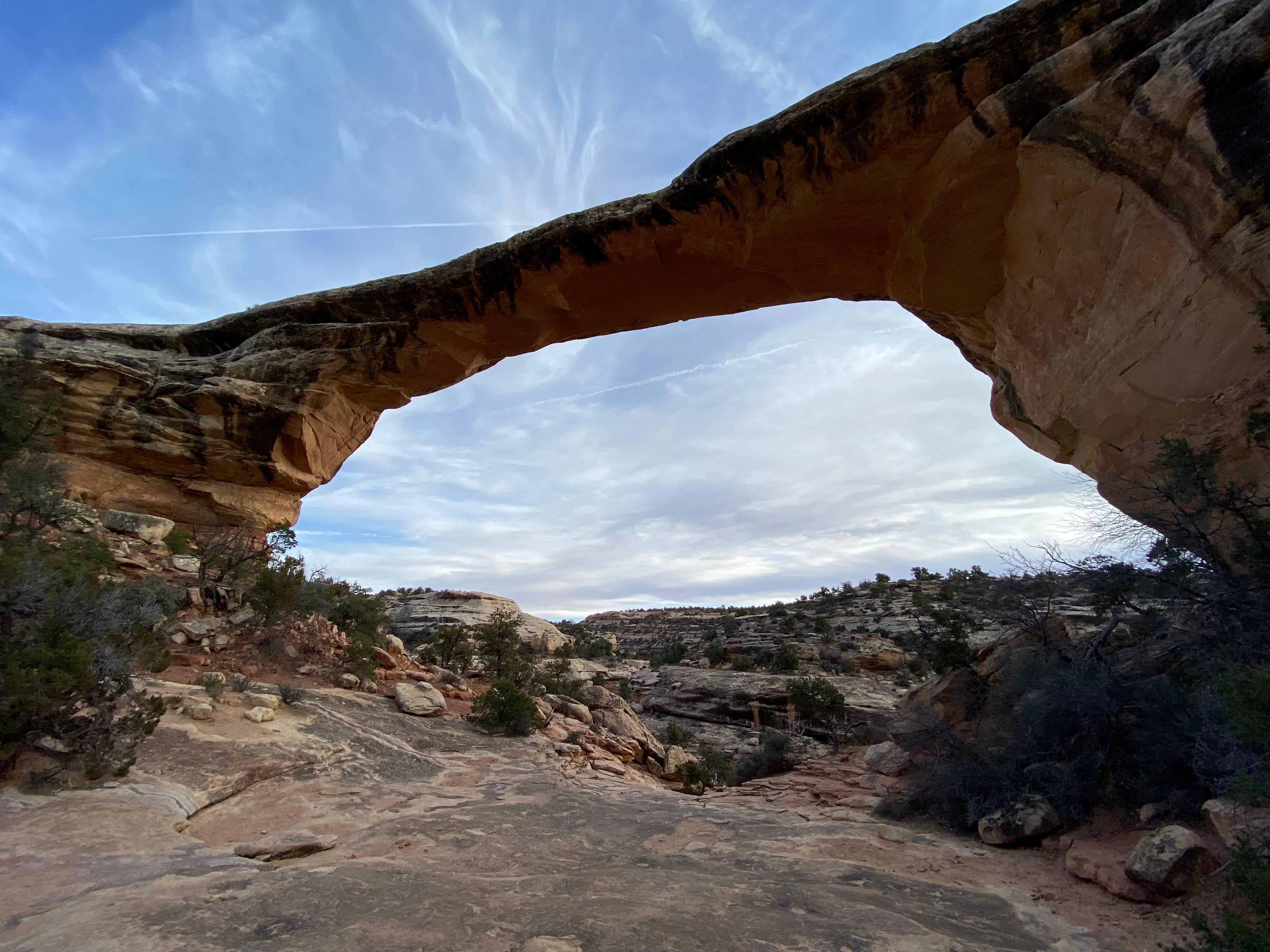
Geology aside, what I notice about the white formations is that they’re round and swirly and subtly layered. The technical term for that is “cross-bedded.” They’re also massive — when you descend into them you are enveloped by rock.
At the Owachomo Natural Bridge we hike down into the canyon in order to view the bridge from underneath. The round-trip is only a half mile, but it’s steep, and we’re tired at the end of a long day.
Monday, November 15
In the morning we decide to hike Sipapu Bridge, which is the second largest natural bridge in the world. Our brochure tells us that “In Hopi mythology a sipapu is a gateway through which souls may pass to the spirit world.” I once read “The Clan of the Cave Bear” and remember that Jean Auel makes much use of this word and concept.
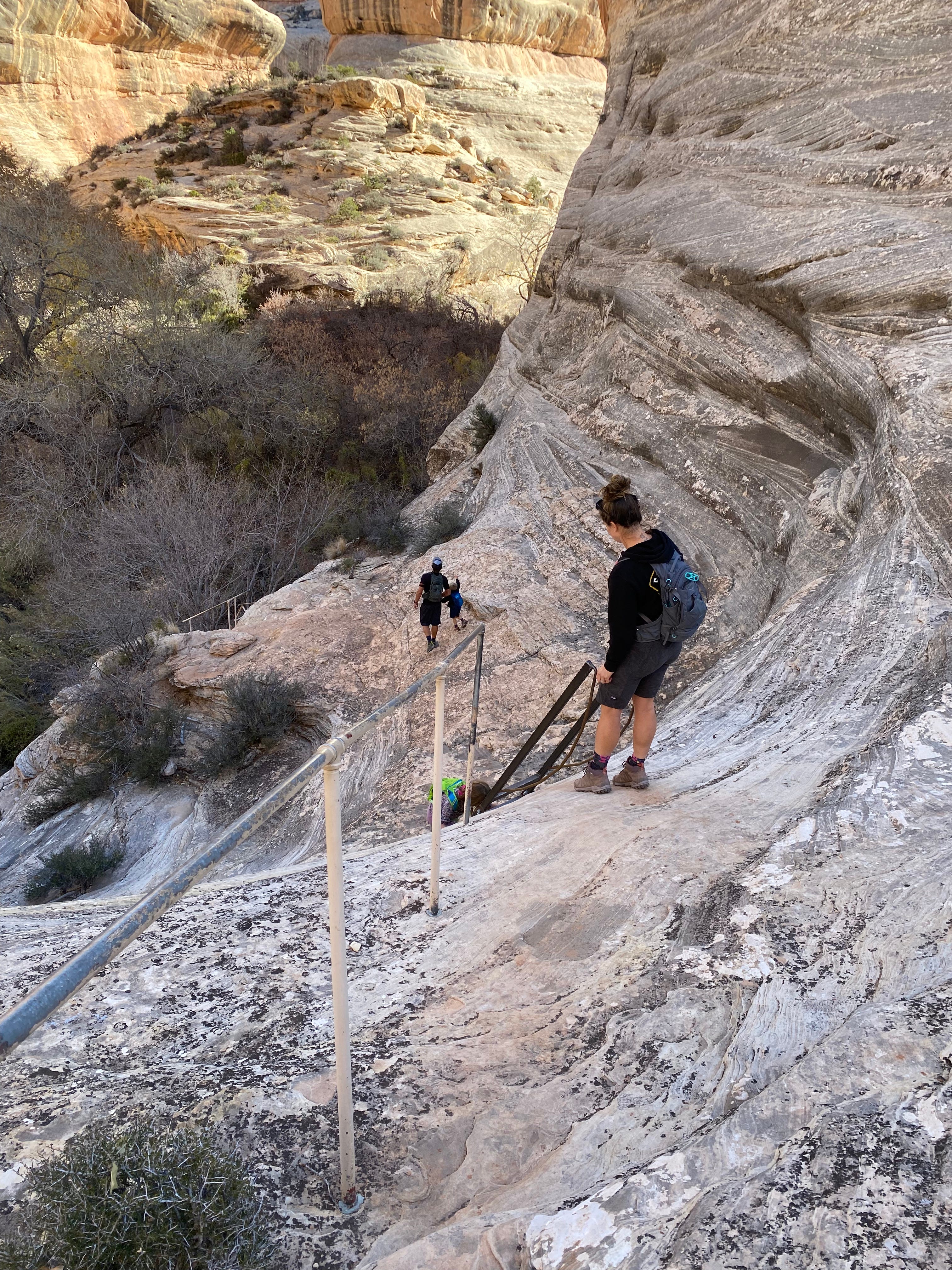
The trail is a mile and a half long and descends into the canyon using metal ladders. As we hike, we can hear a family with young children coming behind us. Doug tells me, “I think that’s the Fiery Furnace lady.”
But that’s silly, what are the chances? The family catches up to us — and indeed it’s the Fiery Furnace lady! Plus her husband and their two children. Her name is Bree and they’re from Bellingham, Washington. The family is taking a nine month sojourn.
We talk for quite a long time. Bree tells us all about a hike they loved yesterday — Moon House Ruins. Her enthusiasm is contagious.
Then they head down the rock which gives me a chance to take photos with humans, for a better perspective on this canyon.
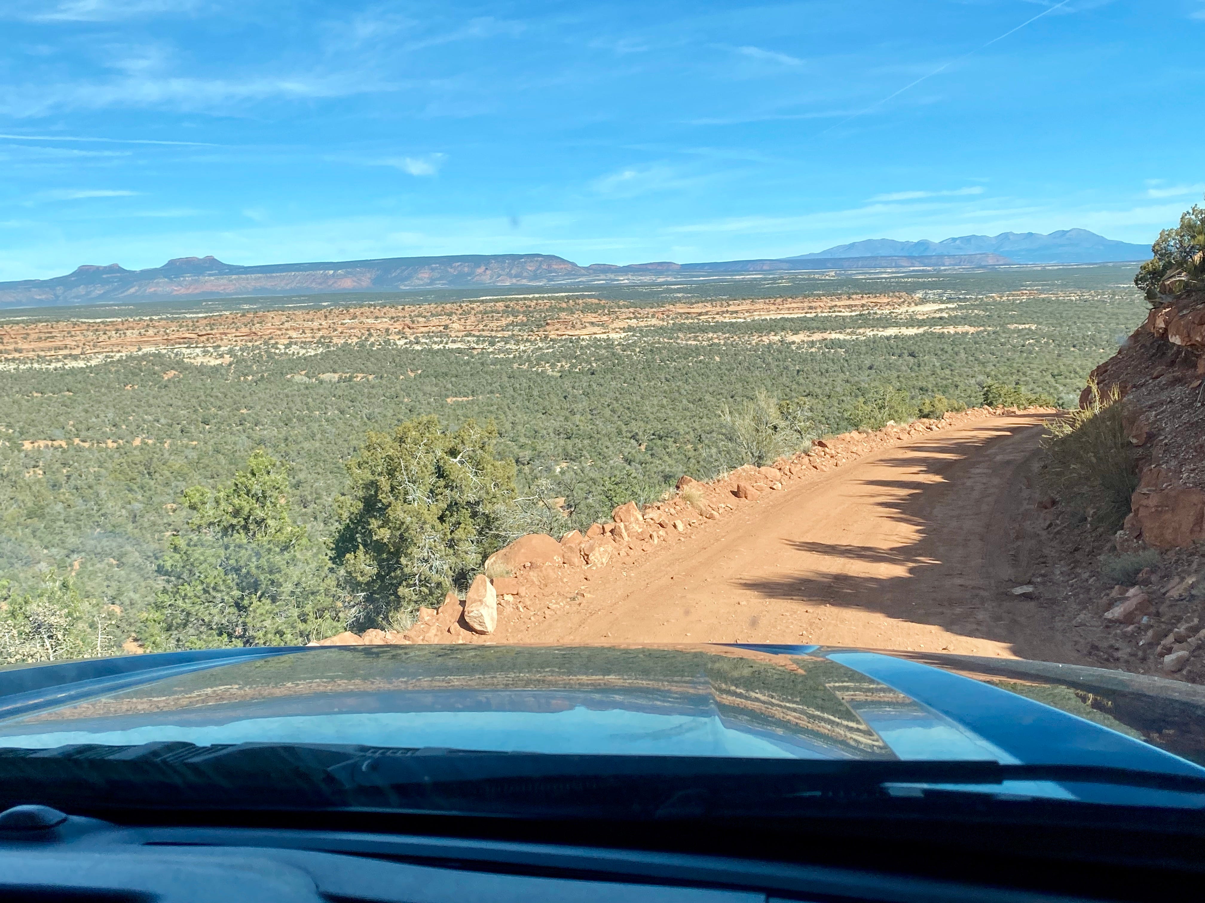
When Doug and I finish the Sipapu hike, we decide to follow Bree’s recommendation and detour to the Moon House Ruins. That means retracing our path on Route 95 to Route 261. The ruins are on Snow Flat Road, which is a dirt road.
Bears Ears
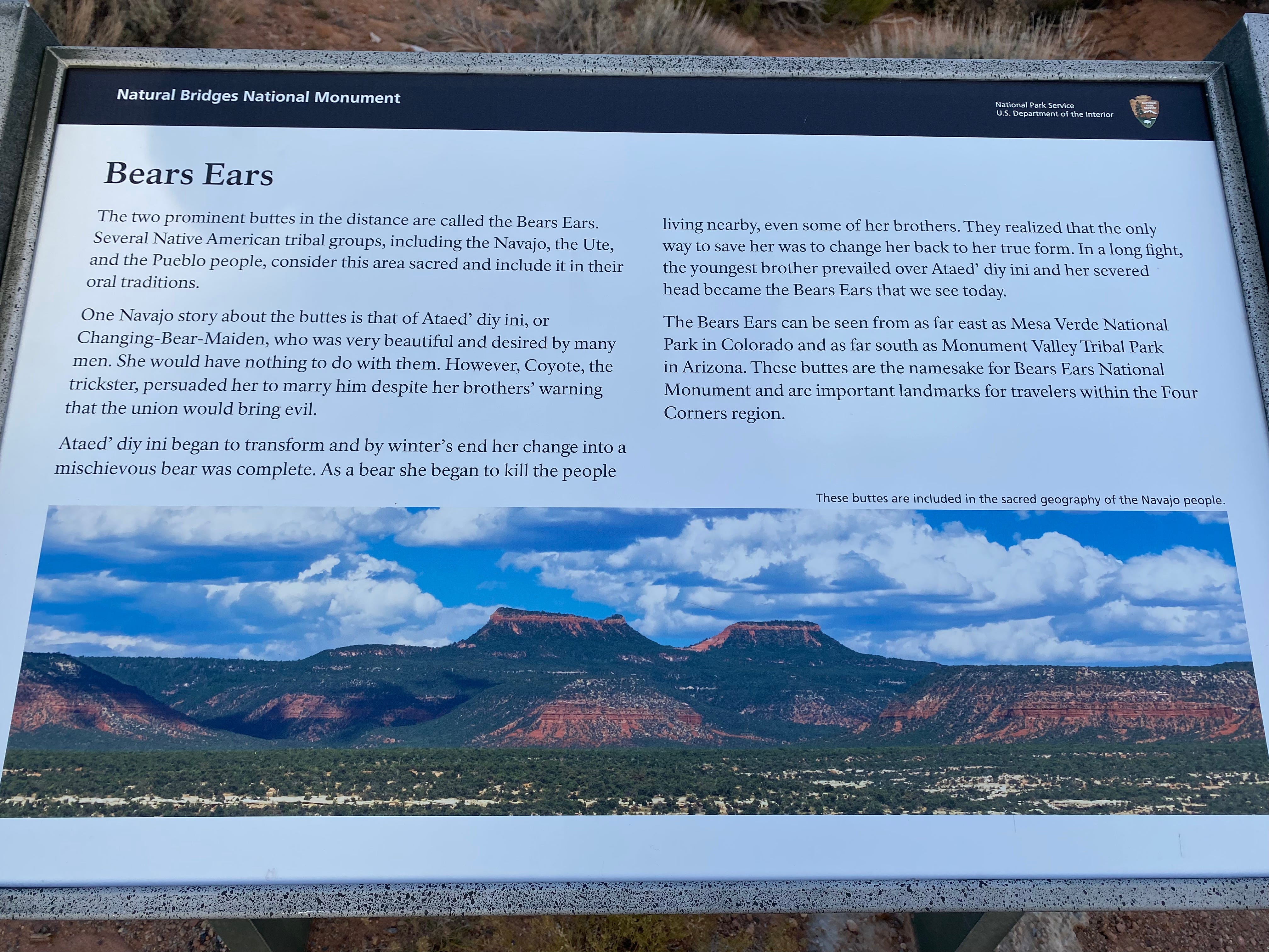
As we bump down Snow Flat Road we can see the twin buttes named Bears Ears in the distance (left).
I loved the name Bears Ears until I read the legend below. A cute name, but a cruel legend! I’ll paste the photo so you can read the legend yourself, if you like. Apparently a beautiful, powerful woman must be brought down and bloodied in order for the world to turn on its axis.
Misogyny is a trait shared by all cultures, unfortunately.
We drive a couple of miles down Snow Flat Road but the road becomes increasingly rough. Bree said we’d have no problem but she was wrong. This has happened a number of times — someone sees our rig and thinks it looks tough. “You can go anywhere!” they say.
But actually we hate jouncing around on dirt roads. It seems especially hard on the tie-downs and just difficult for the rig overall. The deep dips pose a special problem.

So, we reversed away from this section and took a lunch break. We have learned a lesson about letting other people decide what our rig can do.

After lunch we decided to set out on foot. We aren’t sure, but guesstimate that Moon House Ruins are approximately 5 miles down the road.
At this point I made a note on my phone — for whoever might find our bodies. (I am quite thoughtful that way. I want to make the forensics easy. Or you might say I want to control my own story, even after I’m dead. I’ll cop to that — I’m a memoirist! At any rate, check for notes and photos if something ends badly.)
We walk some 45 minutes before we see anyone. At that point a car with New Jersey plates passes us going the opposite direction. The driver, who is alone, informs us that we have at least 3 miles to go on this road. “Walking’s got to be better than driving this damn road,” he grouses before scraping along his way.
I update the note on my phone — we’re about halfway and have probably another 45 minutes or so. If we arrive at Moon House Ruin at approximately 2:00, we’ll have an hour to explore the ruin and two hours to hike back to the rig. Oh, and did I mention that the descent into the ruin is very steep and involves shimmying down a rope?
Doug and I walk the dusty road in silence. There are lots of tracks — small mammals and various cleft hoof prints, and also bicycles.
That’s what we need, bicycles. My kingdom for a bicycle! (That’s an oblique Shakespeare reference. If you recognize it, put it in the comments!)
Eventually I must stop to pee. When I squat, the phone tips out of my back pocket unbeknownst. We walk another quarter mile down the road before I realize my phone is missing.
This becomes a tipping point. Retracing our steps each way is just too much. We decide to return to our vehicle. Note the time is 1:34. It is hot. I am hot.
We return to Big Blue at 2:37. Apparently this forensic note is unnecessary.
We decide to boondock where we are parked. As we’re doing some chores, a pair of mountain bikes appear, coming from the direction of Moon House Ruin. The couple stops to chat. They noticed our foot prints and followed us to the rig.
“You were so close!” they say. “Just a mile or so” one says. “Oh, plus the mile once you get to the site” the other adds. “It’s two miles into the site,” the first one amends. “So, very close!” they chorus.
They show us some photos from the ruins, saying how wonderful it was.
We feel disappointed that we missed it, that we came so close and missed it. Maybe tomorrow when we’re fresh we can try again?
The Real Crisis Strikes
At suppertime we discover another crisis, potentially even worse than this godforsaken road. We are completely out of coffee.
No, we will not try again in the morning.
Tuesday, Nov 16
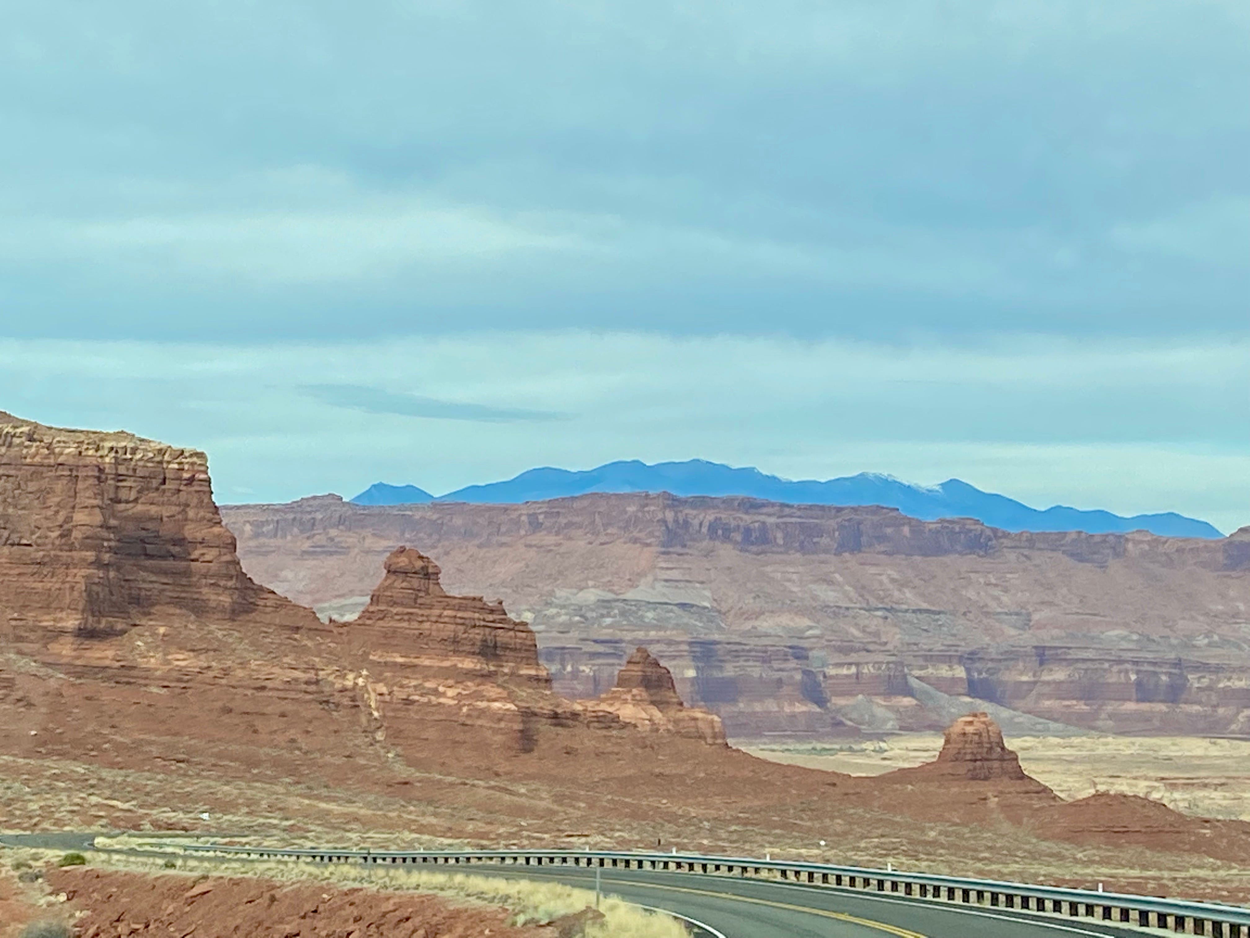
In the morning we retrace our route to Natural Bridges SP. Then we continue on Route 95 toward Hanksville. This is a very scenic road, passing through Glen Canyon and crossing the Colorado River. In fact, it has got to be in the Top 10 Most Scenic lists. Amazing.
Since we’re operating without benefit of caffeine, as soon as we arrive in Hanksville we go immediately to Dukes Slickrock Café (which is an homage to John Wayne) to order coffee and sandwiches. Ah! The journey can continue.
Ruth! I’m so sorry the road was too rough! We had hoped to let you experience it also! Another time. Glad you made it out safe. Hope to see you in the future! - Brie
How have I missed your blogs until today. You are a great writer. Thanks for your memories.