


What's In a Name? Kodachrome & Bryce
Nov 21-22, 2021
“Kodachrome”
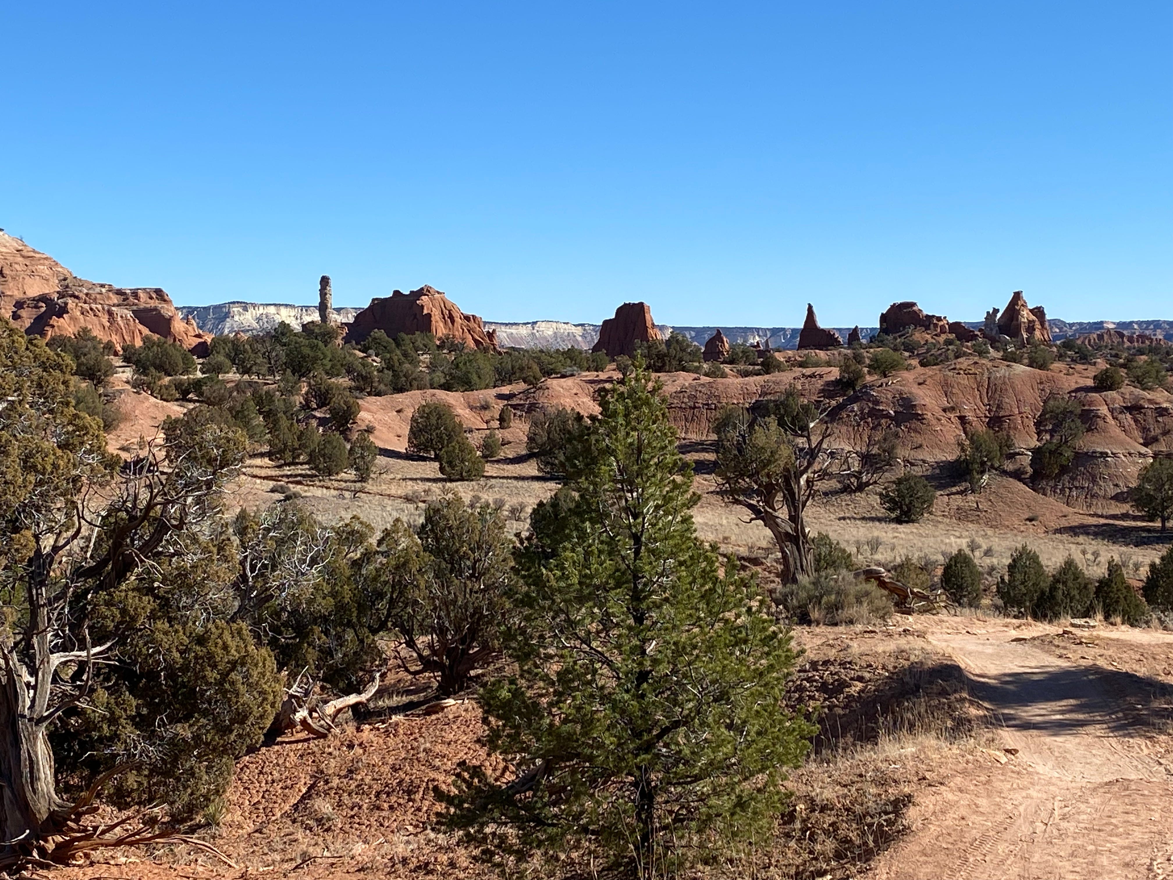
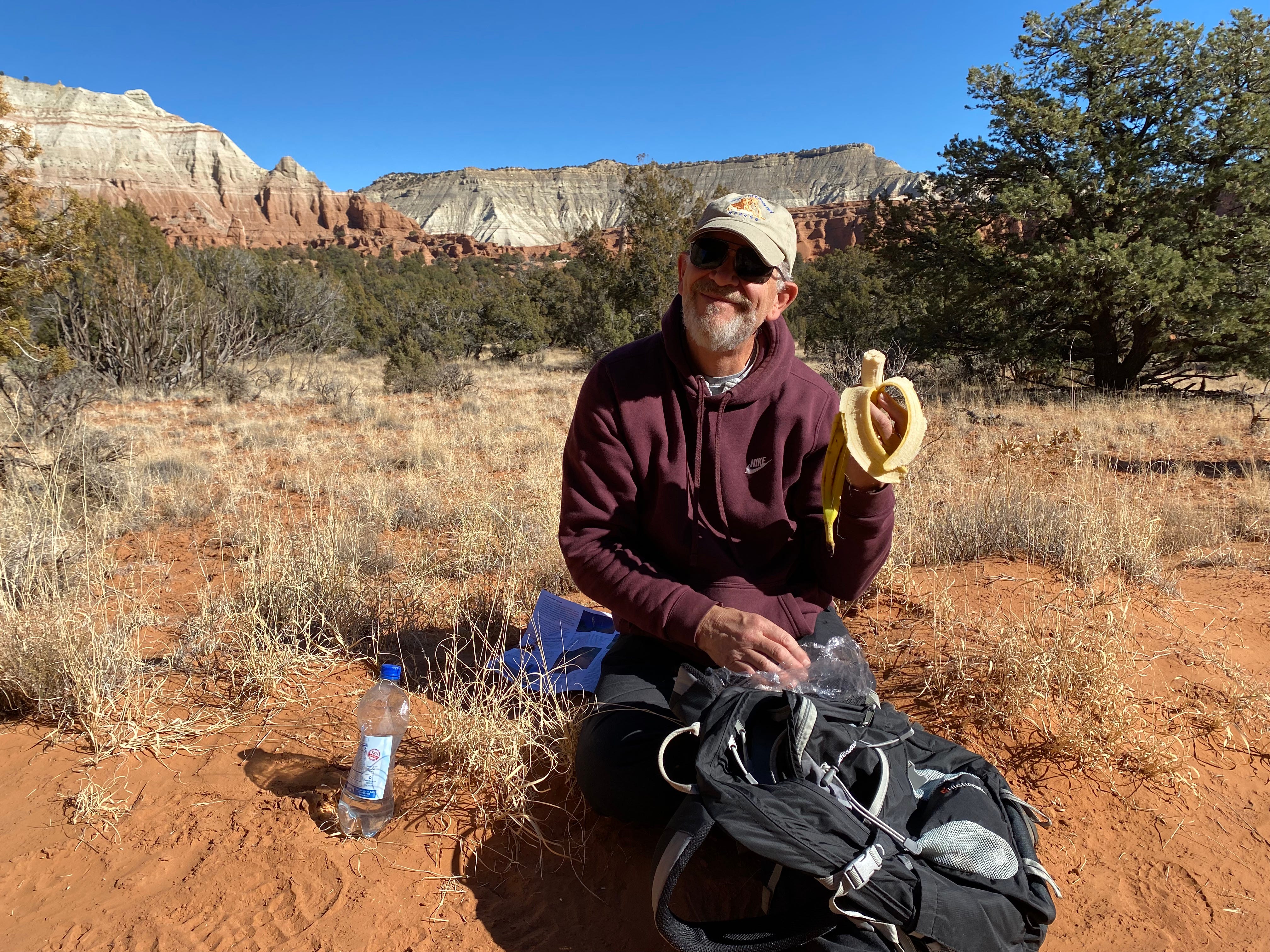
On our way to Bryce Canyon National Park, we stop at Kodachrome Basin SP for a few hours. Among other things, I’m intrigued by the name. Apparently the colors in the park — the red rock, blue sky, and white sand — are so stunning that a National Geographic camera crew suggested the name change in 1948. Back then “Kodachrome” was a brand new, exciting process introducing the world to color film.
“Kodachrome” reminds me of my childhood — yellow cardboard cameras and flash bulbs that revolved after they burst. The word also makes me want to hum the catchy Paul Simon tune by that name.
And also, the Internet told us there are unique “sedimentary pipes” that make this stop worthwhile.
Hiking at Kodachrome Basin SP
We hike the 3 mile Panorama Trail in the late morning. The trail is wide and sandy and passes through gently rolling hills. At other times of the year, horses share these trails.
The National Geographic folks were right about the color. On the day we visited, the sun shone brightly in an intensely blue sky and the red spires jutting up from the rock walls felt fantastical.
The Sedimentary Pipes
No one actually knows how the sedimentary pipes, or spires, were formed. There are three different geological theories but I won’t bother you with them. None of the theories struck me as particularly compelling or imaginative. You can always google that info.
On the other hand, whoever named the spires was truly imaginative. For instance, I appreciated the whimsical “Hat Shop” which featured three top-heavy formations.
But at other times the naming committee seemed to work overtime to ignore the obvious. Check out “Ballerina Spire” below.
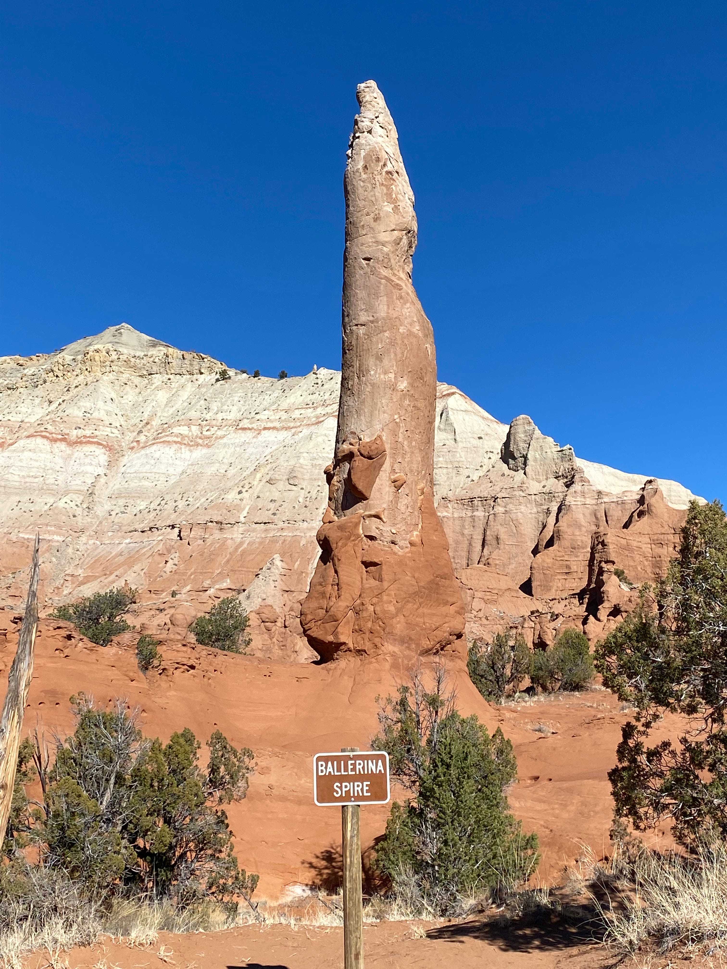
Excuse me, but was your first thought, “Ah yes, that is definitely a female form!”
Bryce Canyon National Park
We drive on and arrive at Bryce Canyon NP around 2:00. Because it’s November, we are able to get a campsite (without amenities). We drop off a few items to claim our site, then drive to the far end of the park — a slow 18 miles.
By the time we get to the furthest point, the sun is going down and the temperature has dropped dramatically. We grab hats and gloves to hike the Bristlecone Loop Trail, which is quite short. The temperature difference isn’t just the time of day — it’s also the altitude. Bryce Canyon NP is above 7,600 feet.
Bristlecone Loop
Bristlecone pines only grow at high altitude, in a harsh, exposed environment. In recent times, as the globe warms, bristlecone pines have become an endangered species. Which is a huge shame. They are funky-looking trees with fabulous cones. I hope you meet one IRL. Check out the one below.

The Bristlecone trail brings us to an overlook called Yovimpa Point, which has views to both the east and the west. We always assume the western view will have the best color, but sometimes it’s the opposite side that gets painted by the setting sun. At Bryce there’s so much beauty it’s hard to know where to look.
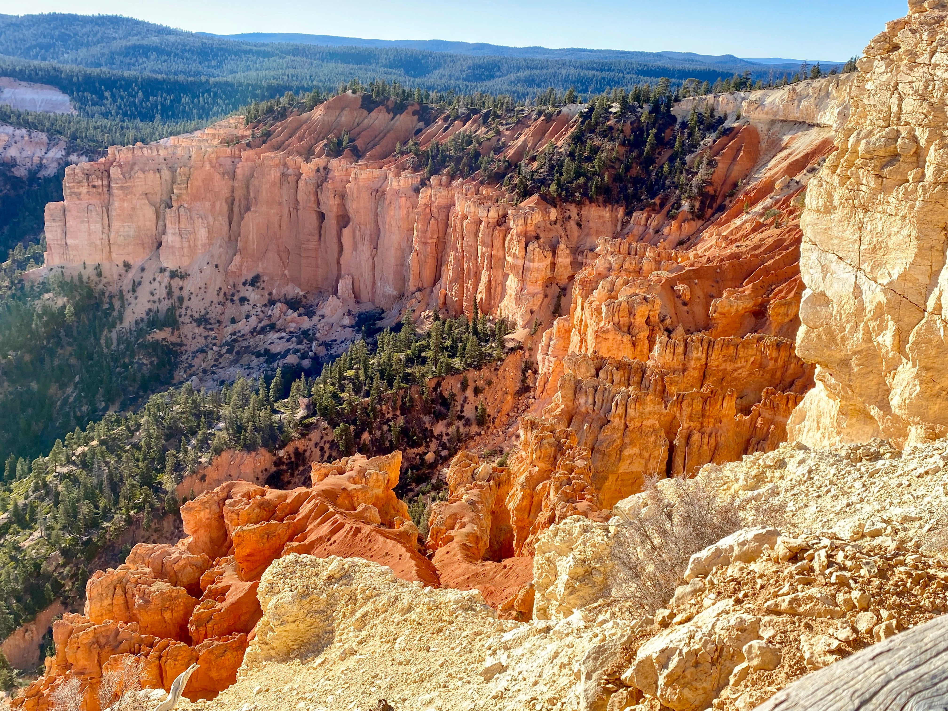
If you read my earlier post about the Staircase of Time you might remember that Bryce’s pink cliffs and hoodoos are the highest step of the Grand Staircase, the Claron layer. The hoodoos, which are shafts of rock in strange shapes, were created by the uplifting of the land beneath, as well as erosion and weathering from above.
MONDAY, Nov 22
Last night a neighboring RV ran their generator almost constantly. I tried to be charitable in my thoughts — maybe someone needs a medical device. But gosh, the noise! (Or does living in an RV mean I can’t complain about RV-life problems?)
The Cold and Changing Plans
Last night it got down to 23 degrees, which strikes me as pretty cold for late November. Which represents a change in my attitude. When I was in my early 20s and living in Minneapolis, I bought into the stoic-Minnesotan-vibe: it isn’t truly cold until the temperature reaches single digits.
Doug grew up in a Minneapolis suburb. He was a cross country skier and looked the part, with a bushy beard and an ever-present wool sweater. (Fun aside: If you’ve read my memoir, you might remember that a wool sweater factored into the story of our first kiss!)
But after a few decades, we have both changed! Now we prefer to be warm, given the choice. We may be changing our plans. Last June we made reservations in Yosemite for early January (WWIT?). But one beauty of life on the road is that we can make adjustments as we go.
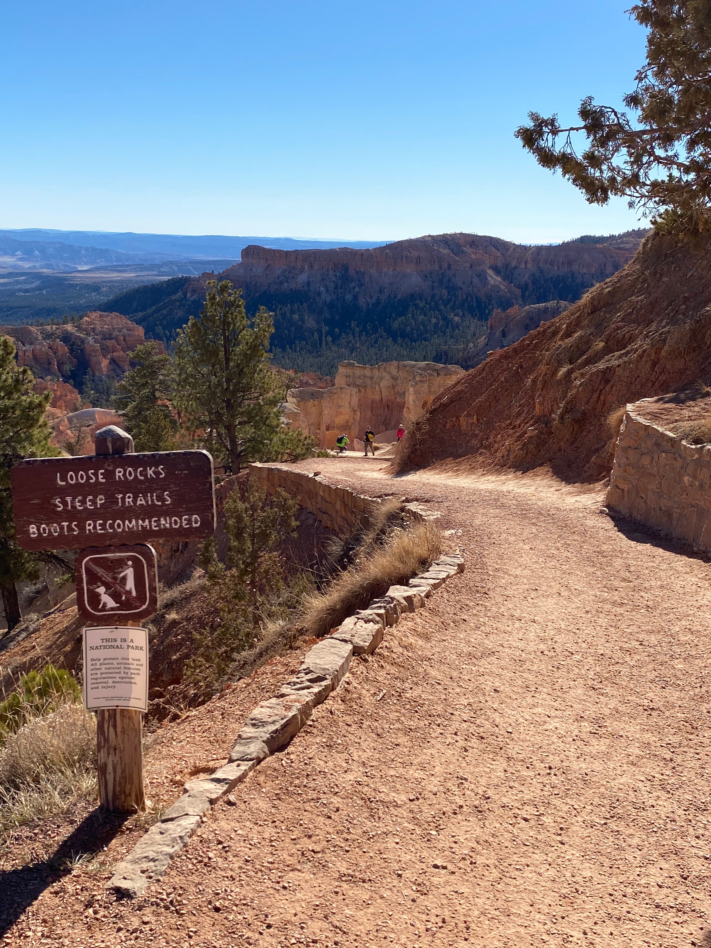
Hiking the Hoodoos
This morning we drove to the Amphitheater area. It’s not called that because there’s an amphitheater where they give concerts. The name refers to the formations along the rim. Since Bryce is technically not a canyon (though yes, canyon is in the name!), it has it’s own vocabulary. Weird.
We spent about 90 minutes hiking the Under the Rim Trail to Queen Victoria’s hoodoo. It’s a fairly steep trail with many switchbacks. Despite the trail’s relative difficulty, it is well-used. We saw and heard people from all around the globe.
You don’t have to hike far to get a different perspective on Bryce. As you descend, you are able to see the hoodoos and rock formations from both sides. That ever-changing perspective is part of the allure of the place. The sun changes the colors of the rock from gold to peach to pink. It’s all quite enchanting.
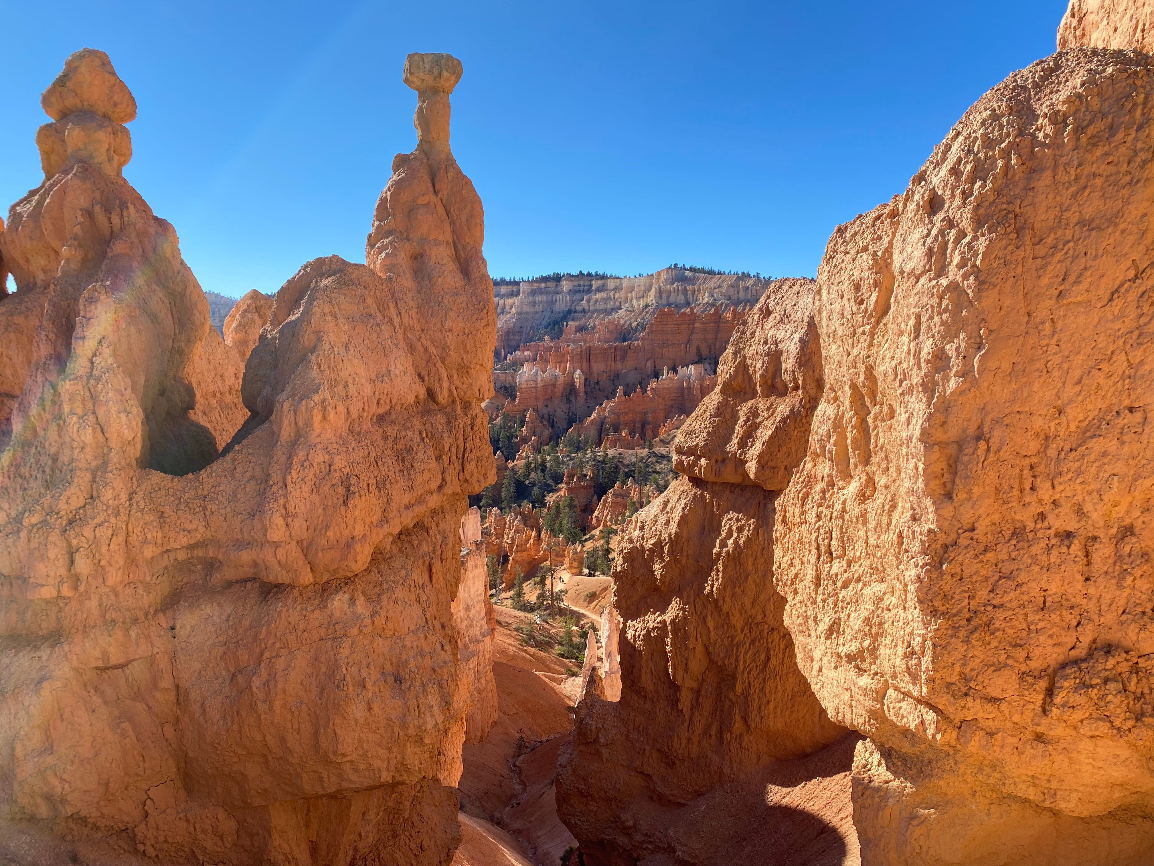
We’re not positive, but think the hoodoo above is the one that belongs to the queen. Although we are not clear as to why the queen gets a hoodoo. Talk about crazy names!
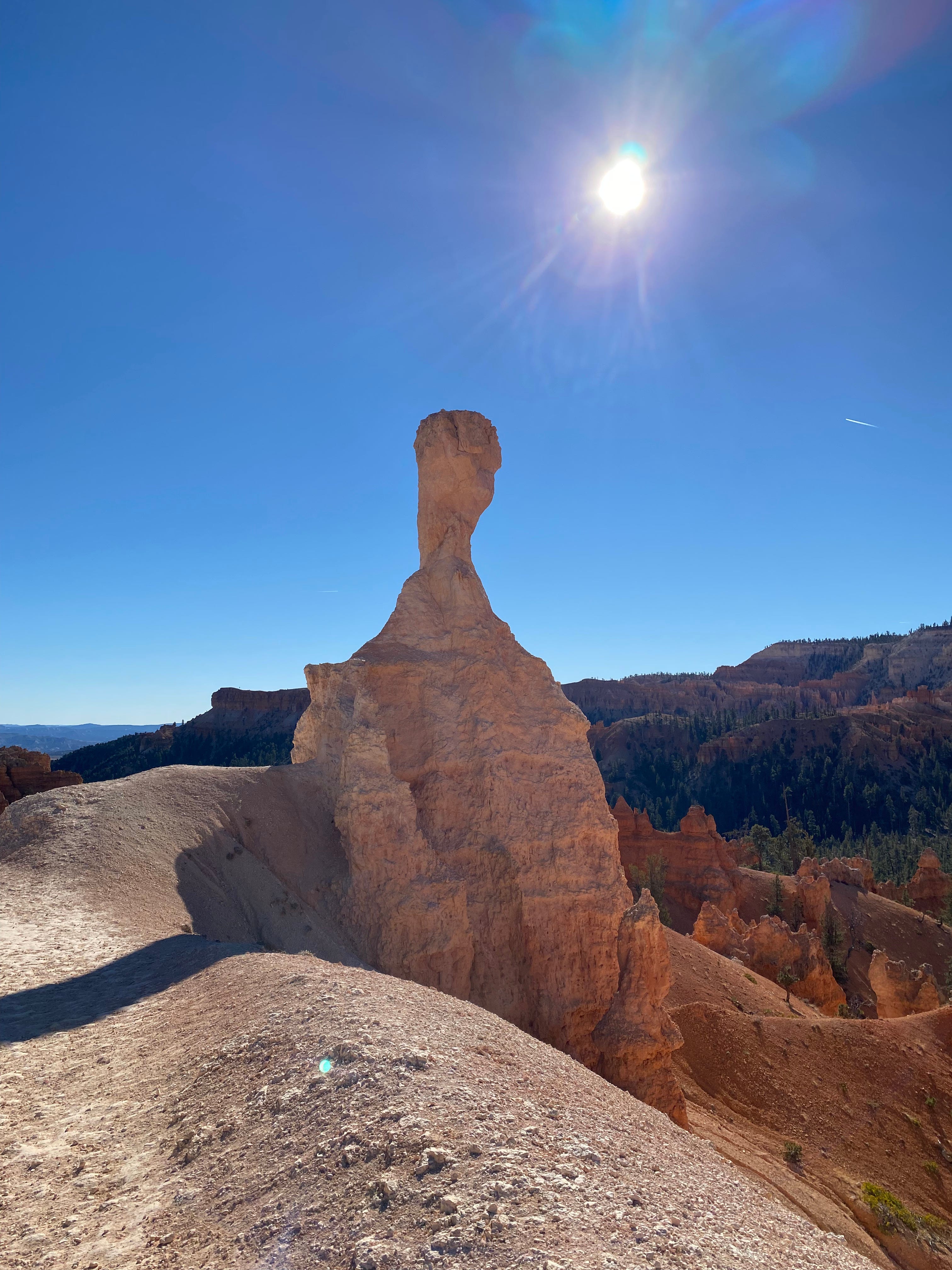
What would you name the hoodoo below?
Here’s one last look back at the trail, so you can see the grade and the switchbacks.

We would have liked to stay another night and do a longer Below-Rim hike the next day. Maybe we should have!
But we had big plans to get to Zion NP and hike a particularly famous trail!
That’s coming next.