


On Mormon Turf: Capitol Reef NP
Nov 17-19, 2021
Capitol Reef NP is the “Most Mormon” of all the parks we’ve visited. Not only is the place replete with Mormon history, but the early settlers planted orchards which continue to produce fruit — peaches, apricots, plums, pears and apples — which have spun off a culture that continues to thrive.
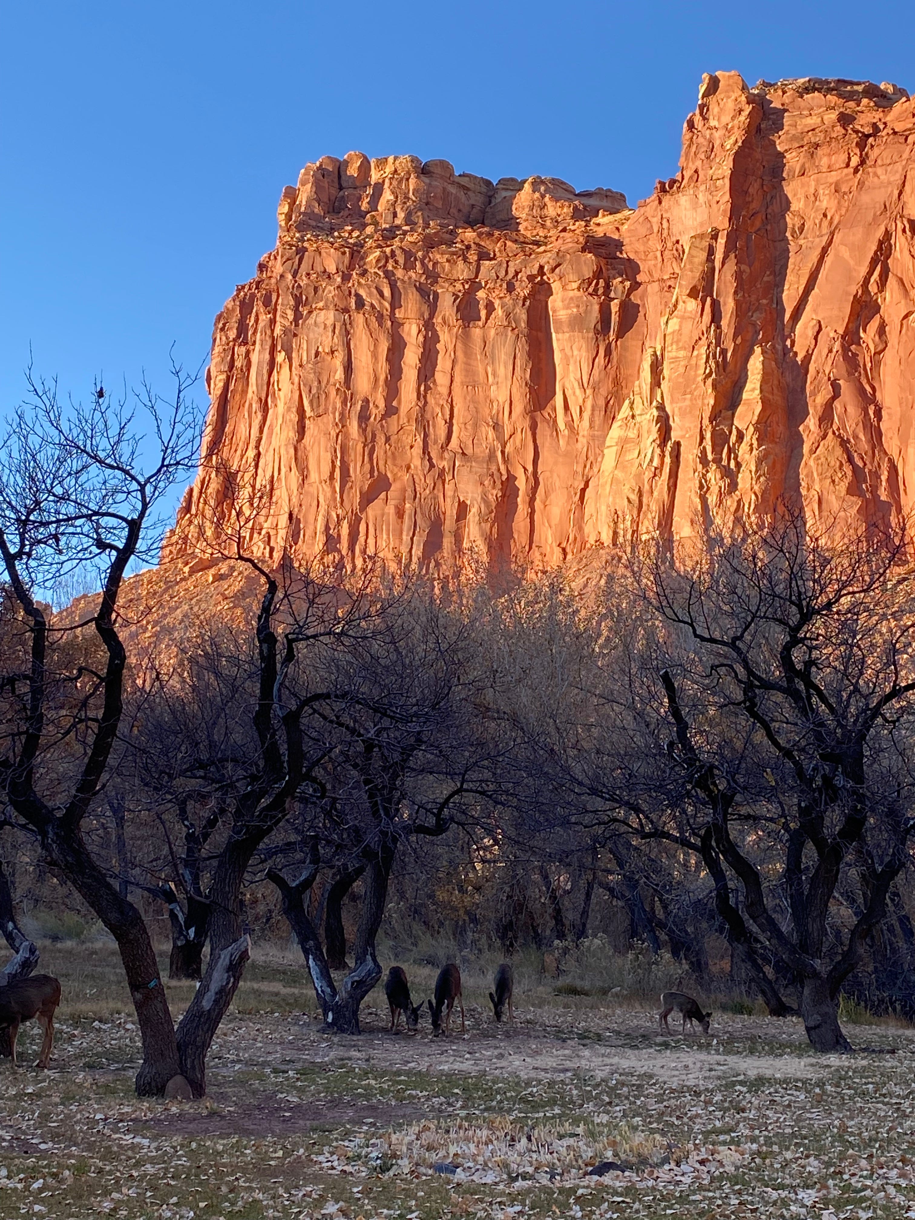
The photo shows fruit trees in their rather naked state in November, with plump mule deer grazing below and red cliffs towering above.
I suspect that Mormon missionaries are sent here to bake and sell the fruit pies that are a calling card of this region. I noticed some off-limits dorms, many more than are present at other parks. Plus there seem to be plenty of laborers on hand. And let’s face it, the rest of the world is scrounging for employees in these pandemic days.
Capitol Reef — the Name
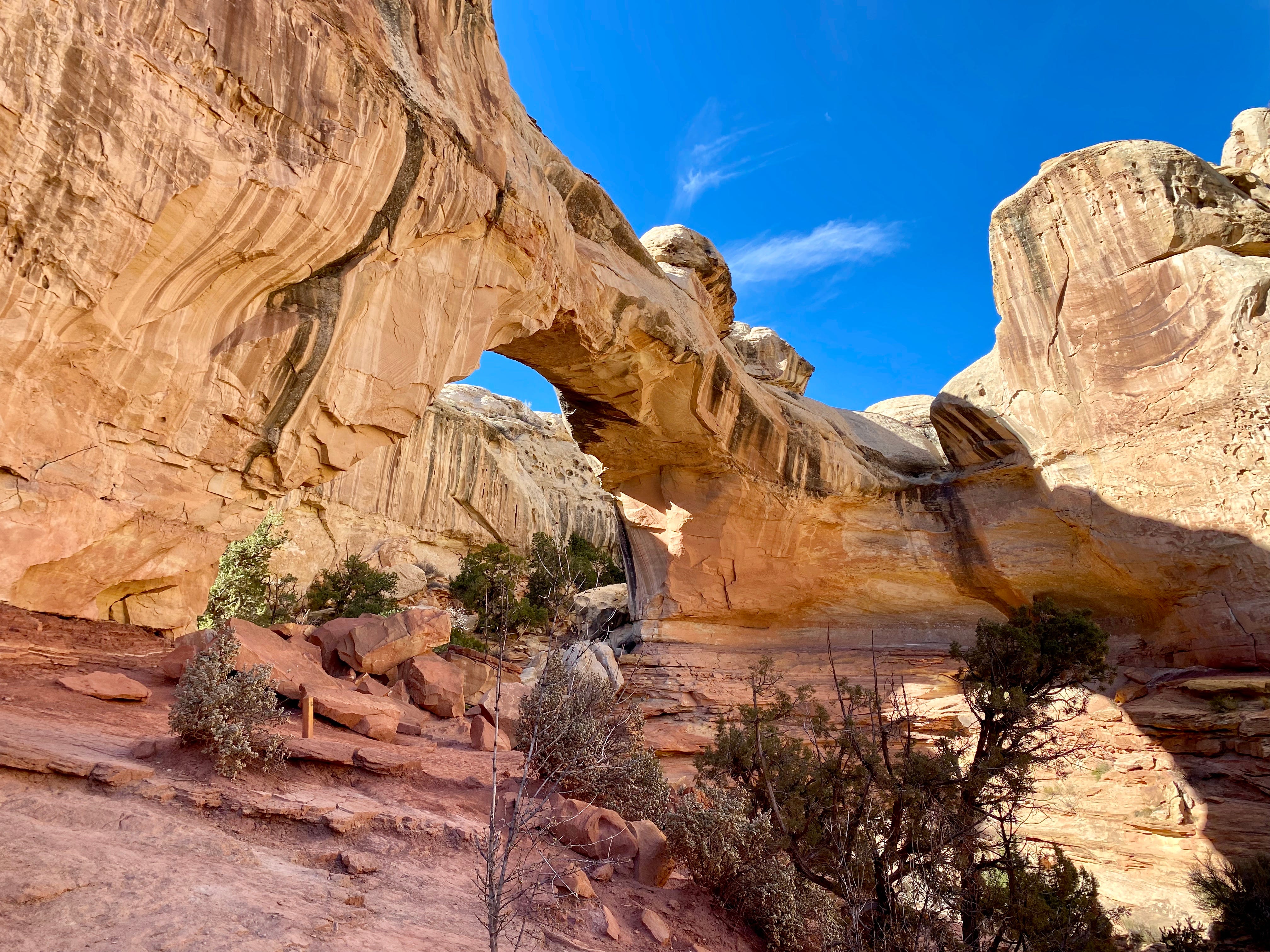
The name “Capitol Reef” is embedded in the region’s history. “Capitol” refers to a particular formation of white sandstone that early settlers thought looked like the dome in Washington DC. I’ll post a photo from our hike to Hickman Bridge — you can see that the formation is a combination of dome and triangle.
“Reef” refers to the park’s main geological feature — a craggy seam of ridges thrusting into the sky. Or, as the brochure says: “the Waterpocket Fold is a 100 mile long monocline, or fold, in the Earth’s crust that towers as much as 2,000 feet above its eastern base.”
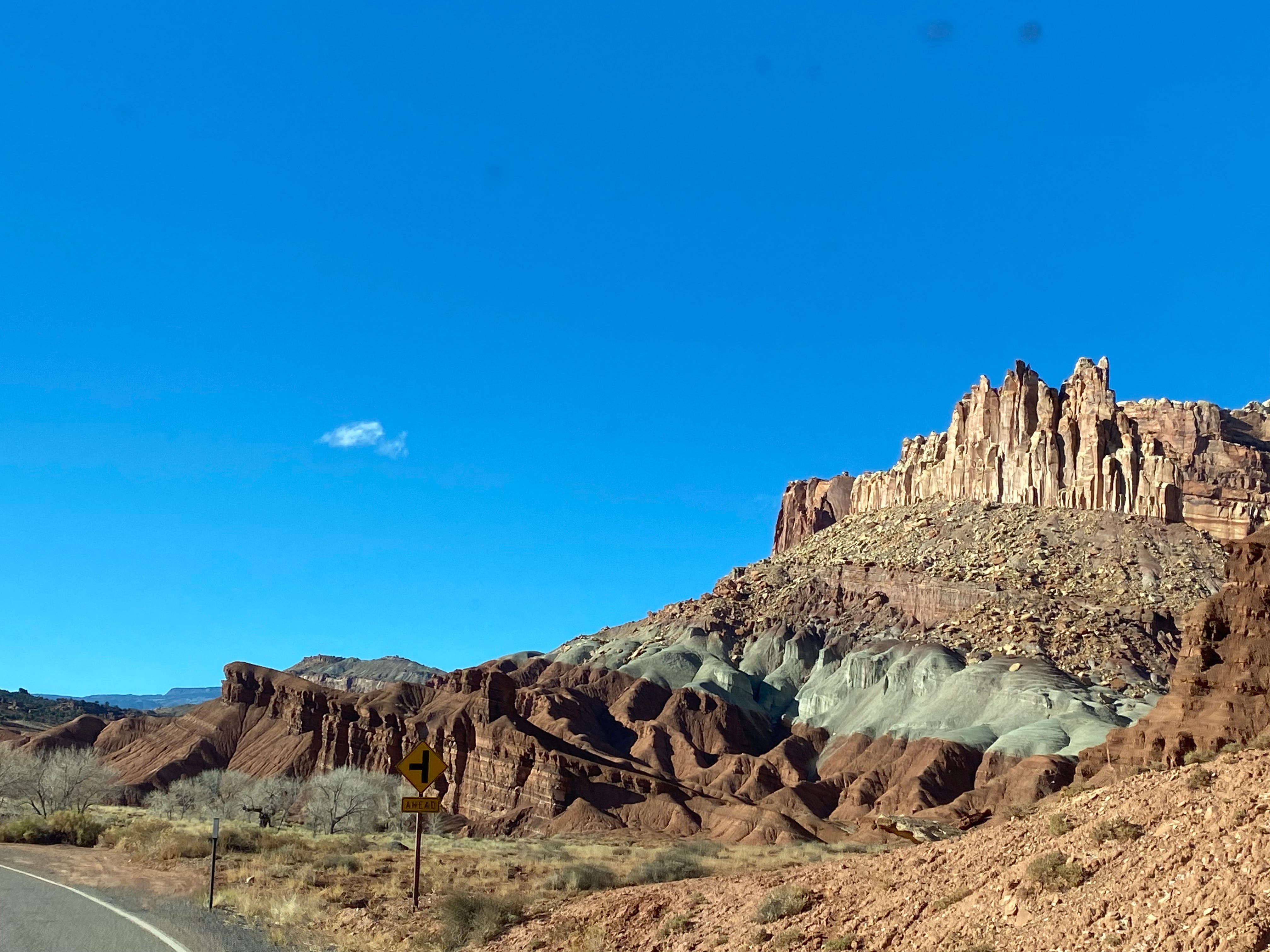
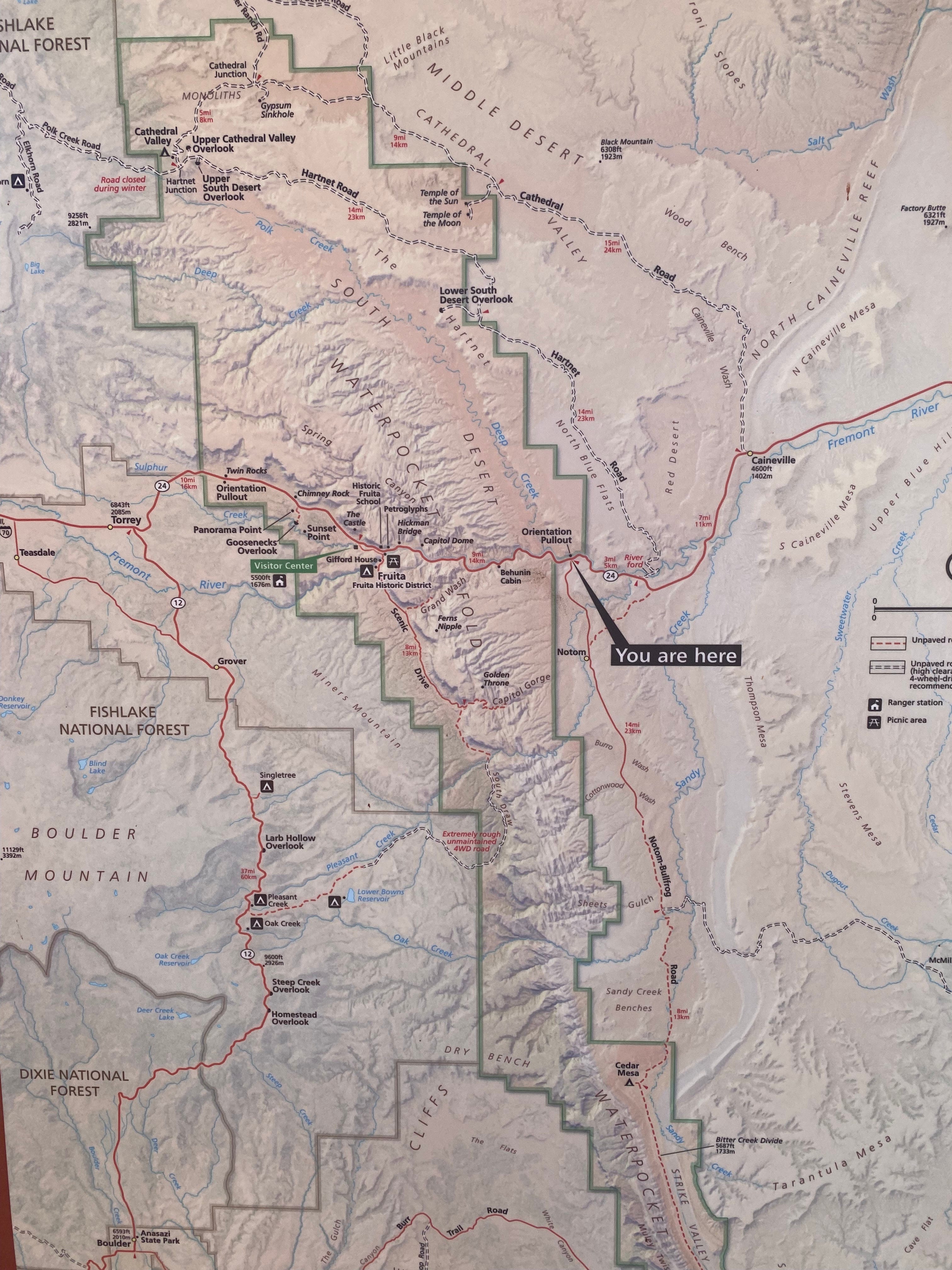
I should note that the park stretches to the south along the waterpocket fold and we did not venture there. Most of the developed area is concentrated in the Fruita section, which is in the middle of this long, vertical park.
Wednesday Nov 17
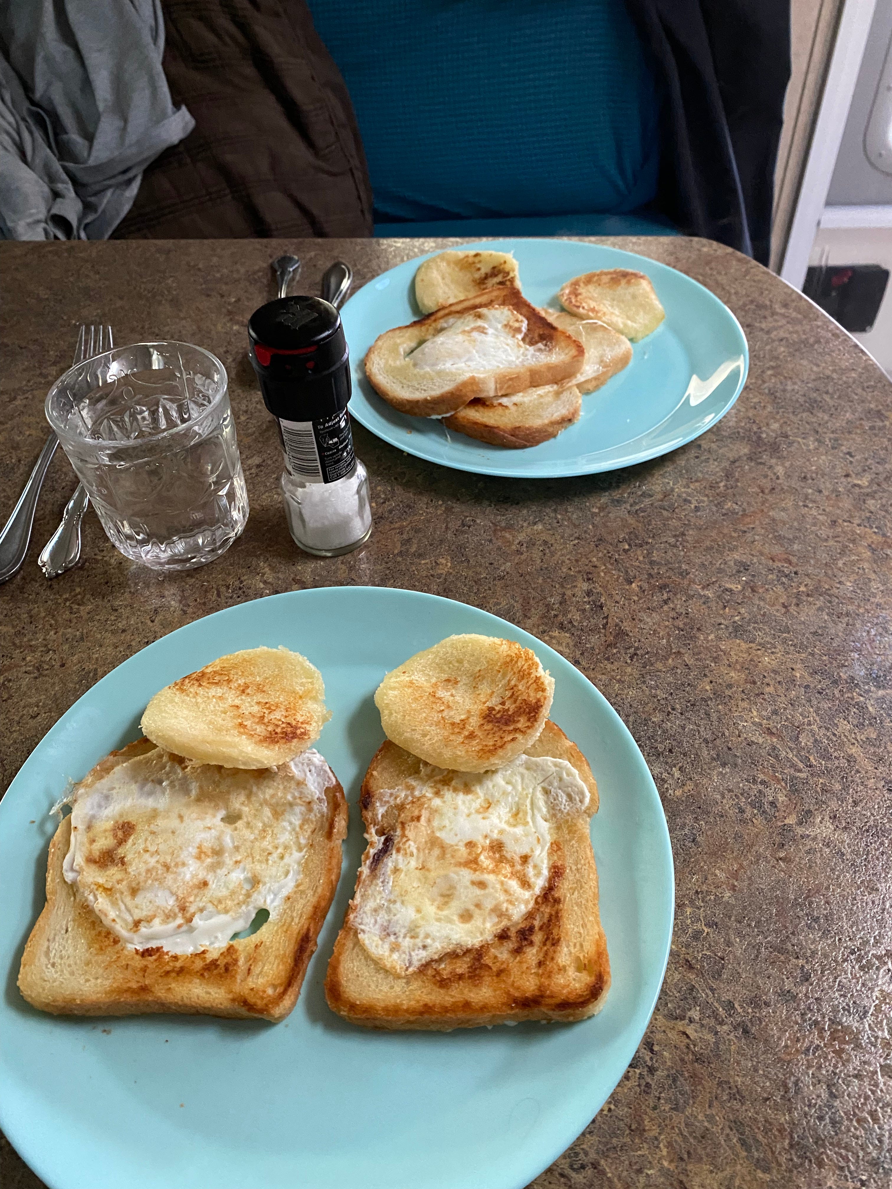
On most mornings we’re up and out pretty early. Occasionally we laze about and Doug cooks a big breakfast.
On this particular morning we enjoy one of his specialties. The recipe hearkens back to his Boy Scout days — “One-Eyed Wigglers.” Have you ever had them? (They’re best if you have lots of bacon grease for frying the “round tuits”.)
Hickman Natural Bridge Hike
After breakfast we leisurely hike the Hickman Natural Bridge Trail, taking 90 minutes to cover less than two miles.
Using a brochure, we stop to notice things like:
~ a ring of pumice-like rocks which formed a pithouse used by the prehistoric Fremont people.
~ the biological soil crust which includes cyanobacteria, lichens, green algae, mosses and microfungi.
~ the juniper berries, which are not actually berries, but small closed cones.
~ the tubular-looking plant called Mormon tea, which turns out to be ephedra. (Hello! Isn’t that hilarious? Caffeine is off-limits, but ephedra . . . )
~ the buffalo berry bush which has rounded, wooly leaves that glint silver in the sun.
~ the dimensions of the Hickman Natural Bridge: 133 feet long and 125 feet high.
~ the fact that Hickman was the guy who proposed naming this area “Wayne Wonderland.”
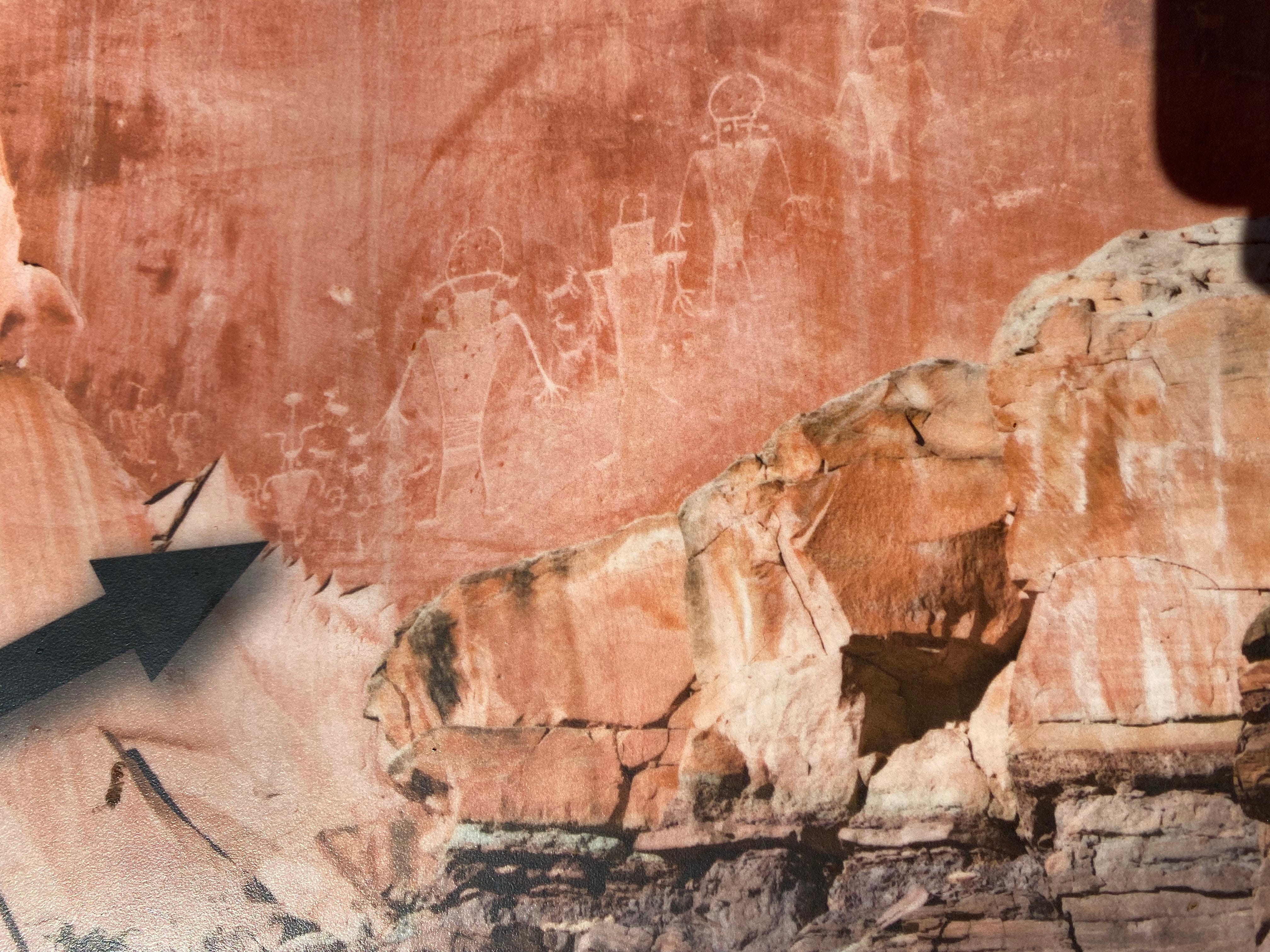
Petroglyphs
There are a number of ancient petroglyphs in the Fruita area. I will spare you the really annoying interpretive sign that compares the Fremont people to the early Mormon settlers, complete with sexist gender roles.
But the petroglyphs themselves are pretty cool, especially if you like aliens and space travelers.
Grand Wash Hike
Around 3:00 we head out to hike Grand Wash, which is a 4.5 mile round trip. A wash is similar to a wadi — an area where water courses during and after rainstorms, which tend to come fast and furious in desert regions. The wash is mainly sand, dotted with rocks, so it makes for easy walking.
The canyon is made of Navajo sandstone, which is a lighter color rock. The walls stretch so high that walking between them is hard to describe. I’ll include two photos with one or the other of us in the wash, to give a sense of scale.
To me the canyon feels as sacred as a cathedral, and as jaw-dropping as a city skyscraper.
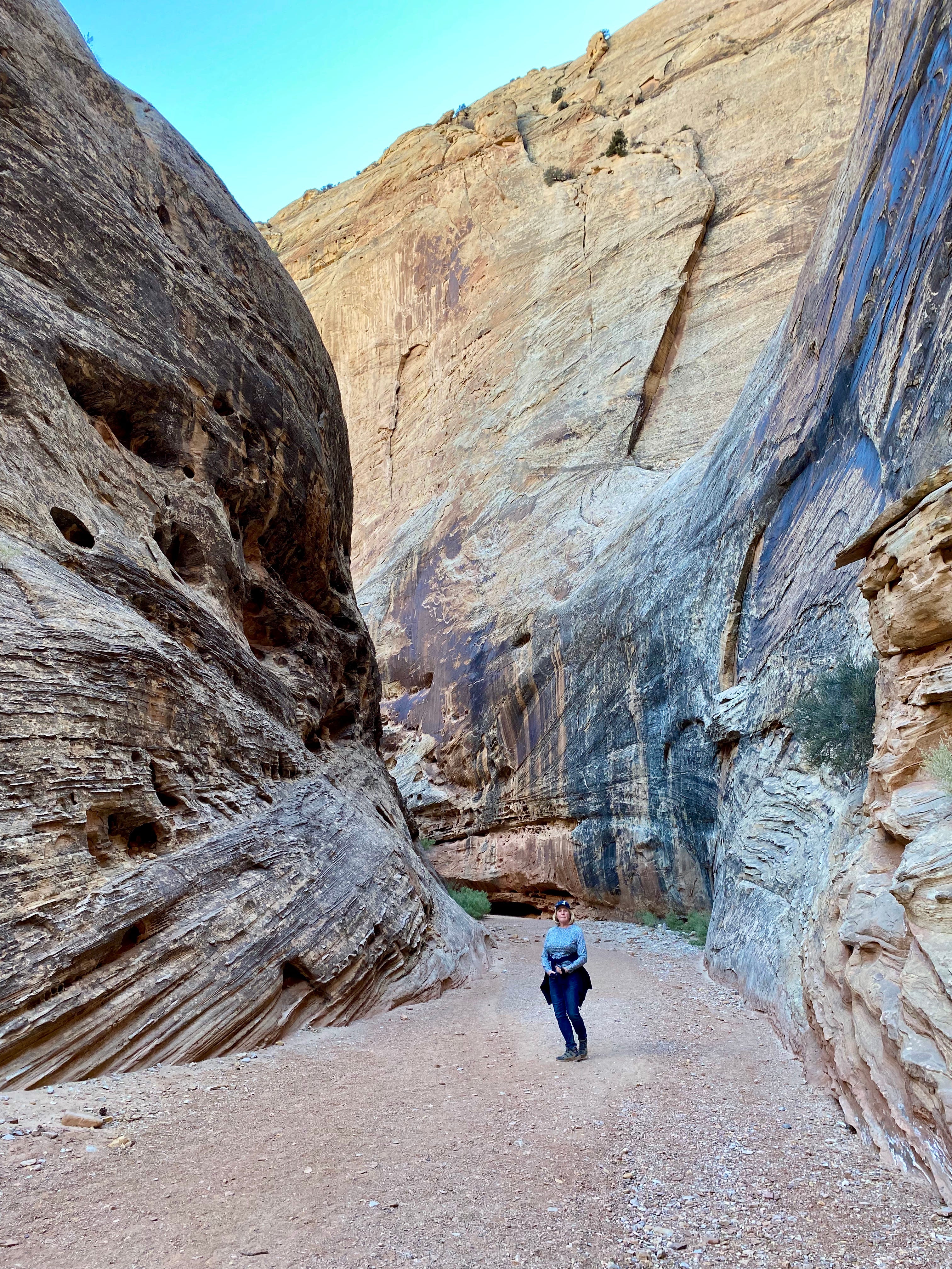
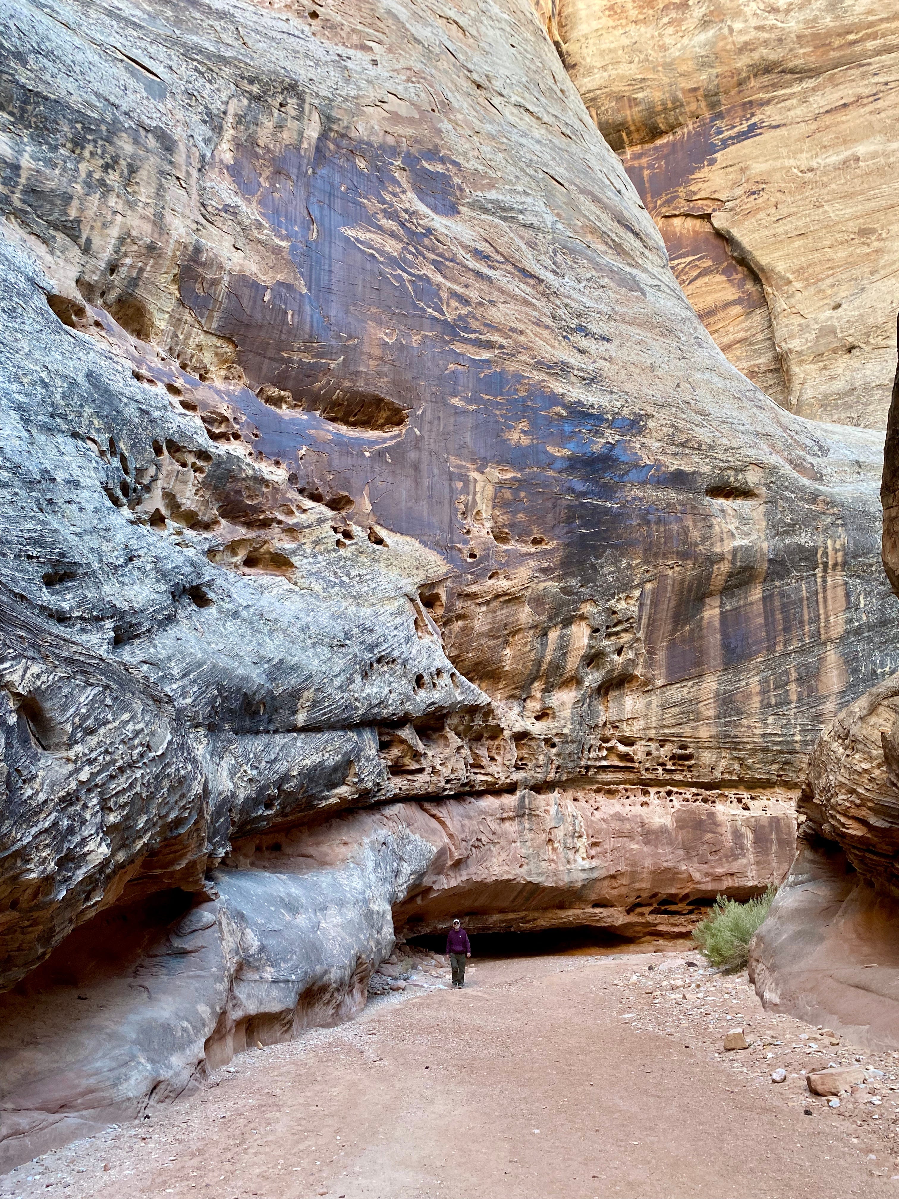
According to the sign at the trailhead, in the middle part of the hike (pictured above) the canyon narrows to only 16 feet wide. In that section the rock walls tower at 800 feet.
Wherever the canyon bends, the walls are undercut from floodwaters raging against the curves. Doug was a rafting guide and has a healthy appreciation for the power of water against rock. When people die in rafting accidents it’s most often because the force of the water traps them beneath an undercut ledge or rock. Trailing a hand along the smooth, undercut rock feels eerie.
After 90 minutes of hiking, as we approach the end, where we will turn around, I spot movement along the canyon wall to our left. I’m thrilled to see a group of bighorn sheep. I silently jump up and down and clamp Doug on the shoulder, pointing.
Four sheep leap across rocks, following the leader. Their enormous curving horns, which look heavy, don’t compromise the grace and ease of their movement. They graze, moving from green patch to green patch.
The photo below is poor, but see if you can spot three sheep.
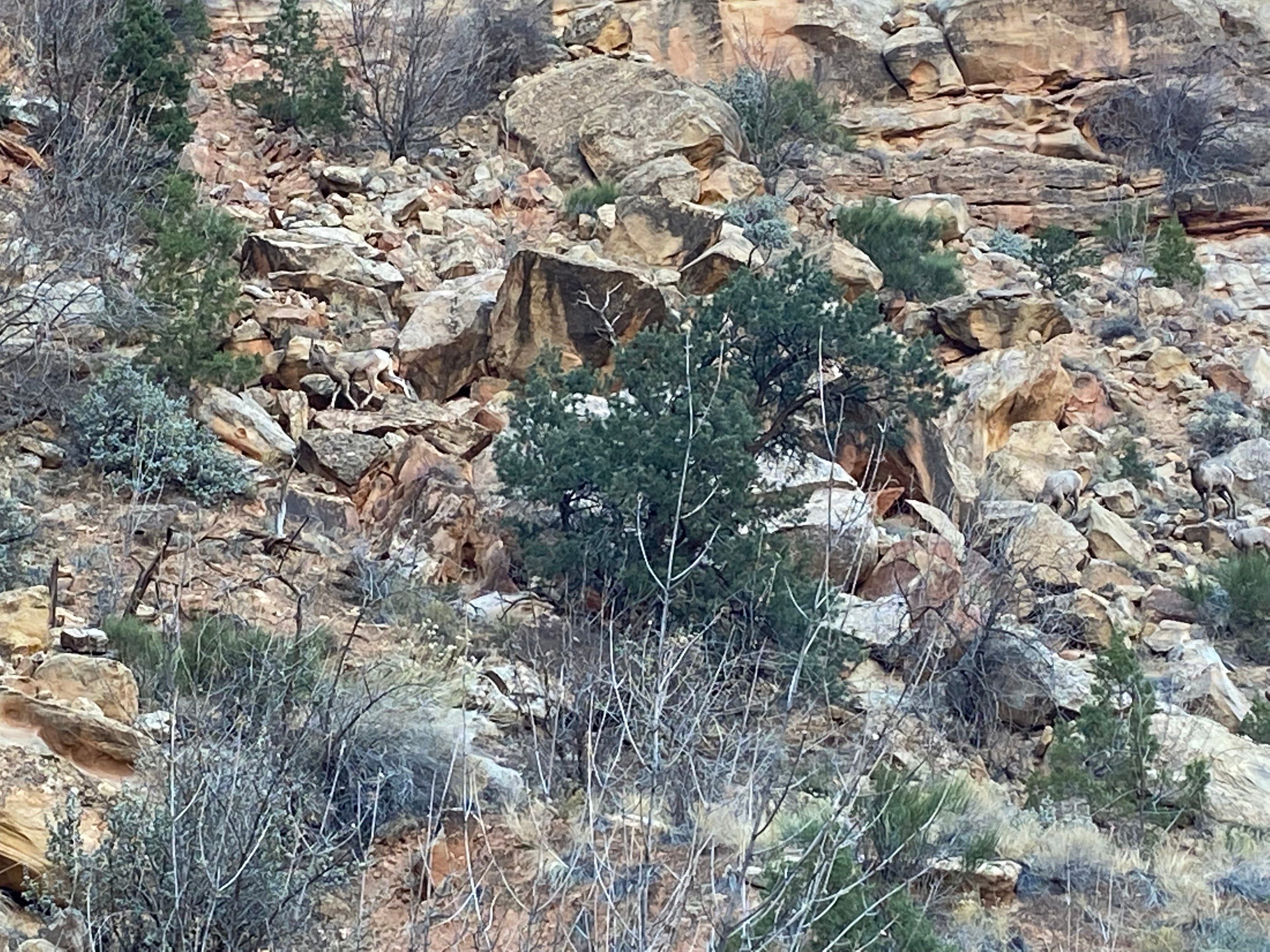
I’ve seen bighorn before, closer-up, but those animals seemed tame and accustomed to people (most recently in the Badlands).
This is a different experience. It feels like we’ve encountered bighorn sheep in their natural habitat and can glimpse their normal activities. It’s mesmerizing.
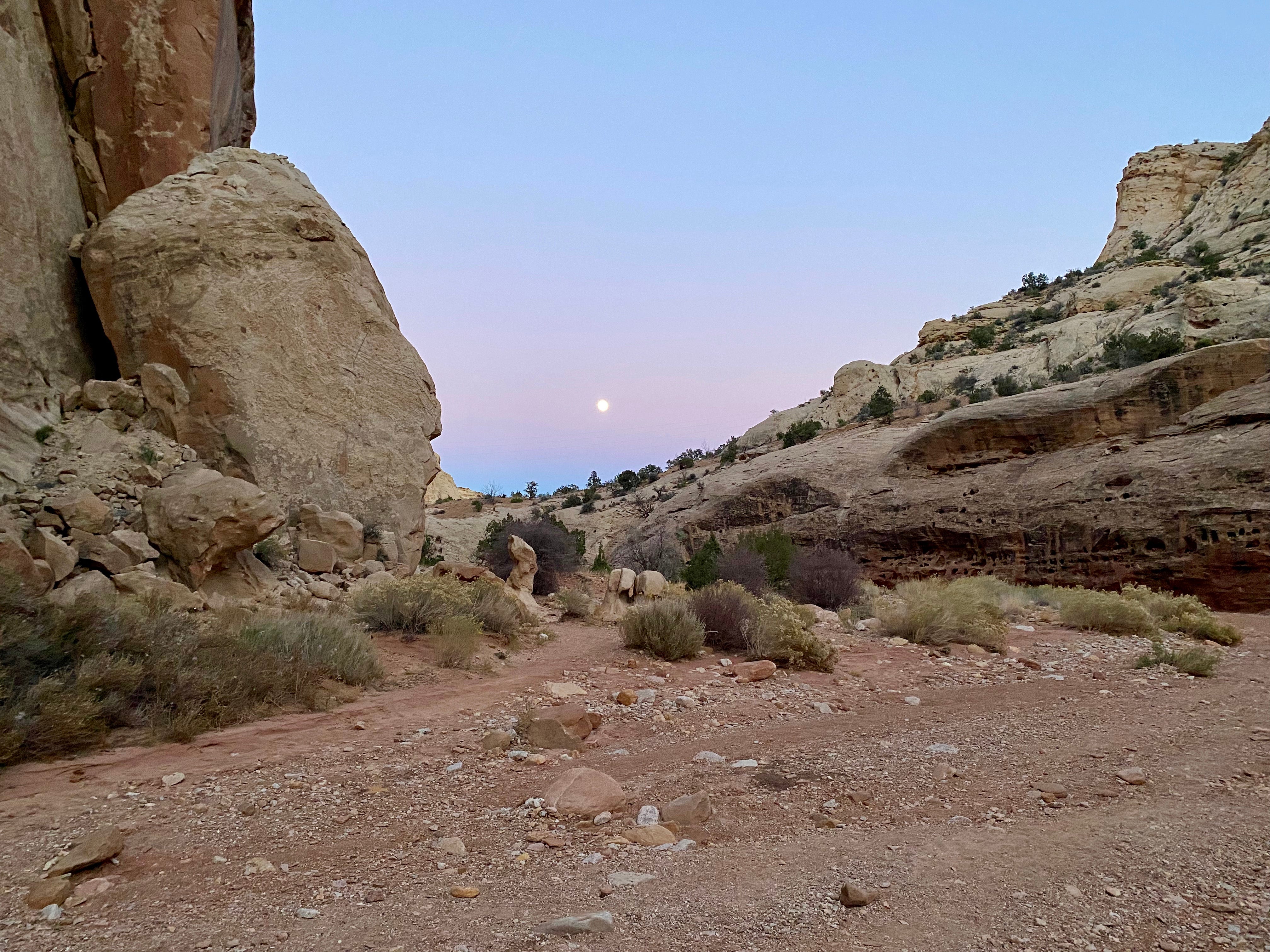
After watching them a long time we realize that it’s getting dark and we literally have miles to go before we sleep. Plus it’s getting colder now that the sun has set. Actually, it’s gotten quite cold! Was it really just two days ago that we slogged along a dusty road in the heat toward Moon House Ruins? The changeability of weather is astounding. I suppose it always has been, and I just notice it more keenly now that the road is our home.
Our return trip through the Grand Wash becomes even more magical when a full moon rises, casting a faint pink light over the canyon.
Thursday, November 18 — Life Maintenance Day
Last night’s low was 34, which helps us decide it’s time to head south. As we prepare to leave camp, Bree (the “Fiery Furnace Lady”) and her family walk across the campground to greet us. They recognized Big Blue. We chat a long time about the highlights of where we’ve each been, then wonder aloud if we’ll overlap in the future. But who knows? We are both traveling without an itinerary.
After we say goodbye to Bree and family, Doug and I drive west to a town called Torrey. We stop at the Wild Rabbit Café to have breakfast for lunch. Torrey has good cell service so we’re finally able to catch up with both of our daughters by phone. And then both of our moms. It’s been too long. This is definitely the hardest part of traveling, staying in touch with our family members.
(By the way, in Torrey I counted three restaurants up for sale, in case you’re considering a new career.)
Doug and I can’t seem to make up our mind about what to do next. We intended to take Route 12 south, which is a scenic highway passing through Grand Staircase Escalante. But the forecast calls for continued cold weather. So it would make more sense to take Interstate 70 and get somewhere warmer, faster.
We keep dithering, but also need to buy groceries and gas. We drive to the next town, named Loa. By the time we finish our errands, it’s late in the day and we are still undecided. So we head back to the campground at Capitol Reef for a third night.
Friday, Nov 19 — Decision Day
Last night the temperature dropped below freezing again. And even though we ran the generator for 30 minutes yesterday evening, the battery shows a decrease this morning. Our heating situation could fail again, as it did in Yellowstone. It would be prudent to take the Interstate. Still, we can’t let go of the idea of a days-long scenic drive.
We turn Big Blue south toward Grand Staircase Escalante.
THOSE CANYONS wow you aren't kidding about skyscrapers!
When we were in New Mexico in 2018, we saw petroglyphs at the Three Rivers Petroglyph Site north of Alamagordo. We spent a couple of hours walking the trails. I came to some conclusions: 1) maybe these glyphs were like road signs for people travelling through the area. Or, 2) they were property markers which seems a little unlikely. Or, 3) they were classrooms where the younger ones were taught stuff. OR 4) someone was having fun scraping pictures into the rock.
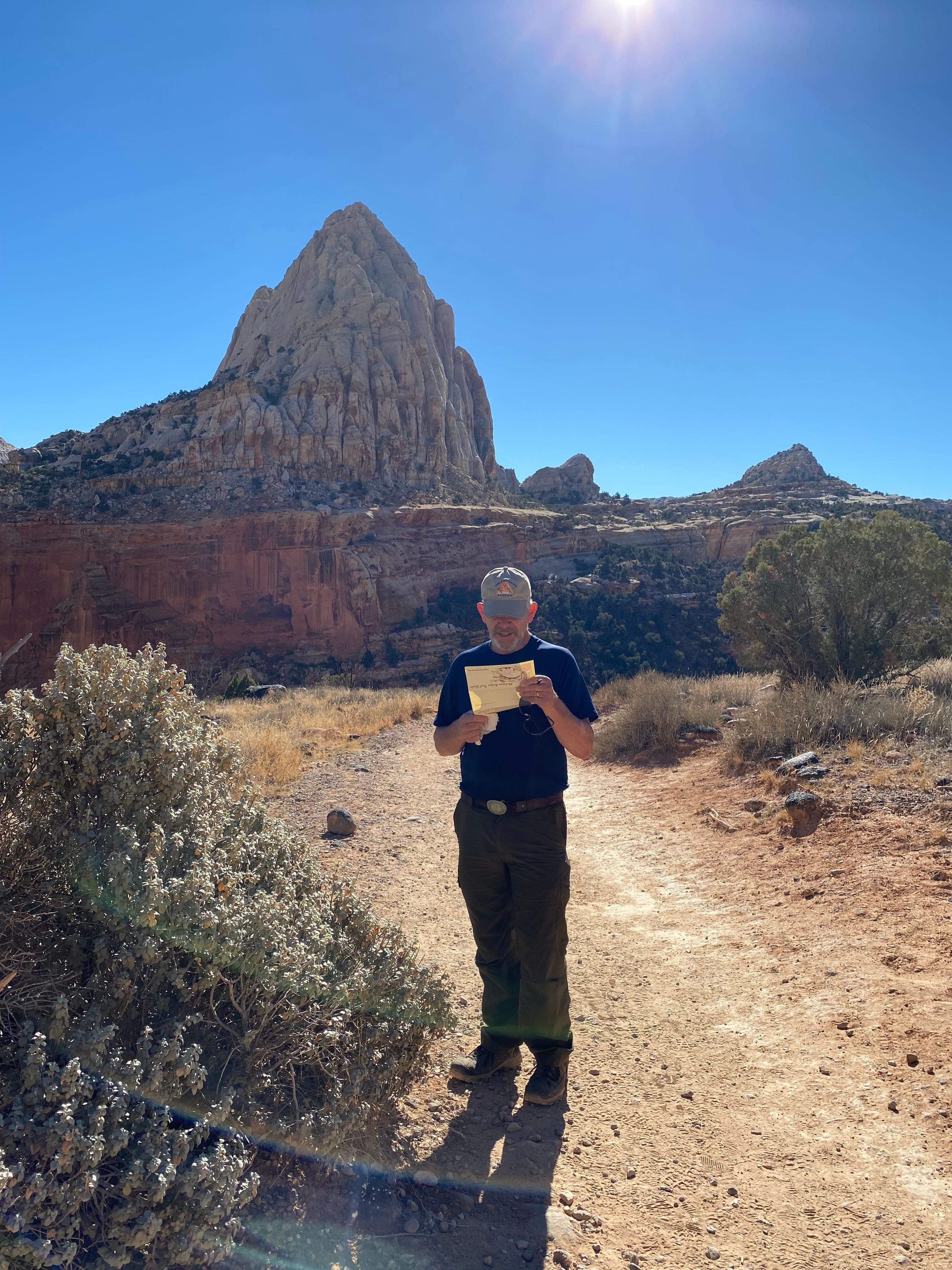
I also like the picture of Doug examining a map and that breakfast idea is great and I'm going to try it and add an avocado.
Orem here. It appears you went in November? So is the Hickman bridge hike open now - January?