


Crossing from St. Barbe to Blanc Salon
On Sunday morning, St. Anthony was again socked in by fog. Our plan was to leave by 10:45 for the drive to St. Barbe, where we intended to catch the 1:00 ferry to Blanc Sablon.
We needed to drive about 90 minutes south down Route 430, retracing the path we took north just four days previously. We calculated that a 45 minute buffer would be adequate to catch the ferry. We’d been told that reservations were unnecessary.
Planning this crossing has always been confusing. The ferry crosses from the island of Newfoundland to the mainland of Labrador (which are in the same province). But the port on the Labrador side, Blanc Salon, is not actually in Labrador. It’s in Quebec, some miles south of Labrador. I didn’t realize this at first because this tiny easterly portion of Quebec doesn’t connect by road to the rest of Quebec. Who does that? I thought I was misreading the map.
To complicate matters, Quebec, plus the southern portion of Labrador, are on Atlantic time, rather than Newfoundland time, which varies by 30 minutes. Who does THAT?
Upshot of all this: on the ferry crossing we’ll lose 30 minutes. And then, at some point during our time in Labrador, we’ll gain them back. And unless you’re trying to catch a ferry, the time probably won’t matter much.
On the Road, Route 430
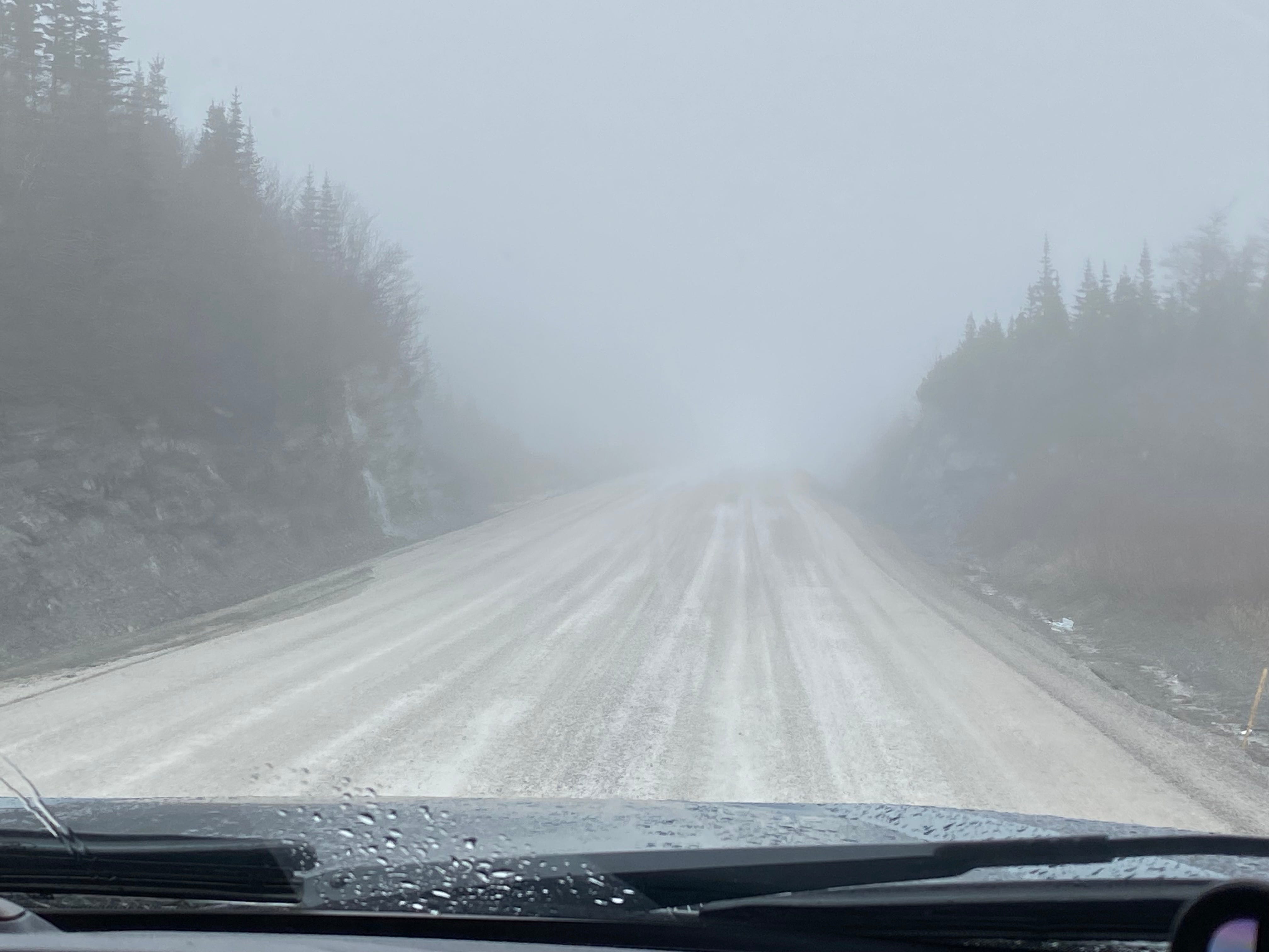
Once we got past the road construction around St. Anthony, the road was in decent shape, with very little traffic. Occasionally the fog lifted, or almost did. At one point, Doug saw two caribou close to the road. They looked like large, shaggy sheep appearing out of the mist.
When it came into view, the big water was frosted with whitecaps. The horizon was completely obscured by a marine layer. At Eddie’s Cove, where we saw our first icebergs last week, the same bergs were still visible in the same places.
A bit further south, near Green Island Cove, we spotted a large iceberg that was new to us. The road followed the cove, curving around this piece of ice. The high end of the ice was closest to shore and the rest was a down-slope away from us. A visible blue line bisected the berg like a dangling rope.
I took a photo from the truck as it was too cold and wet to step outside.

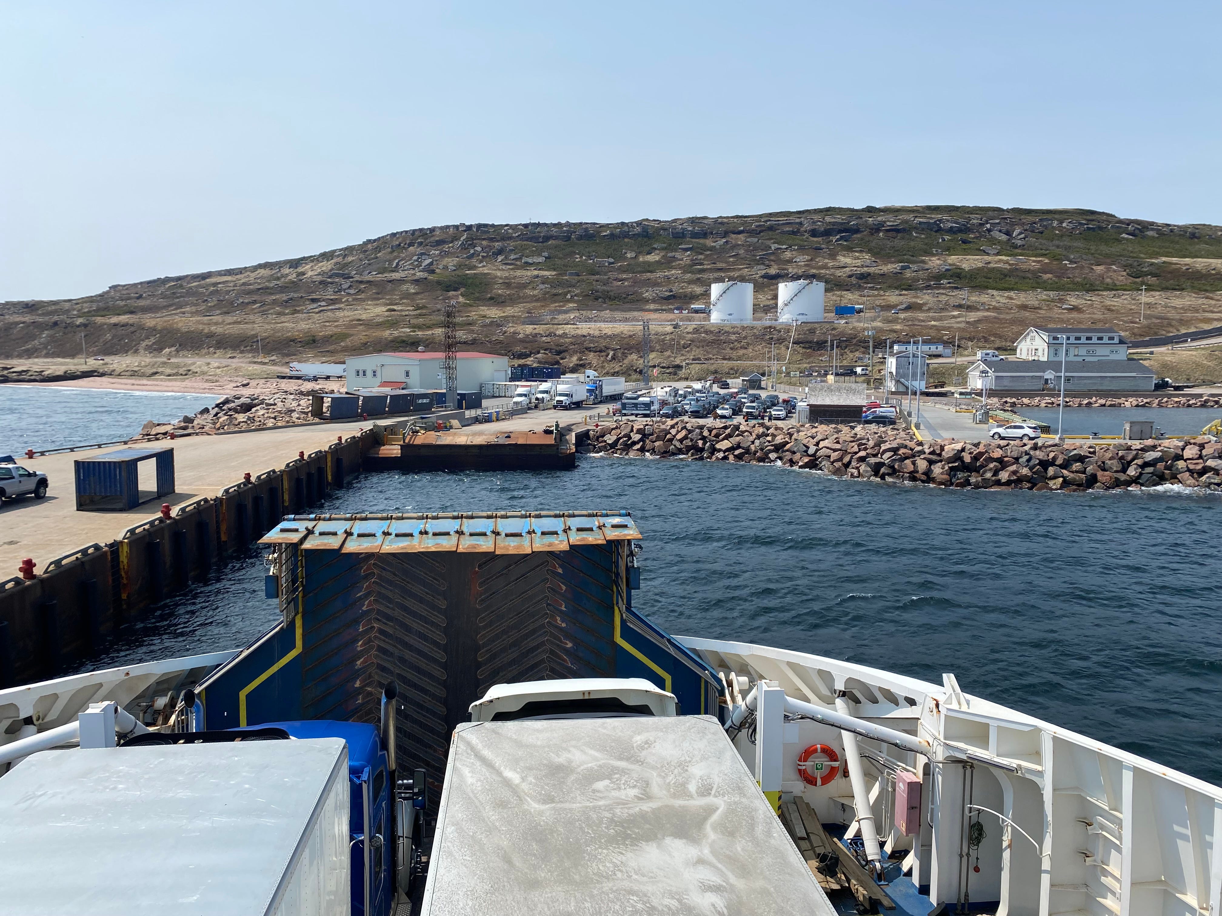
We arrived at the ferry ticket office, only to be told that space was very tight, there were no guarantees we could board. But we bought our ticket, knowing we might have to wait until the next crossing, at 6:00.
At the ferry dock, all was organized chaos. We watched many large rigs board, including a tour bus, and then lots of camping rigs — many of them made Big Blue look like Little Blue.
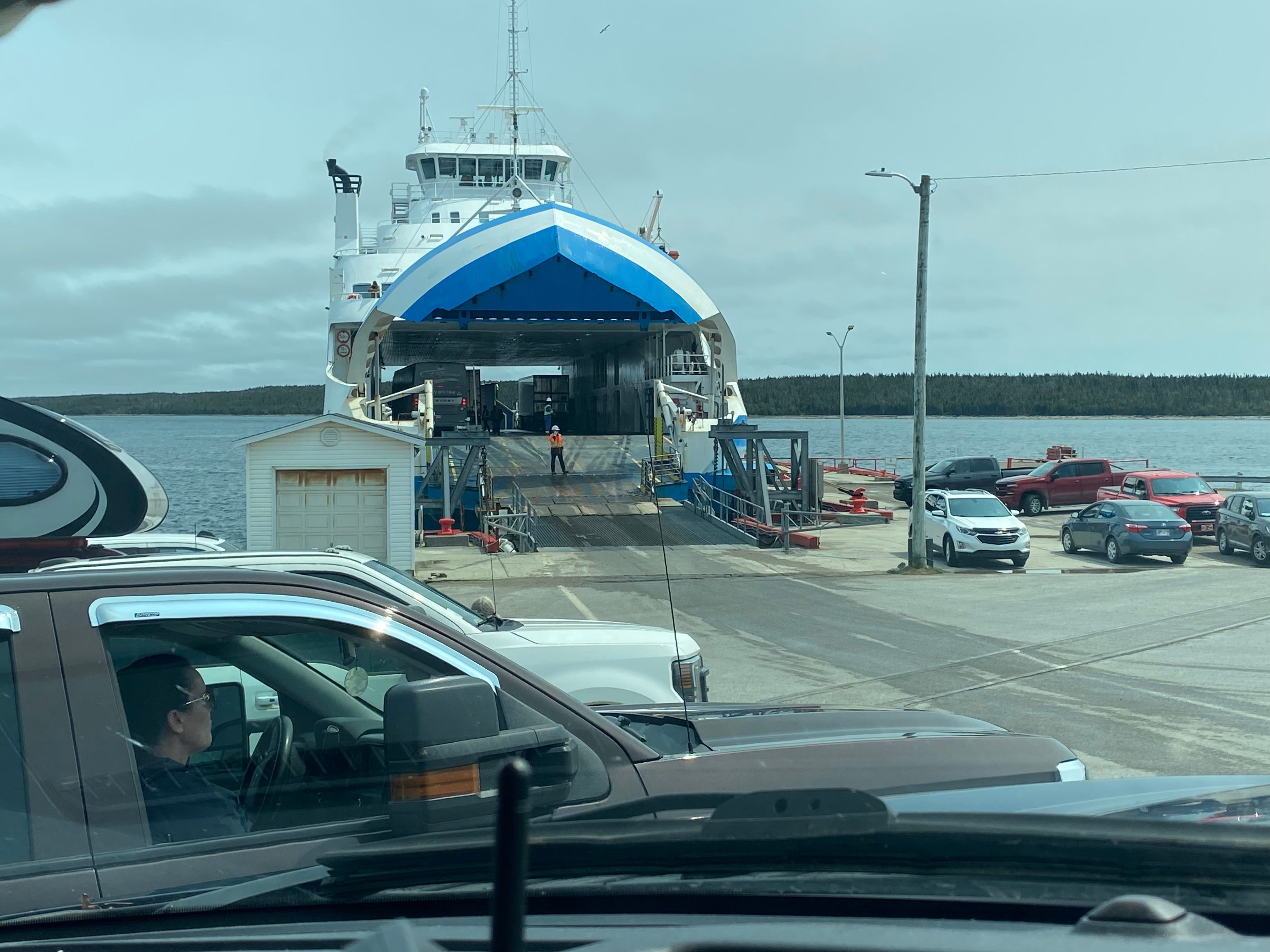
We were fortunate to be the last vehicle to board!
The crossing took almost two hours. There was a lounge area with very limited food options. In fact the only items left when we got to the counter were egg salad sandwiches. So we bought two, and were grateful for them.
Almost every seat on the ferry was occupied. I realized later that the tour bus contributed greatly to the passenger count. There were a number of young families on board. I counted 8 young boys who apparently became instant best friends a few minutes after boarding. One empty corner was set aside so they could play with a large soft ball. The rest of the time they ran to and fro.
Heartening to see a number of dads stepping up — commandeering the ball, managing the bathroom trips, dispensing snacks, spooning soup into a toddler’s mouth.
The weather was very foggy as we began the crossing, clearing as we went.
Shortly before we docked, we passed a large iceberg. I decided not to jockey into position for a photo.
This is what it looks like when you arrive in Blanc Sablon. I don’t recall seeing a single service or amenity on shore.
On the Road, Route 510
After disembarking, we headed north on Route 510. The road makes swooping bends along the coast and offers sweeping views out to sea. Within minutes we passed from Quebec into Labrador.
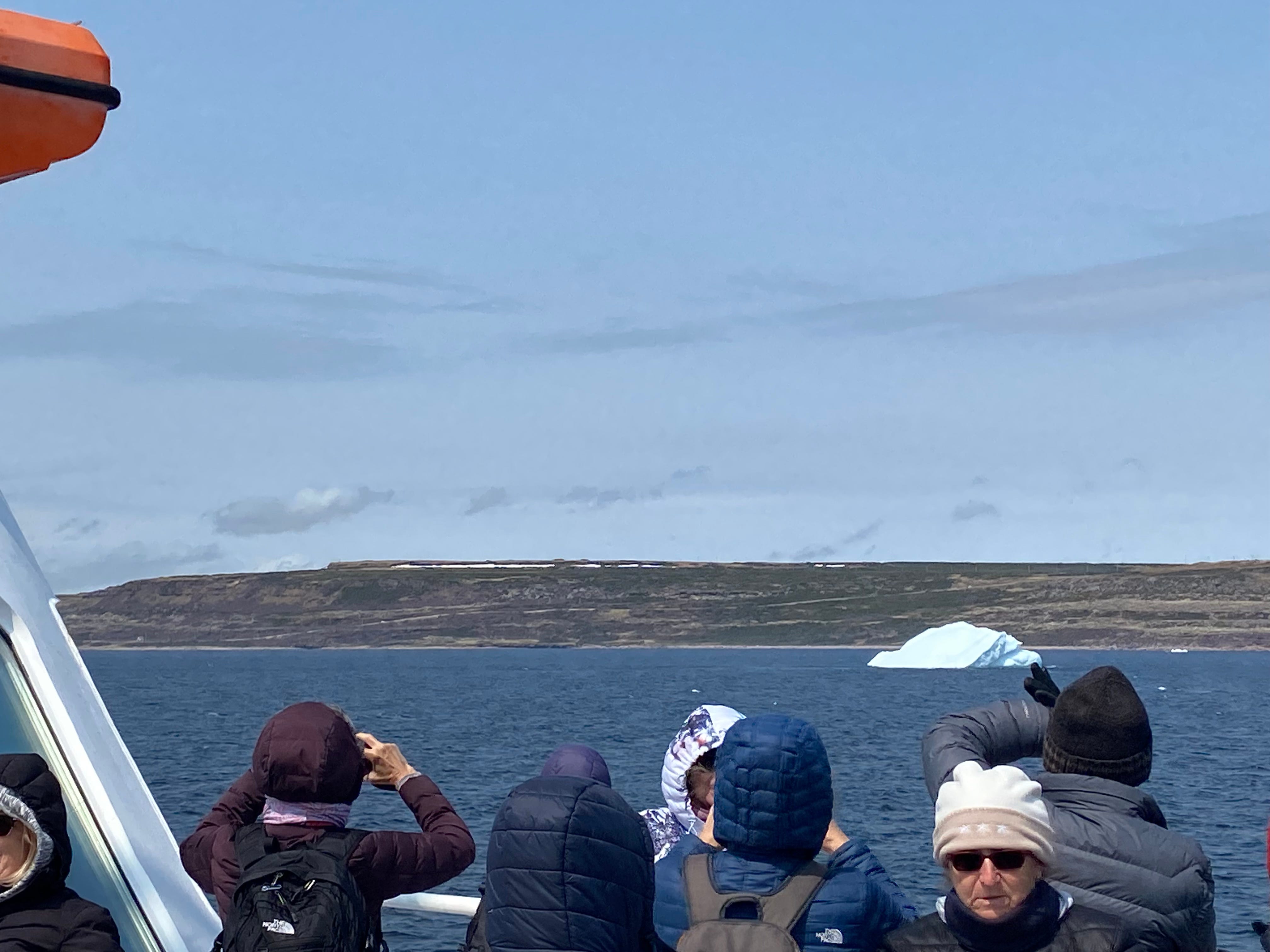
Almost immediately we saw a large iceberg in the distance, and pulled into a rest area to appreciate it.
IMO the Tourism Board would be smart to start naming icebergs. I understand that icebergs change over time, but so do hurricanes, and we name those.
The “Gateway to Labrador Visitor Center” is housed in an old church. We pulled in, then saw the Closed sign. However, there was a helpful map posted outside. We took photos.
Name that Iceberg!
In Forteau Bay we spotted another large iceberg, which we also stopped to admire. This one was shaped like a whale — it even had a line where the whale’s mouth would be. Doug noticed that it seemed to have a wake. Apparently the berg was large enough to block the wind coming out of the northeast, which changed the patterns of the water.
I named this iceberg, of course. What would you name it? Put it in the comments!

So interesting reading of your journey through my home province, but actually the southern portion of Labrador (Charlottetown-South) is on Newfoundland Time. Blanc Sablon is on Atlantic Standard Time while the rest of Labrador is on Atlantic Daylight Time. So when it's 7pm in Newfoundland, its 7pm in the southern part of Labrador (with the exception of Cartwright/Black Tickle), 5:30 in Blanc Sablon (they don't participate in daylight savings time), and it's 6:30 in the rest of Labrador. It can be extremely confusing 😅
Ahab. Of course.