


The Vast Loneliness of Labrador
Day 16, June 4
Labrador is a big land!
Why We Drove to Happy Valley Goose Bay
Happy Valley Goose Bay (or simply “Goose Bay”) is one of the few population centers in Labrador. It’s quite a ways inland, so wasn’t on our original iceberg-based itinerary. But sometimes plans change.
By Day 16 we felt a bit at loose ends. We’d spent two nights boondocking in a gravel parking lot in Red Bay, being buffeted by the wind. We were waiting, fruitlessly, for the weather to clear. Meanwhile we enjoyed hiking in Red Bay, but the inability to see icebergs was a disappointment. Especially difficult since the icebergs were indeed out there — but too far at sea to see from shore, with seas too rough for a boat ride.
We tried to widen our horizons. While we were planning this trip, Doug would occasionally bring up a side trip to Goose Bay. I knew he was curious about it.
So I told him: “Look at it this way. If we see Goose Bay now, we’ll never have to come to Labrador again.”
Which is not an ultra-positive way to begin a trip, I’ll admit.
The Road to Goose Bay
The drive from Red Bay to Goose Bay is 542 km (325 miles) on the Trans-Labrador Highway.
The road was the best we’ve ever traveled in this province — absolutely smooth, with no traffic, and many stunning views.
Pools of water sparkled in the sun; other pools, deep in shadow, glistened with ice. Stunted pine trees appeared and disappeared as the road dipped below, then above, treeline. At the highest points, great expanses of bare rock stretched to a big sky.
Doug said, “It’s like driving through a Bob Ross painting.
Mother’s Day Blizzard in Labrador
Just last month, on Mother’s Day, there was a major blizzard in this area. Doug read a news account about a family who had gone to visit grandma in Goose Bay, and were headed home to Port Hope Simpson. The car got stuck in three feet of snow. They misjudged how close they were to help and an older teenager set off on foot. She had a harrowing experience, as she tells in her own words.
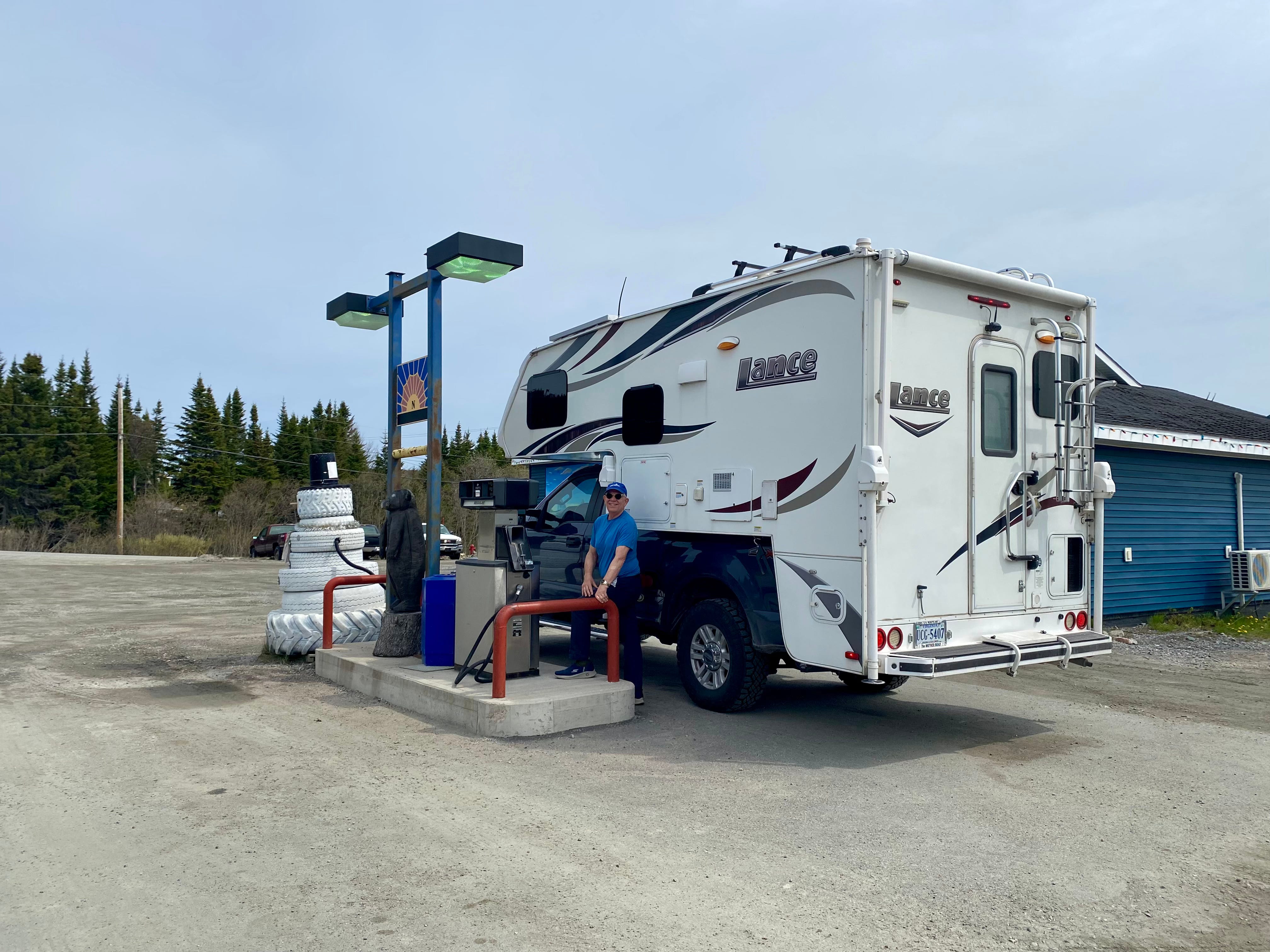
Port Hope Simpson
If you do drive to Goose Bay, I’m sure you’ll do as we did and tank up at Penney’s Pit Stop in Port Hope Simpson. It’s the last opportunity to buy gas for more than 400 km — the signs warn you of this fact. Doug filled the tank for $176 Canadian. (approx $5.19 USD gallon).
Check out the “snow man” made of tires below, at Penney’s, one of Labrador’s “no frills” gas stations.
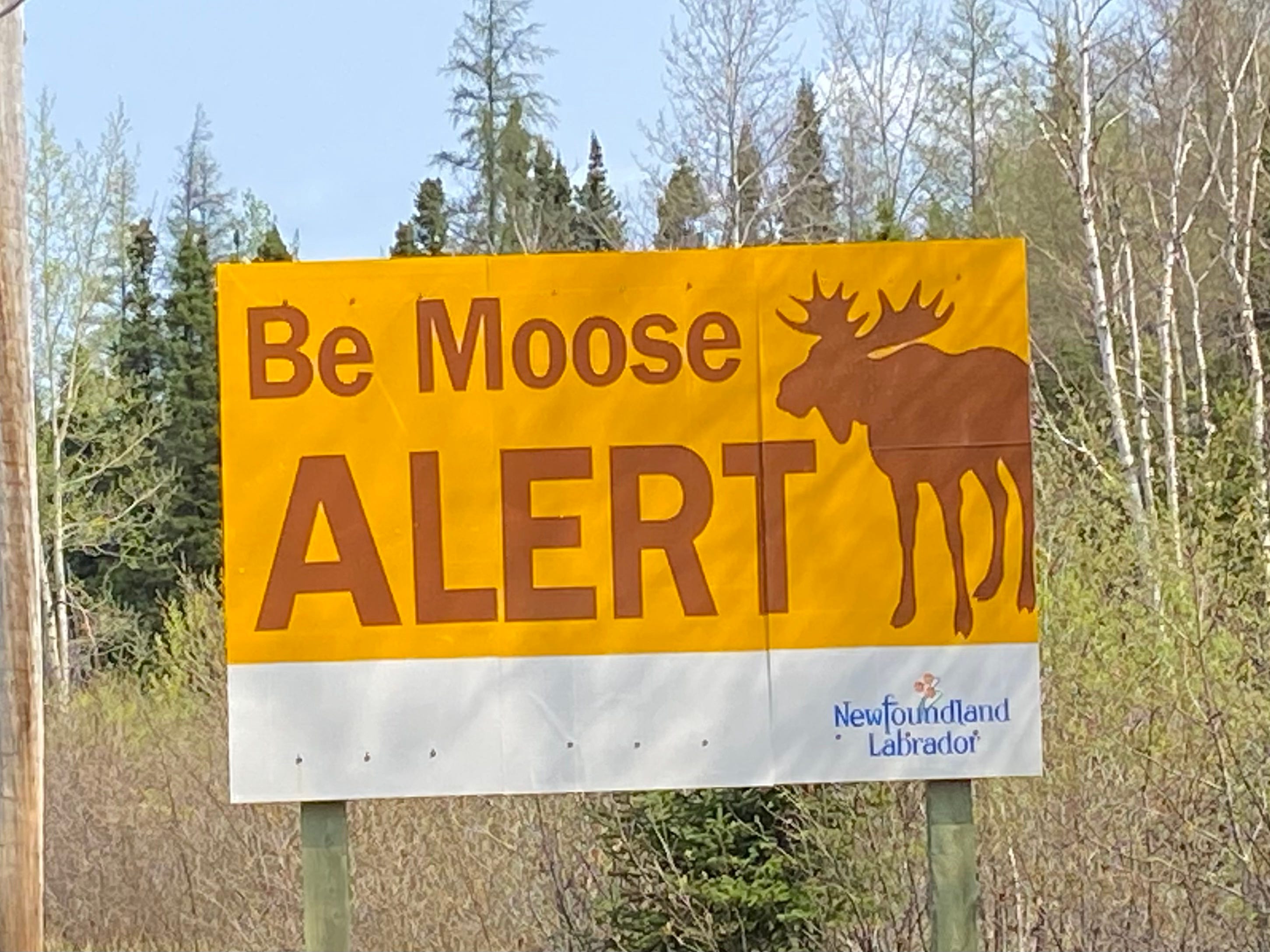
Wildlife on the Road
We kept hoping we’d see a moose. Enormous “Be Moose Alert” signs fueled our hope.
But alas, we had to be content with smaller sightings.
At one point a ground squirrel darted across the road carrying something in its mouth, its tail held high. I laughed out loud —and all of a sudden understood where the expression “hightailing it” comes from.
Hours down the road, we noticed a dark spot along the opposite side of the road. As we got closer, we hoped it was an animal. Sure enough, we could clearly see a large black bear. Doug slowed down.
At that very moment, a car appeared from behind and zipped around us. It reached the bear first and scared it into the woods.
I swore out loud. The timing really angered me. This was the first vehicle we’d seen in hours, at this very moment? What were the chances? Gah! To say nothing of the fact that we could have witnessed an accident.
Philosophizing
Around 2:00 we were road weary, and pulled over on the side of the road. We took a 20 minute nap, then debated whether or not to continue. We decided to plunge ahead. I made a list of words that came to mind as we drove:
Vast
Lonely
Desolate
Isolated
Doug made the observation that both of the historic sites we’ve seen so far — the Viking settlement and the Basque whaling camp — were peopled by groups who never settled here and have nothing to do with modern Canada. So it’s hard to feel invested in that history.
In fact, when you think about it, most of the history of Newfoundland and Labrador revolves around the exploitation of natural resources that are now largely exhausted. Whales. Then Seal (which now abound, but are infrequently hunted due to restrictions). Then Cod.
Next is minerals, including gold, and some rare earth minerals.
I don’t like the expression “raping the land” but I understand why others might use it. That phrase conveys the degradation the land undergoes, and the fact that the land itself is unable to protest. In this case, the “land” includes the sea.
Hydroelectric lines run alongside the road. Each separate tower has its own little access road from the highway. One of Labrador’s resources is the hydroelectric power coming from Churchill Falls.
Digression about the Labrador Flag
Back in Red Bay, Doug had a conversation with Karen about the relationship between Newfoundland and Labrador. Karen’s perception is that Labrador carries most of the economic weight of the province, to the degree that Newfoundland could not sustain itself without Labrador. Despite that, Labrador gets shafted by the federal government in favor of Newfoundland.
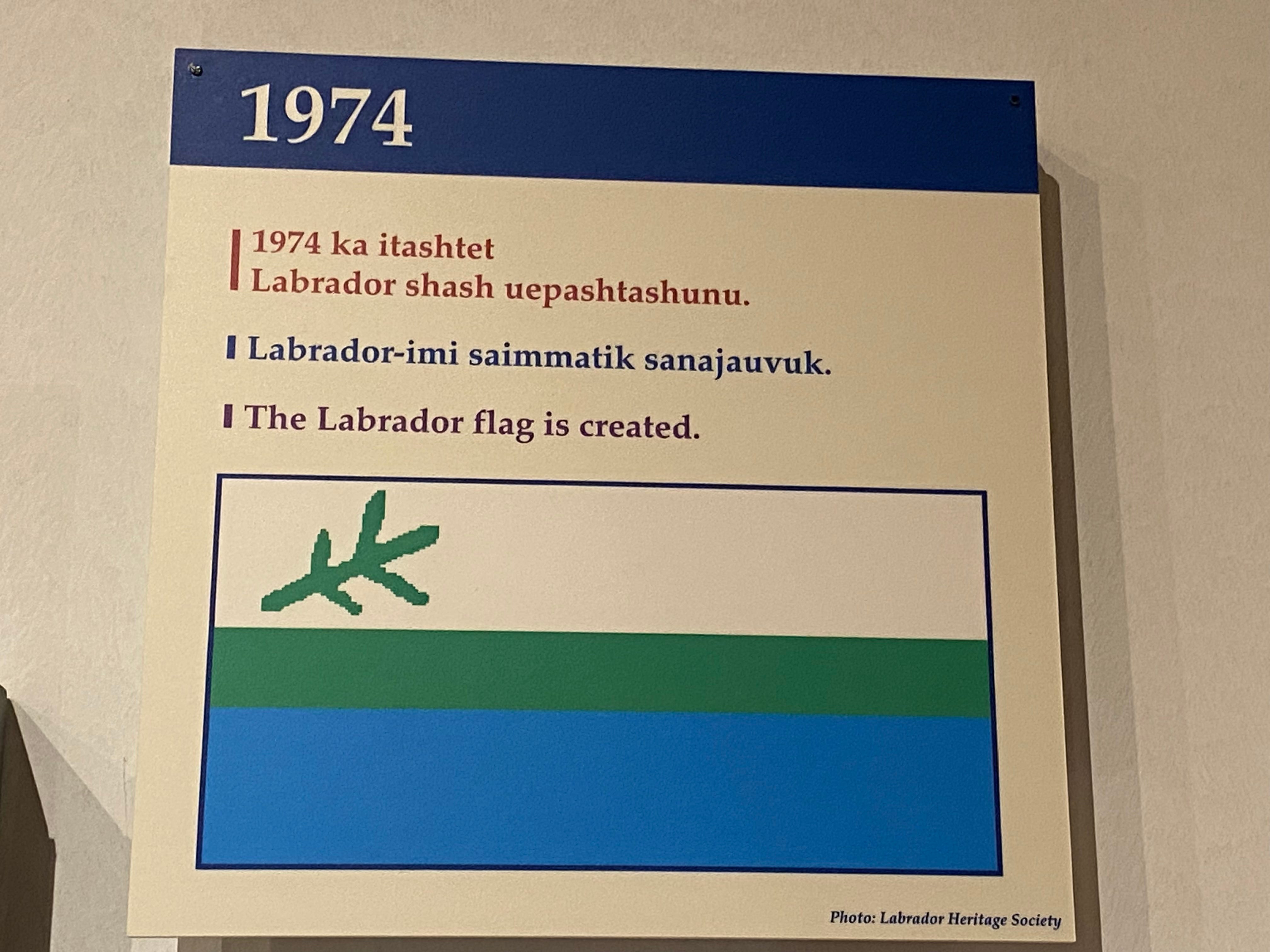
She said this is why you will never see a Newfoundland flag in Labrador, except at government offices. Instead we see only the Labrador flag, which is a field of white above a field of blue, separated by a thinner strip of green, representing the land. A green twig floats in the white.
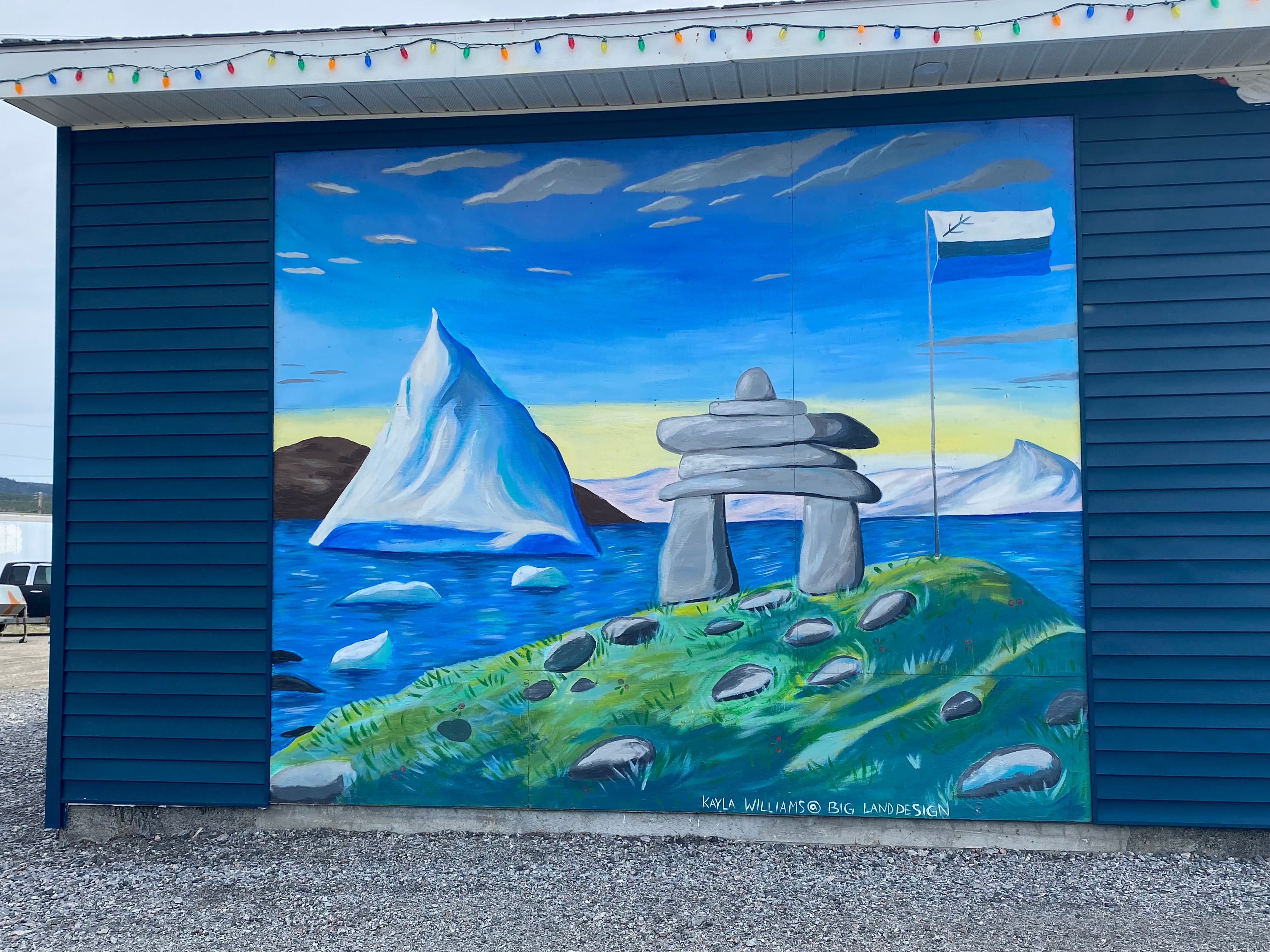
I also appreciated this mural, from Penney’s Pit Stop. It includes the Labrador flag, an iceberg, and an Inukshuk (in-NOOK-SHOOK) which has roots in Inuit culture. The artist is Kayla Williams.
Philosophizing through the Miles
There’s no doubt about it — driving to Goose Bay gives a person lots of time to think. There’s no radio signal. There’s no place to turn off. There’s just, as we say, “a whole lotta nothing.”
Around 3:30 I asked Doug if he would still like to turn around.
He replied that we had passed the point of no return. We didn’t have enough gas to make it back to Port Hope Simpson.
This eventuality was not something I anticipated. The thought was sobering.
We kept driving. On a long curve in the road, we passed a wrecked pick-up truck.
The speed limit was 80 km and Doug observed it. He is normally a cautious and courteous driver. This drive was no different. Occasionally, unpredictably, the wind would gust. Big Blue would sway a bit.
At Last
A dark brown ball appeared in the distance. It wasn’t moving. As we drew closer, we could see that it was indeed a porcupine — busy chomping on something, oblivious to us. Woo hoo! Wildlife!
At 5:30 we crossed a bridge over Churchill River. The sign welcomed us: “Happy Valley Goose Bay, the Heart of Labrador.”
We pull into the Ultramar with 42 miles left on the gas tank. Victory!
I am from a small community in Labrador called St. Lewis,ext 513. It’s just before you get to Port Hope Simpson. We have a panoramic view of the ocean. If you’re really lucky, a great place to spot icebergs. It’s funny when you describe the drive to Goose Bay, as lonely or desolate. The communities drive it many times for appointments,airport,visiting family ,meetings,shopping etc. It’s a normal part of life.
As a Canadian military family, we lived in Goose Bay from 1990 to 1993. At that time, the highway you took didn't exist. When my husband was fortunate(?) enough to get posted back to Goose Bay in 2000, he went unaccompanied as we didn't want to take our teenage son out of civilization back to that. Long story short, hubby drove what was then referred to by Canadians as 'The Freedom Highway.' He packed extra jerry cans of gas, canned tire repair kits in case he had a blow-out, lots of food and many MANY CDs. We can empathize with the loneliness of the trip but applaud your courage for taking on the challenge! Beautiful country but the only way I'll visit that area again is in my memories!